 Deutsch
 English
 Nederlands
 français
 italiano
 Español
 български
 босански
 čeština
 dansk
dansk Ελληνικά
 eesti
eesti suomi
suomi hrvatski
 magyar
 lietuvių
 latviešu
 norsk bokmål
 polski
 português
 română
 русский
 slovenčina
 slovenščina
 српски
 svenska
 Türkçe
%20-%20https://sketchapp.com%20--%3e%3ctitle%3e178342C7-E563-41CE-8EC0-A9A54298CB55%3c/title%3e%3cdesc%3eCreated%20with%20sketchtool.%3c/desc%3e%3cdefs%3e%3ccircle%20id='path-1'%20cx='25'%20cy='25'%20r='25'%3e%3c/circle%3e%3c/defs%3e%3cg%20id='Page-1'%20stroke='none'%20stroke-width='1'%20fill='none'%20fill-rule='evenodd'%3e%3cg%20id='Transparenz'%20transform='translate(-1158.000000,%20-29.000000)'%3e%3cg%20id='Header'%20transform='translate(108.000000,%2031.000000)'%3e%3cg%20id='Profile'%20transform='translate(1052.000000,%200.000000)'%3e%3cg%20id='CI-Placeholder'%3e%3cmask%20id='mask-2'%20fill='white'%3e%3cuse%20xlink:href='%23path-1'%3e%3c/use%3e%3c/mask%3e%3cuse%20id='Background'%20stroke='%23FFFFFF'%20stroke-width='2.5'%20xlink:href='%23path-1'%3e%3c/use%3e%3cpath%20d='M24.9650909,39.2018953%20C22.42,39.2018953%2020.2218182,37.8707667%2019.6992727,36.1567717%20L20.7421818,36.1567717%20C21.1643636,36.1567717%2021.5058182,35.8072948%2021.5058182,35.3765701%20L21.5058182,32.1288835%20C22.5618182,32.6530989%2023.7465455,32.9491525%2025,32.9491525%20C26.2534545,32.9491525%2027.4381818,32.6530989%2028.4941818,32.1299965%20L28.4941818,35.3765701%20C28.4941818,35.8072948%2028.8367273,36.1567717%2029.2589091,36.1567717%20L30.232,36.1567717%20C29.7083636,37.8707667%2027.5101818,39.2018953%2024.9650909,39.2018953%20M18.58,25.4008967%20L18.0956364,20.5093332%20C18.0661818,20.2411041%2018.0465455,19.969536%2018.0465455,19.6924031%20C18.0465455,15.7591185%2021.1665455,12.5592902%2025,12.5592902%20C28.8345455,12.5592902%2031.9534545,15.7591185%2031.9534545,19.6924031%20C31.9534545,19.969536%2031.9349091,20.2411041%2031.9010909,20.5605304%20L31.4189091,25.4053487%20C31.1047273,28.8177569%2028.3458182,31.3898623%2025,31.3898623%20C21.6552727,31.3898623%2018.8963636,28.8177569%2018.58,25.4008967%20M32.6341818,34.5974815%20L30.0225455,34.5974815%20L30.0225455,31.1327631%20C31.6327273,29.7982955%2032.7290909,27.8305403%2032.9396364,25.5567145%20L33.4218182,20.6851846%20C33.4578182,20.3579674%2033.4818182,20.0274112%2033.4818182,19.6924031%20C33.4818182,14.8998951%2029.6767273,11%2025,11%20C20.3232727,11%2016.5192727,14.8998951%2016.5192727,19.6924031%20C16.5192727,20.0274112%2016.5421818,20.3579674%2016.5792727,20.7174611%20L17.0603636,25.5511496%20C17.2709091,27.8283143%2018.3672727,29.7971826%2019.9785455,31.1327631%20L19.9785455,34.5974815%20L17.3658182,34.5974815%20C11.6505455,34.5974815%207,39.3643909%207,45.2209114%20C7,45.6516361%207.34254545,46%207.76363636,46%20C8.18581818,46%208.52836364,45.6516361%208.52836364,45.2209114%20C8.52836364,40.2225014%2012.4916364,36.1567717%2017.3658182,36.1567717%20L18.1316364,36.1567717%20C18.6192727,38.7555888%2021.4938182,40.7600725%2024.9661818,40.7600725%20C28.4374545,40.7600725%2031.312,38.7555888%2031.7996364,36.1567717%20L32.6341818,36.1567717%20C37.5083636,36.1567717%2041.4727273,40.2225014%2041.4727273,45.2209114%20C41.4727273,45.6516361%2041.8141818,46%2042.2363636,46%20C42.6585455,46%2043,45.6516361%2043,45.2209114%20C43,39.3643909%2038.3505455,34.5974815%2032.6341818,34.5974815'%20id='Icon'%20fill='%23FFFFFF'%20mask='url(%23mask-2)'%3e%3c/path%3e%3c/g%3e%3c/g%3e%3c/g%3e%3c/g%3e%3c/g%3e%3c/svg%3e)


From18.40€
Camping Les Platanes
- Operating hours: 01.04 - 15.10 - currently in operation
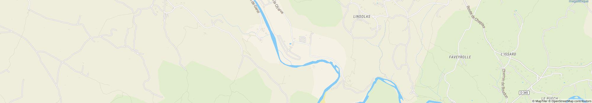
- Address: route de La Charve 3600, 07260 Rosieres, France - Show on map
- Region: ArdècheLargentièrePrivasSouthern France
Ratings
Ratings in detail
- Tranquillity4.5
- Food / Shops4.5
- Overall cleanliness4.5
- Cleanliness of sanitary facilities4.5
- Friendliness5.0
- Infrastructure5.0
- Leisure activities4.5
- Location4.0
- Value for money5.0
- Sanitary facilities4.5
What guests write
%20-%20https://sketchapp.com%20--%3e%3ctitle%3e178342C7-E563-41CE-8EC0-A9A54298CB55%3c/title%3e%3cdesc%3eCreated%20with%20sketchtool.%3c/desc%3e%3cdefs%3e%3ccircle%20id='path-1'%20cx='25'%20cy='25'%20r='25'%3e%3c/circle%3e%3c/defs%3e%3cg%20id='Page-1'%20stroke='none'%20stroke-width='1'%20fill='none'%20fill-rule='evenodd'%3e%3cg%20id='Transparenz'%20transform='translate(-1158.000000,%20-29.000000)'%3e%3cg%20id='Header'%20transform='translate(108.000000,%2031.000000)'%3e%3cg%20id='Profile'%20transform='translate(1052.000000,%200.000000)'%3e%3cg%20id='CI-Placeholder'%3e%3cmask%20id='mask-2'%20fill='white'%3e%3cuse%20xlink:href='%23path-1'%3e%3c/use%3e%3c/mask%3e%3cuse%20id='Background'%20stroke='%239b9b9b'%20stroke-width='2.5'%20xlink:href='%23path-1'%3e%3c/use%3e%3cpath%20d='M24.9650909,39.2018953%20C22.42,39.2018953%2020.2218182,37.8707667%2019.6992727,36.1567717%20L20.7421818,36.1567717%20C21.1643636,36.1567717%2021.5058182,35.8072948%2021.5058182,35.3765701%20L21.5058182,32.1288835%20C22.5618182,32.6530989%2023.7465455,32.9491525%2025,32.9491525%20C26.2534545,32.9491525%2027.4381818,32.6530989%2028.4941818,32.1299965%20L28.4941818,35.3765701%20C28.4941818,35.8072948%2028.8367273,36.1567717%2029.2589091,36.1567717%20L30.232,36.1567717%20C29.7083636,37.8707667%2027.5101818,39.2018953%2024.9650909,39.2018953%20M18.58,25.4008967%20L18.0956364,20.5093332%20C18.0661818,20.2411041%2018.0465455,19.969536%2018.0465455,19.6924031%20C18.0465455,15.7591185%2021.1665455,12.5592902%2025,12.5592902%20C28.8345455,12.5592902%2031.9534545,15.7591185%2031.9534545,19.6924031%20C31.9534545,19.969536%2031.9349091,20.2411041%2031.9010909,20.5605304%20L31.4189091,25.4053487%20C31.1047273,28.8177569%2028.3458182,31.3898623%2025,31.3898623%20C21.6552727,31.3898623%2018.8963636,28.8177569%2018.58,25.4008967%20M32.6341818,34.5974815%20L30.0225455,34.5974815%20L30.0225455,31.1327631%20C31.6327273,29.7982955%2032.7290909,27.8305403%2032.9396364,25.5567145%20L33.4218182,20.6851846%20C33.4578182,20.3579674%2033.4818182,20.0274112%2033.4818182,19.6924031%20C33.4818182,14.8998951%2029.6767273,11%2025,11%20C20.3232727,11%2016.5192727,14.8998951%2016.5192727,19.6924031%20C16.5192727,20.0274112%2016.5421818,20.3579674%2016.5792727,20.7174611%20L17.0603636,25.5511496%20C17.2709091,27.8283143%2018.3672727,29.7971826%2019.9785455,31.1327631%20L19.9785455,34.5974815%20L17.3658182,34.5974815%20C11.6505455,34.5974815%207,39.3643909%207,45.2209114%20C7,45.6516361%207.34254545,46%207.76363636,46%20C8.18581818,46%208.52836364,45.6516361%208.52836364,45.2209114%20C8.52836364,40.2225014%2012.4916364,36.1567717%2017.3658182,36.1567717%20L18.1316364,36.1567717%20C18.6192727,38.7555888%2021.4938182,40.7600725%2024.9661818,40.7600725%20C28.4374545,40.7600725%2031.312,38.7555888%2031.7996364,36.1567717%20L32.6341818,36.1567717%20C37.5083636,36.1567717%2041.4727273,40.2225014%2041.4727273,45.2209114%20C41.4727273,45.6516361%2041.8141818,46%2042.2363636,46%20C42.6585455,46%2043,45.6516361%2043,45.2209114%20C43,39.3643909%2038.3505455,34.5974815%2032.6341818,34.5974815'%20id='Icon'%20fill='%239b9b9b'%20mask='url(%23mask-2)'%3e%3c/path%3e%3c/g%3e%3c/g%3e%3c/g%3e%3c/g%3e%3c/g%3e%3c/svg%3e)
Activities recommended by guests
Mountain biking
(1 Guest)Relaxing
(1 Guest)Rated by guests as "Suitable for"
Guests with tents
Guests with dogs
Families with children under 12
Families with children under 6
Couples
Senior citizens
Families with children under 18
Youth groups
Description
Profile
Welcome to Les Platanes Campsite Ardeche. Located on a riverbank in "La Beaume" canyon, our campsite is surrounded by exceptional natural beauty, vineyards and white limestone cliffs.
- Campsite category:
- Size of the site: 5 ha (Ground conditions: Grass)
- Total number of pitches: 151
- Motorhome pitches in front of the gates: Not available
- Stopover pitches in front of the gates also for caravans: Not available
Reference price
Peak season €32.50*
Low season €18.40*
*Two adults, caravan, car, electricity and local taxes per night
Operating hours
01. April - 15. October
Properties
Equipment
- Gas bottle exchange(3 km)
- Individual washing cubicles(20)
- Internet terminal
- Motorhome service point
- Tumble dryers
- Washing machines
- Wi-Fi(Price unknown)
- Charcoal grill allowed
- Firewood available
At the parking place
- Car permitted on pitch
- Electric hook-ups
- Shade on pitches(Half shaded)
- Campfire permitted on pitch
- Car-free pitches
- Gas hook-up on pitch
- Separate space for youth groups
- TV hook-up on pitch
- Waste water drainage on pitch
- Water hook-up on pitch
Pets
- Dog swimming area
- Dogs allowed in low season
- Dogs allowed in peak season
- Dog showers
Family & Children
- Baby changing room
- Kids entertainment programme
- Playground
- Indoor play facilities
- Petting zoo
Swimming & Wellness
- Outdoor pool
- Nudist beach
Leisure opportunities
- Fishing
- Golf(20 km)
- Table tennis
- Tennis(1 km)
Fare & Catering
- Bread sold on-site
- Grocery shop
- Restaurant
- Snack
Accessibility
- Universally accessible sanitary facilities
- Wheelchair ramps
Rental accommodations
- Bungalows
- Cabins
- Holiday apartments
- Rental caravans
- Rental tents
Vacation type
- Mini campsite
- Nudism
- Permanent camping
- Winter camping
Location
Directions
- Access to the campsite: From the North: From the A7 highway take Montelimar Nord exit, then direction "Le Teil" then Aubenas via the N102, then towards Alès and Rosières up to the D 104. From the highway A75: take …
- River: On site
- Height (above sea level): 130 m
- Next city: 20 km
- Next town/village: 4 km
- Train or bus station: 4 km
Address
route de La Charve 360007260 Rosieres
France
GPS Coordinates
Lat 44.45686397120186, Long 4.277338914010778
Get directionsContact
Camping Les Platanes
Call or fax
Frequently asked questions
How far from the river is Camping Les Platanes?
Camping Les Platanes is located directly at the river. Learn more about the location
Are dogs allowed at the campsite Camping Les Platanes?
Dogs are allowed in high season and low season. Guests rate Camping Les Platanes as "suitable for guests with dogs" with 5 out of 5. Read reviews in detail now
When is Camping Les Platanes open?
Camping Les Platanes is open from April 1 until October 15. Show campsite details
Is Camping Les Platanes family friendly?
Guests rate Camping Les Platanes as particularly suitable for families with children under 6, 12 and 18 years. For leisure activities, the campsite Camping Les Platanes offers many possibilities, such as Playground, Outdoor pool, Kids entertainment programme and much more.
View all recreational opportunities
View all recreational opportunities
How do guests and other campers rate Camping Les Platanes?
Campers rate Camping Les Platanes 5 out of 5.
Guests rate the following properties particularly well: Friendliness, Infrastructure, Value for money
According to its guests Camping Les Platanes is particularly suitable for: Guests with tents and Families with children under 12
According to its guests Camping Les Platanes is ideal for: Hiking and Swimming
Read all camper reviews
Are there shopping facilities near Camping Les Platanes?
There is a grocery store directly on the campsite. In addition, Camping Les Platanes offers a bread service directly at the site. The nearest town is 4 km away, the nearest city is 20 km away. Learn more about the location
How far is the nearest town or city from Camping Les Platanes?
The nearest town is 4 km away, the nearest city is 20 km away. You can reach a bus or train stop in 4 km. Learn more about the location
What food options does Camping Les Platanes offer?
Food is well taken care of, because there is a restaurant directly at the site. Furthermore, there is also a snack bar directly at the site.
With the bread service directly at the site you can start the day relaxed.
For self-catering there is a grocery store directly at the site.
Overall, guests rate the food and beverage at the site 4.5 out of 5.
By the way, gas bottles can be exchanged in 3 km distance.
View all options in detail
With the bread service directly at the site you can start the day relaxed.
For self-catering there is a grocery store directly at the site.
Overall, guests rate the food and beverage at the site 4.5 out of 5.
By the way, gas bottles can be exchanged in 3 km distance.
View all options in detail
Is there wifi or internet at the campsite Camping Les Platanes?
The campsite Camping Les Platanes offers wifi. In addition, there is an Internet terminal on site.
Is Camping Les Platanes barrier-free?
Ramps are available for wheelchair users. The sanitary facilities are barrier-free. View all campsite features
How many pitches does Camping Les Platanes have?
Unfortunately, the campsite Camping Les Platanes has not yet provided any information about tourist pitches. Send request now
Search for other campsites in Auvergne-Rhône-Alpes
Search for other campsites in Auvergne-Rhône-Alpes
How big is Camping Les Platanes?
Camping Les Platanes has a size of 5 hectares. Ground condition is: Grass
View all campsite information now
View all campsite information now
How much does it cost to stay at Camping Les Platanes?
An overnight stay at Camping Les Platanes costs €18.40 - €32.50, but prices vary depending on the chosen period, guests, etc. At camping.info you can send a no-obligation request to Camping Les Platanes to find out current prices and availability. Send request now