 Deutsch
 English
 Nederlands
 français
 italiano
 Español
 български
 босански
 čeština
 dansk
dansk Ελληνικά
 eesti
eesti suomi
suomi hrvatski
 magyar
 lietuvių
 latviešu
 norsk bokmål
 polski
 português
 română
 русский
 slovenčina
 slovenščina
 српски
 svenska
 Türkçe
%20-%20https://sketchapp.com%20--%3e%3ctitle%3e178342C7-E563-41CE-8EC0-A9A54298CB55%3c/title%3e%3cdesc%3eCreated%20with%20sketchtool.%3c/desc%3e%3cdefs%3e%3ccircle%20id='path-1'%20cx='25'%20cy='25'%20r='25'%3e%3c/circle%3e%3c/defs%3e%3cg%20id='Page-1'%20stroke='none'%20stroke-width='1'%20fill='none'%20fill-rule='evenodd'%3e%3cg%20id='Transparenz'%20transform='translate(-1158.000000,%20-29.000000)'%3e%3cg%20id='Header'%20transform='translate(108.000000,%2031.000000)'%3e%3cg%20id='Profile'%20transform='translate(1052.000000,%200.000000)'%3e%3cg%20id='CI-Placeholder'%3e%3cmask%20id='mask-2'%20fill='white'%3e%3cuse%20xlink:href='%23path-1'%3e%3c/use%3e%3c/mask%3e%3cuse%20id='Background'%20stroke='%23FFFFFF'%20stroke-width='2.5'%20xlink:href='%23path-1'%3e%3c/use%3e%3cpath%20d='M24.9650909,39.2018953%20C22.42,39.2018953%2020.2218182,37.8707667%2019.6992727,36.1567717%20L20.7421818,36.1567717%20C21.1643636,36.1567717%2021.5058182,35.8072948%2021.5058182,35.3765701%20L21.5058182,32.1288835%20C22.5618182,32.6530989%2023.7465455,32.9491525%2025,32.9491525%20C26.2534545,32.9491525%2027.4381818,32.6530989%2028.4941818,32.1299965%20L28.4941818,35.3765701%20C28.4941818,35.8072948%2028.8367273,36.1567717%2029.2589091,36.1567717%20L30.232,36.1567717%20C29.7083636,37.8707667%2027.5101818,39.2018953%2024.9650909,39.2018953%20M18.58,25.4008967%20L18.0956364,20.5093332%20C18.0661818,20.2411041%2018.0465455,19.969536%2018.0465455,19.6924031%20C18.0465455,15.7591185%2021.1665455,12.5592902%2025,12.5592902%20C28.8345455,12.5592902%2031.9534545,15.7591185%2031.9534545,19.6924031%20C31.9534545,19.969536%2031.9349091,20.2411041%2031.9010909,20.5605304%20L31.4189091,25.4053487%20C31.1047273,28.8177569%2028.3458182,31.3898623%2025,31.3898623%20C21.6552727,31.3898623%2018.8963636,28.8177569%2018.58,25.4008967%20M32.6341818,34.5974815%20L30.0225455,34.5974815%20L30.0225455,31.1327631%20C31.6327273,29.7982955%2032.7290909,27.8305403%2032.9396364,25.5567145%20L33.4218182,20.6851846%20C33.4578182,20.3579674%2033.4818182,20.0274112%2033.4818182,19.6924031%20C33.4818182,14.8998951%2029.6767273,11%2025,11%20C20.3232727,11%2016.5192727,14.8998951%2016.5192727,19.6924031%20C16.5192727,20.0274112%2016.5421818,20.3579674%2016.5792727,20.7174611%20L17.0603636,25.5511496%20C17.2709091,27.8283143%2018.3672727,29.7971826%2019.9785455,31.1327631%20L19.9785455,34.5974815%20L17.3658182,34.5974815%20C11.6505455,34.5974815%207,39.3643909%207,45.2209114%20C7,45.6516361%207.34254545,46%207.76363636,46%20C8.18581818,46%208.52836364,45.6516361%208.52836364,45.2209114%20C8.52836364,40.2225014%2012.4916364,36.1567717%2017.3658182,36.1567717%20L18.1316364,36.1567717%20C18.6192727,38.7555888%2021.4938182,40.7600725%2024.9661818,40.7600725%20C28.4374545,40.7600725%2031.312,38.7555888%2031.7996364,36.1567717%20L32.6341818,36.1567717%20C37.5083636,36.1567717%2041.4727273,40.2225014%2041.4727273,45.2209114%20C41.4727273,45.6516361%2041.8141818,46%2042.2363636,46%20C42.6585455,46%2043,45.6516361%2043,45.2209114%20C43,39.3643909%2038.3505455,34.5974815%2032.6341818,34.5974815'%20id='Icon'%20fill='%23FFFFFF'%20mask='url(%23mask-2)'%3e%3c/path%3e%3c/g%3e%3c/g%3e%3c/g%3e%3c/g%3e%3c/g%3e%3c/svg%3e)


Od18,40€
Camping Les Platanes
- Godziny pracy: 01.04 - 15.10 - obecnie w eksploatacji
- Adres: route de La Charve 3600, 07260 Rosieres, Francja - Pokaż na mapie
- Region: ArdècheLargentièrePrivasPołudnie Francji
Oceny
Oceny w szczegółach
- Spokój4.5
- Jedzenie / sklepy4.5
- Ogólna czystość4.5
- Czystość urządzeń sanitarnych4.5
- Przyjazność5.0
- Infrastruktura5.0
- Zajęcia rekreacyjne4.5
- Lokalizacja4.0
- Wartość w stosunku do ceny5.0
- Urządzenia sanitarne4.5
Co piszą goście
%20-%20https://sketchapp.com%20--%3e%3ctitle%3e178342C7-E563-41CE-8EC0-A9A54298CB55%3c/title%3e%3cdesc%3eCreated%20with%20sketchtool.%3c/desc%3e%3cdefs%3e%3ccircle%20id='path-1'%20cx='25'%20cy='25'%20r='25'%3e%3c/circle%3e%3c/defs%3e%3cg%20id='Page-1'%20stroke='none'%20stroke-width='1'%20fill='none'%20fill-rule='evenodd'%3e%3cg%20id='Transparenz'%20transform='translate(-1158.000000,%20-29.000000)'%3e%3cg%20id='Header'%20transform='translate(108.000000,%2031.000000)'%3e%3cg%20id='Profile'%20transform='translate(1052.000000,%200.000000)'%3e%3cg%20id='CI-Placeholder'%3e%3cmask%20id='mask-2'%20fill='white'%3e%3cuse%20xlink:href='%23path-1'%3e%3c/use%3e%3c/mask%3e%3cuse%20id='Background'%20stroke='%239b9b9b'%20stroke-width='2.5'%20xlink:href='%23path-1'%3e%3c/use%3e%3cpath%20d='M24.9650909,39.2018953%20C22.42,39.2018953%2020.2218182,37.8707667%2019.6992727,36.1567717%20L20.7421818,36.1567717%20C21.1643636,36.1567717%2021.5058182,35.8072948%2021.5058182,35.3765701%20L21.5058182,32.1288835%20C22.5618182,32.6530989%2023.7465455,32.9491525%2025,32.9491525%20C26.2534545,32.9491525%2027.4381818,32.6530989%2028.4941818,32.1299965%20L28.4941818,35.3765701%20C28.4941818,35.8072948%2028.8367273,36.1567717%2029.2589091,36.1567717%20L30.232,36.1567717%20C29.7083636,37.8707667%2027.5101818,39.2018953%2024.9650909,39.2018953%20M18.58,25.4008967%20L18.0956364,20.5093332%20C18.0661818,20.2411041%2018.0465455,19.969536%2018.0465455,19.6924031%20C18.0465455,15.7591185%2021.1665455,12.5592902%2025,12.5592902%20C28.8345455,12.5592902%2031.9534545,15.7591185%2031.9534545,19.6924031%20C31.9534545,19.969536%2031.9349091,20.2411041%2031.9010909,20.5605304%20L31.4189091,25.4053487%20C31.1047273,28.8177569%2028.3458182,31.3898623%2025,31.3898623%20C21.6552727,31.3898623%2018.8963636,28.8177569%2018.58,25.4008967%20M32.6341818,34.5974815%20L30.0225455,34.5974815%20L30.0225455,31.1327631%20C31.6327273,29.7982955%2032.7290909,27.8305403%2032.9396364,25.5567145%20L33.4218182,20.6851846%20C33.4578182,20.3579674%2033.4818182,20.0274112%2033.4818182,19.6924031%20C33.4818182,14.8998951%2029.6767273,11%2025,11%20C20.3232727,11%2016.5192727,14.8998951%2016.5192727,19.6924031%20C16.5192727,20.0274112%2016.5421818,20.3579674%2016.5792727,20.7174611%20L17.0603636,25.5511496%20C17.2709091,27.8283143%2018.3672727,29.7971826%2019.9785455,31.1327631%20L19.9785455,34.5974815%20L17.3658182,34.5974815%20C11.6505455,34.5974815%207,39.3643909%207,45.2209114%20C7,45.6516361%207.34254545,46%207.76363636,46%20C8.18581818,46%208.52836364,45.6516361%208.52836364,45.2209114%20C8.52836364,40.2225014%2012.4916364,36.1567717%2017.3658182,36.1567717%20L18.1316364,36.1567717%20C18.6192727,38.7555888%2021.4938182,40.7600725%2024.9661818,40.7600725%20C28.4374545,40.7600725%2031.312,38.7555888%2031.7996364,36.1567717%20L32.6341818,36.1567717%20C37.5083636,36.1567717%2041.4727273,40.2225014%2041.4727273,45.2209114%20C41.4727273,45.6516361%2041.8141818,46%2042.2363636,46%20C42.6585455,46%2043,45.6516361%2043,45.2209114%20C43,39.3643909%2038.3505455,34.5974815%2032.6341818,34.5974815'%20id='Icon'%20fill='%239b9b9b'%20mask='url(%23mask-2)'%3e%3c/path%3e%3c/g%3e%3c/g%3e%3c/g%3e%3c/g%3e%3c/g%3e%3c/svg%3e)
Zajęcia polecane przez gości
Kolarstwo górskie
(1 Gość)Odprężenie
(1 Gość)Ocenione przez gości jako „Odpowiedni dla”
Goście z namiotami
Goście z psami
Rodziny z dziećmi poniżej 12 roku życia
Rodziny z dziećmi poniżej 6 roku życia
Pary
Seniorzy
Rodziny z dziećmi poniżej 18 roku życia
Grupy młodzieży
Opis
Profil
Welcome to Les Platanes Campsite Ardeche. Located on a riverbank in "La Beaume" canyon, our campsite is surrounded by exceptional natural beauty, vineyards and white limestone cliffs.
- Kategoria kempingu:
- Rozmiar witryny: 5 ha (Warunki gruntowe: Trawa)
- Całkowita liczba boisk: 151
- Stanowiska dla kamperów przed bramami: Niedostępne
- Stanowiska postojowe przed bramami również dla przyczep kempingowych: Niedostępne
Cena referencyjna
Sezon szczytowy 32,50 €*
Poza sezonem 18,40 €*
*Dwie osoby dorosłe, przyczepa kempingowa, samochód, prąd i podatki lokalne za noc.
Godziny pracy
01. kwiecień - 15. październik
Nieruchomości
Udogodnienia
- Indywidualne kabiny do mycia(20)
- Pralki
- Punkt serwisowy dla samochodów kempingowych
- Suszarki bębnowe
- Terminal internetowy
- Wi-Fi(Cena nieznana)
- Wymiana butli gazowych(3 km)
- Drewno opałowe jest dostępne
- Grill na węgiel drzewny jest dozwolony
Na miejscu parkingowym
- Cień na polach(W połowie zacienione)
- Podłączenie elektryczne
- Samochód jest dozwolony na polu
- Oddzielna przestrzeń dla grup młodzieżowych
- Ognisko na polu jest dozwolone
- Podłączenie dla telewizora na polu
- Podłączenie gazu na polu
- Podłączenie wody na polu
- Pola bez samochodów
- Punkt usuwania substancji chemicznych na polu
Zwierzęta
- Kąpielisko dla psów
- Psy są dozwolone poza sezonem
- Psy są dozwolone w sezonie szczytowym
- Prysznice dla psów
Rodzina i dzieci
- Plac zabaw
- Pomieszczenie do zmiany pieluszki
- Program rozrywkowy dla dzieci
- Mini zoo
- Udogodnienia do zabawy w pomieszczeniu
Pływanie i odnowa biologiczna
- Basen zewnętrzny
- Plaża nudystów
Możliwości spędzania wolnego czasu
- Golf(20 km)
- Rybołówstwo
- Tenis(1 km)
- Tenis stołowy
Ceny i catering
- Chleb sprzedawany na miejscu
- Restauracja
- Sklep spożywczy
- Snack bar
Dostępność
- Ogólnie dostępne urządzenia sanitarne
- Podjazdy dla wózków inwalidzkich
Wynajem mieszkań
- Domy jednopiętrowe
- Apartamenty wakacyjne
- Kabiny
- Wynajem namiotów
- Wynajem przyczep kempingowych
Typ wakacji
- Kemping zimowy
- Mini miejsce kempingowe
- Nudyzm
- Stałe miejsce kempingowe
Lokalizacja
Kierunki
- Access to the campsite: From the North: From the A7 highway take Montelimar Nord exit, then direction "Le Teil" then Aubenas via the N102, then towards Alès and Rosières up to the D 104. From the highway A75: take …
- Rzeka: Na miejscu
- Wysokość nad poziomem morza): 130 m
- Następne miasto: 20 km
- Następne miasto/wieś: 4 km
- Dworzec kolejowy lub autobusowy: 4 km
Adres
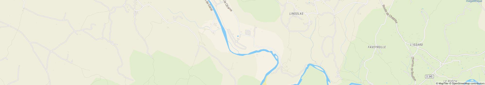
route de La Charve 360007260 Rosieres
Francja
Współrzędne GPS
Lat 44.45686397120186, Long 4.277338914010778
Uzyskaj wskazówki, jak to zrobić.Kontakt
Camping Les Platanes
Zadzwoń lub prześlij faks