 Deutsch
 English
 Nederlands
 français
 italiano
 Español
 български
 босански
 čeština
 dansk
dansk Ελληνικά
 eesti
eesti suomi
suomi hrvatski
 magyar
 lietuvių
 latviešu
 norsk bokmål
 polski
 português
 română
 русский
 slovenčina
 slovenščina
 српски
 svenska
 Türkçe
%20-%20https://sketchapp.com%20--%3e%3ctitle%3e178342C7-E563-41CE-8EC0-A9A54298CB55%3c/title%3e%3cdesc%3eCreated%20with%20sketchtool.%3c/desc%3e%3cdefs%3e%3ccircle%20id='path-1'%20cx='25'%20cy='25'%20r='25'%3e%3c/circle%3e%3c/defs%3e%3cg%20id='Page-1'%20stroke='none'%20stroke-width='1'%20fill='none'%20fill-rule='evenodd'%3e%3cg%20id='Transparenz'%20transform='translate(-1158.000000,%20-29.000000)'%3e%3cg%20id='Header'%20transform='translate(108.000000,%2031.000000)'%3e%3cg%20id='Profile'%20transform='translate(1052.000000,%200.000000)'%3e%3cg%20id='CI-Placeholder'%3e%3cmask%20id='mask-2'%20fill='white'%3e%3cuse%20xlink:href='%23path-1'%3e%3c/use%3e%3c/mask%3e%3cuse%20id='Background'%20stroke='%23FFFFFF'%20stroke-width='2.5'%20xlink:href='%23path-1'%3e%3c/use%3e%3cpath%20d='M24.9650909,39.2018953%20C22.42,39.2018953%2020.2218182,37.8707667%2019.6992727,36.1567717%20L20.7421818,36.1567717%20C21.1643636,36.1567717%2021.5058182,35.8072948%2021.5058182,35.3765701%20L21.5058182,32.1288835%20C22.5618182,32.6530989%2023.7465455,32.9491525%2025,32.9491525%20C26.2534545,32.9491525%2027.4381818,32.6530989%2028.4941818,32.1299965%20L28.4941818,35.3765701%20C28.4941818,35.8072948%2028.8367273,36.1567717%2029.2589091,36.1567717%20L30.232,36.1567717%20C29.7083636,37.8707667%2027.5101818,39.2018953%2024.9650909,39.2018953%20M18.58,25.4008967%20L18.0956364,20.5093332%20C18.0661818,20.2411041%2018.0465455,19.969536%2018.0465455,19.6924031%20C18.0465455,15.7591185%2021.1665455,12.5592902%2025,12.5592902%20C28.8345455,12.5592902%2031.9534545,15.7591185%2031.9534545,19.6924031%20C31.9534545,19.969536%2031.9349091,20.2411041%2031.9010909,20.5605304%20L31.4189091,25.4053487%20C31.1047273,28.8177569%2028.3458182,31.3898623%2025,31.3898623%20C21.6552727,31.3898623%2018.8963636,28.8177569%2018.58,25.4008967%20M32.6341818,34.5974815%20L30.0225455,34.5974815%20L30.0225455,31.1327631%20C31.6327273,29.7982955%2032.7290909,27.8305403%2032.9396364,25.5567145%20L33.4218182,20.6851846%20C33.4578182,20.3579674%2033.4818182,20.0274112%2033.4818182,19.6924031%20C33.4818182,14.8998951%2029.6767273,11%2025,11%20C20.3232727,11%2016.5192727,14.8998951%2016.5192727,19.6924031%20C16.5192727,20.0274112%2016.5421818,20.3579674%2016.5792727,20.7174611%20L17.0603636,25.5511496%20C17.2709091,27.8283143%2018.3672727,29.7971826%2019.9785455,31.1327631%20L19.9785455,34.5974815%20L17.3658182,34.5974815%20C11.6505455,34.5974815%207,39.3643909%207,45.2209114%20C7,45.6516361%207.34254545,46%207.76363636,46%20C8.18581818,46%208.52836364,45.6516361%208.52836364,45.2209114%20C8.52836364,40.2225014%2012.4916364,36.1567717%2017.3658182,36.1567717%20L18.1316364,36.1567717%20C18.6192727,38.7555888%2021.4938182,40.7600725%2024.9661818,40.7600725%20C28.4374545,40.7600725%2031.312,38.7555888%2031.7996364,36.1567717%20L32.6341818,36.1567717%20C37.5083636,36.1567717%2041.4727273,40.2225014%2041.4727273,45.2209114%20C41.4727273,45.6516361%2041.8141818,46%2042.2363636,46%20C42.6585455,46%2043,45.6516361%2043,45.2209114%20C43,39.3643909%2038.3505455,34.5974815%2032.6341818,34.5974815'%20id='Icon'%20fill='%23FFFFFF'%20mask='url(%23mask-2)'%3e%3c/path%3e%3c/g%3e%3c/g%3e%3c/g%3e%3c/g%3e%3c/g%3e%3c/svg%3e)


Desde18,40€
Camping Les Platanes
- Horas de funcionamiento: 01.04 - 15.10 - actualmente en funcionamiento
- Dirección: route de La Charve 3600, 07260 Rosieres, Francia - Mostrar en el mapa
- Región: ArdècheArgentièiraPrivàsSur de Francia
Calificaciones
Valoraciones en detalle
- Tranquilidad4.5
- Comida / Tiendas4.5
- Limpieza general4.5
- Limpieza de las instalaciones sanitarias4.5
- Amabilidad5.0
- Infraestructura5.0
- Actividad(es) de entretenimiento4.5
- Lugar4.0
- Relación calidad-precio5.0
- Instalaciones sanitarias4.5
Lo que escriben los invitados
%20-%20https://sketchapp.com%20--%3e%3ctitle%3e178342C7-E563-41CE-8EC0-A9A54298CB55%3c/title%3e%3cdesc%3eCreated%20with%20sketchtool.%3c/desc%3e%3cdefs%3e%3ccircle%20id='path-1'%20cx='25'%20cy='25'%20r='25'%3e%3c/circle%3e%3c/defs%3e%3cg%20id='Page-1'%20stroke='none'%20stroke-width='1'%20fill='none'%20fill-rule='evenodd'%3e%3cg%20id='Transparenz'%20transform='translate(-1158.000000,%20-29.000000)'%3e%3cg%20id='Header'%20transform='translate(108.000000,%2031.000000)'%3e%3cg%20id='Profile'%20transform='translate(1052.000000,%200.000000)'%3e%3cg%20id='CI-Placeholder'%3e%3cmask%20id='mask-2'%20fill='white'%3e%3cuse%20xlink:href='%23path-1'%3e%3c/use%3e%3c/mask%3e%3cuse%20id='Background'%20stroke='%239b9b9b'%20stroke-width='2.5'%20xlink:href='%23path-1'%3e%3c/use%3e%3cpath%20d='M24.9650909,39.2018953%20C22.42,39.2018953%2020.2218182,37.8707667%2019.6992727,36.1567717%20L20.7421818,36.1567717%20C21.1643636,36.1567717%2021.5058182,35.8072948%2021.5058182,35.3765701%20L21.5058182,32.1288835%20C22.5618182,32.6530989%2023.7465455,32.9491525%2025,32.9491525%20C26.2534545,32.9491525%2027.4381818,32.6530989%2028.4941818,32.1299965%20L28.4941818,35.3765701%20C28.4941818,35.8072948%2028.8367273,36.1567717%2029.2589091,36.1567717%20L30.232,36.1567717%20C29.7083636,37.8707667%2027.5101818,39.2018953%2024.9650909,39.2018953%20M18.58,25.4008967%20L18.0956364,20.5093332%20C18.0661818,20.2411041%2018.0465455,19.969536%2018.0465455,19.6924031%20C18.0465455,15.7591185%2021.1665455,12.5592902%2025,12.5592902%20C28.8345455,12.5592902%2031.9534545,15.7591185%2031.9534545,19.6924031%20C31.9534545,19.969536%2031.9349091,20.2411041%2031.9010909,20.5605304%20L31.4189091,25.4053487%20C31.1047273,28.8177569%2028.3458182,31.3898623%2025,31.3898623%20C21.6552727,31.3898623%2018.8963636,28.8177569%2018.58,25.4008967%20M32.6341818,34.5974815%20L30.0225455,34.5974815%20L30.0225455,31.1327631%20C31.6327273,29.7982955%2032.7290909,27.8305403%2032.9396364,25.5567145%20L33.4218182,20.6851846%20C33.4578182,20.3579674%2033.4818182,20.0274112%2033.4818182,19.6924031%20C33.4818182,14.8998951%2029.6767273,11%2025,11%20C20.3232727,11%2016.5192727,14.8998951%2016.5192727,19.6924031%20C16.5192727,20.0274112%2016.5421818,20.3579674%2016.5792727,20.7174611%20L17.0603636,25.5511496%20C17.2709091,27.8283143%2018.3672727,29.7971826%2019.9785455,31.1327631%20L19.9785455,34.5974815%20L17.3658182,34.5974815%20C11.6505455,34.5974815%207,39.3643909%207,45.2209114%20C7,45.6516361%207.34254545,46%207.76363636,46%20C8.18581818,46%208.52836364,45.6516361%208.52836364,45.2209114%20C8.52836364,40.2225014%2012.4916364,36.1567717%2017.3658182,36.1567717%20L18.1316364,36.1567717%20C18.6192727,38.7555888%2021.4938182,40.7600725%2024.9661818,40.7600725%20C28.4374545,40.7600725%2031.312,38.7555888%2031.7996364,36.1567717%20L32.6341818,36.1567717%20C37.5083636,36.1567717%2041.4727273,40.2225014%2041.4727273,45.2209114%20C41.4727273,45.6516361%2041.8141818,46%2042.2363636,46%20C42.6585455,46%2043,45.6516361%2043,45.2209114%20C43,39.3643909%2038.3505455,34.5974815%2032.6341818,34.5974815'%20id='Icon'%20fill='%239b9b9b'%20mask='url(%23mask-2)'%3e%3c/path%3e%3c/g%3e%3c/g%3e%3c/g%3e%3c/g%3e%3c/g%3e%3c/svg%3e)
Actividades recomendadas por los invitados
Ciclismo de montaña
(1 Huésped)Relajación
(1 Huésped)Calificado por invitados como "Adecuado para"
Huéspedes con tiendas de campaña
Huéspedes con perros
Familias con niños menores de 12 años
Familias con niños menores de 6 años
Parejas
Personas mayores
Familias con niños menores de 18 años
Grupos de jóvenes
Descripción
Perfil
Welcome to Les Platanes Campsite Ardeche. Located on a riverbank in "La Beaume" canyon, our campsite is surrounded by exceptional natural beauty, vineyards and white limestone cliffs.
- Categoría de camping:
- Tamaño del sitio: 5 ha (Condiciones del suelo: Césped)
- Número total de parcelas: 151
- Parcelas para caravanas frente a la entrada: No disponible
- Parcelas de escala delante de las puertas también para caravanas: No disponible
Precio de referencia
Temporada alta 32,50 €*
Temporada baja 18,40 €*
*Dos adultos, caravana, coche, electricidad y tasas locales por noche
Horas de funcionamiento
01. abril - 15. octubre
Propiedades
Equipamiento del camping
- Cabinas de lavado individuales(20)
- Cambio de bombona de gas(3 km)
- Lavadoras
- Punto de servicio de autocaravanas
- Secadoras
- Terminal de internet
- WiFi(precio desconocido)
- Leña disponible
- Parrilla de carbón permitida
en el lugar de estacionamiento
- Automóvil permitido en la parcela
- Conexión eléctrica
- Sombra en las parcelas(Sombra en la mitad de la parcela)
- Conexión de agua en la parcela
- Conexión de gas en la parcela
- Conexión de TV en la parcela
- Drenaje de aguas residuales en las parcelas
- Espacio separado para grupos de jóvenes
- Hogueras permitidas en la parcela
- Parcelas sin automóviles
Mascotas
- Perros admitidos en temporada alta
- Perros admitidos en temporada baja
- Zona de nado para perros
- Duchas para perros
Familia & Niños
- Cuarto para cambiar bebés
- Programa de actividades para niños
- Área de juegos para niños
- Instalaciones de juego cubiertas
- Zoológico interactivo
Natación & Bienestar
- Piscina exterior
- Playa nudista
Oportunidades de ocio
- Golf(20 km)
- Pesca
- Ping-pong
- Tenis(1 km)
Catering
- Cafetería
- Restaurante
- Tienda de comestibles
- Venta de pan en el lugar
Accesibilidad
- Instalaciones sanitarias accesibles para cualquier persona
- Rampas para silla de ruedas
Alojamientos de alquiler
- Bungalows
- Alquiler de cabañas
- Alquiler de caravanas
- Alquiler de carpas
- Apartamentos vacacionales
Tipo de vacaciones
- Camping de invierno
- Camping de larga estancia
- Minicamping
- Nudismo
Ubicación
Indicaciones
- Access to the campsite: From the North: From the A7 highway take Montelimar Nord exit, then direction "Le Teil" then Aubenas via the N102, then towards Alès and Rosières up to the D 104. From the highway A75: take …
- Río: En el sitio
- Altura sobre el nivel del mar): 130 m
- Siguiente ciudad: 20 km
- Siguiente ciudad/pueblo: 4 km
- Estación de tren o autobús: 4 km
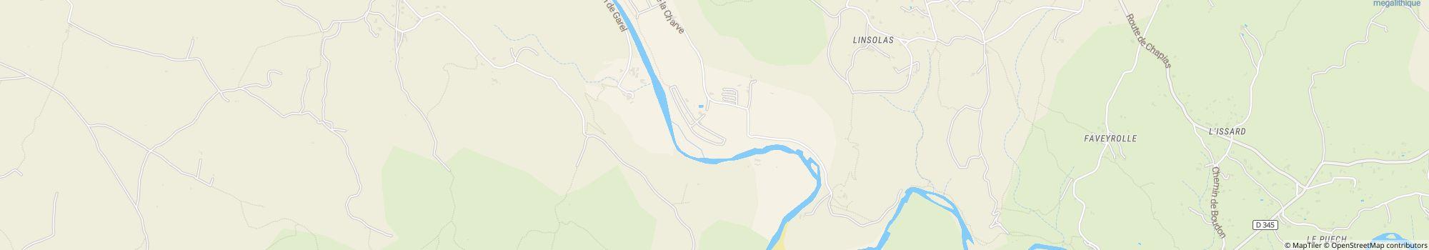
Dirección
route de La Charve 360007260 Rosieres
Francia
Coordenadas GPS
Lat 44.45686397120186, Long 4.277338914010778
Obtener indicaciones de cómo llegarContacto
Camping Les Platanes
Llame o envíe un fax
Preguntas frecuentes
¿A qué distancia del río está Camping Les Platanes?
Camping Les Platanes está situado directamente junto al río. Descubre más sobre la ubicación
¿Se admiten perros en el camping Camping Les Platanes?
Se admiten perros en temporada alta y en temporada baja. Los huéspedes valoran Camping Les Platanes como "adecuado para huéspedes con perros" con un 5 sobre 5. Leer ahora las valoraciones en detalle
¿Cuándo está abierto Camping Les Platanes?
Camping Les Platanes está abierto desde 1. abril hasta 15. octubre. Mostrar detalles del camping
¿Es Camping Les Platanes adecuado para familias?
Los huéspedes valoran Camping Les Platanes como especialmente adecuado para familias con niños menores de 6, 12 y 18 años. Para las actividades de ocio, el camping Camping Les Platanes ofrece muchas posibilidades, como Área de juegos para niños, Piscina exterior, Programa de actividades para niños y mucho más.
Ver todas las actividades recreativas
Ver todas las actividades recreativas
¿Cómo valoran los huéspedes y otros campistas Camping Les Platanes?
Los campistas valoran Camping Les Platanes con un 5 sobre 5.
Los huéspedes valoran especialmente bien las siguientes características: Amabilidad, Infraestructura, Relación calidad-precio
Según sus huéspedes, Camping Les Platanes es especialmente adecuado para: Huéspedes con tiendas de campaña y Familias con niños menores de 12 años
Según sus huéspedes, Camping Les Platanes es ideal para: Caminata y Natación
Leer todas las valoraciones de los campistas
¿Hay posibilidades de compra cerca de Camping Les Platanes?
Hay un supermercado directamente en el camping. Además, el Camping Les Platanes ofrece un servicio de entrega de pan directamente en el camping. El pueblo más cercano está a 4 km., la ciudad más cercana está a 20 km. Descubre más sobre la ubicación
¿A qué distancia está el pueblo o la ciudad más cercana de Camping Les Platanes?
El pueblo más cercano está a 4 km., la ciudad más cercana está a 20 km. Puedes llegar a una parada de autobús o estación de tren en 4 km. Descubre más sobre la ubicación
¿Qué opciones de restauración ofrece Camping Les Platanes?
La comida está bien resuelta, ya que hay un restaurante directamente en el camping. Además, también hay un snack bar directamente en el camping.
Con el servicio de pan directamente en el camping, puedes empezar el día relajado.
Para quienes cocinan su propia comida, hay un supermercado directamente en el camping.
En general, los huéspedes valoran la comida y la bebida del camping con un 4.5 sobre 5.
Por cierto, las bombonas de gas se pueden cambiar a una distancia de 3 km.
Ver todas las opciones en detalle
¿Hay wifi o internet en el camping Camping Les Platanes?
El camping Camping Les Platanes ofrece wifi. Además, hay un terminal de Internet en el camping.
¿Es Camping Les Platanes accesible para personas con movilidad reducida?
Hay rampas disponibles para usuarios de silla de ruedas. Las instalaciones sanitarias son accesibles para personas con movilidad reducida. Ver todas las características del camping
¿Cuántas parcelas tiene Camping Les Platanes?
Lamentablemente, el camping Camping Les Platanes aún no ha proporcionado información sobre parcelas turísticas. Enviar solicitud ahora
Buscar otros campings en Auvernia-Ródano-Alpes
Buscar otros campings en Auvernia-Ródano-Alpes
¿Qué tamaño tiene Camping Les Platanes?
Camping Les Platanes tiene una superficie de 5 hectáreas. El estado del terreno es: Césped
Ver ahora toda la información del camping
Ver ahora toda la información del camping
¿Cuánto cuesta alojarse en Camping Les Platanes?
Una estancia en Camping Les Platanes cuesta 18,40 € - 32,50 €, pero los precios varían según el período elegido, los huéspedes, etc. En camping.info puedes enviar una solicitud sin compromiso a Camping Les Platanes para conocer los precios actuales y la disponibilidad. Enviar solicitud ahora