 Deutsch
 English
 Nederlands
 français
 italiano
 Español
 български
 босански
 čeština
 dansk
dansk Ελληνικά
 eesti
eesti suomi
suomi hrvatski
 magyar
 lietuvių
 latviešu
 norsk bokmål
 polski
 português
 română
 русский
 slovenčina
 slovenščina
 српски
 svenska
 Türkçe
%20-%20https://sketchapp.com%20--%3e%3ctitle%3e178342C7-E563-41CE-8EC0-A9A54298CB55%3c/title%3e%3cdesc%3eCreated%20with%20sketchtool.%3c/desc%3e%3cdefs%3e%3ccircle%20id='path-1'%20cx='25'%20cy='25'%20r='25'%3e%3c/circle%3e%3c/defs%3e%3cg%20id='Page-1'%20stroke='none'%20stroke-width='1'%20fill='none'%20fill-rule='evenodd'%3e%3cg%20id='Transparenz'%20transform='translate(-1158.000000,%20-29.000000)'%3e%3cg%20id='Header'%20transform='translate(108.000000,%2031.000000)'%3e%3cg%20id='Profile'%20transform='translate(1052.000000,%200.000000)'%3e%3cg%20id='CI-Placeholder'%3e%3cmask%20id='mask-2'%20fill='white'%3e%3cuse%20xlink:href='%23path-1'%3e%3c/use%3e%3c/mask%3e%3cuse%20id='Background'%20stroke='%23FFFFFF'%20stroke-width='2.5'%20xlink:href='%23path-1'%3e%3c/use%3e%3cpath%20d='M24.9650909,39.2018953%20C22.42,39.2018953%2020.2218182,37.8707667%2019.6992727,36.1567717%20L20.7421818,36.1567717%20C21.1643636,36.1567717%2021.5058182,35.8072948%2021.5058182,35.3765701%20L21.5058182,32.1288835%20C22.5618182,32.6530989%2023.7465455,32.9491525%2025,32.9491525%20C26.2534545,32.9491525%2027.4381818,32.6530989%2028.4941818,32.1299965%20L28.4941818,35.3765701%20C28.4941818,35.8072948%2028.8367273,36.1567717%2029.2589091,36.1567717%20L30.232,36.1567717%20C29.7083636,37.8707667%2027.5101818,39.2018953%2024.9650909,39.2018953%20M18.58,25.4008967%20L18.0956364,20.5093332%20C18.0661818,20.2411041%2018.0465455,19.969536%2018.0465455,19.6924031%20C18.0465455,15.7591185%2021.1665455,12.5592902%2025,12.5592902%20C28.8345455,12.5592902%2031.9534545,15.7591185%2031.9534545,19.6924031%20C31.9534545,19.969536%2031.9349091,20.2411041%2031.9010909,20.5605304%20L31.4189091,25.4053487%20C31.1047273,28.8177569%2028.3458182,31.3898623%2025,31.3898623%20C21.6552727,31.3898623%2018.8963636,28.8177569%2018.58,25.4008967%20M32.6341818,34.5974815%20L30.0225455,34.5974815%20L30.0225455,31.1327631%20C31.6327273,29.7982955%2032.7290909,27.8305403%2032.9396364,25.5567145%20L33.4218182,20.6851846%20C33.4578182,20.3579674%2033.4818182,20.0274112%2033.4818182,19.6924031%20C33.4818182,14.8998951%2029.6767273,11%2025,11%20C20.3232727,11%2016.5192727,14.8998951%2016.5192727,19.6924031%20C16.5192727,20.0274112%2016.5421818,20.3579674%2016.5792727,20.7174611%20L17.0603636,25.5511496%20C17.2709091,27.8283143%2018.3672727,29.7971826%2019.9785455,31.1327631%20L19.9785455,34.5974815%20L17.3658182,34.5974815%20C11.6505455,34.5974815%207,39.3643909%207,45.2209114%20C7,45.6516361%207.34254545,46%207.76363636,46%20C8.18581818,46%208.52836364,45.6516361%208.52836364,45.2209114%20C8.52836364,40.2225014%2012.4916364,36.1567717%2017.3658182,36.1567717%20L18.1316364,36.1567717%20C18.6192727,38.7555888%2021.4938182,40.7600725%2024.9661818,40.7600725%20C28.4374545,40.7600725%2031.312,38.7555888%2031.7996364,36.1567717%20L32.6341818,36.1567717%20C37.5083636,36.1567717%2041.4727273,40.2225014%2041.4727273,45.2209114%20C41.4727273,45.6516361%2041.8141818,46%2042.2363636,46%20C42.6585455,46%2043,45.6516361%2043,45.2209114%20C43,39.3643909%2038.3505455,34.5974815%2032.6341818,34.5974815'%20id='Icon'%20fill='%23FFFFFF'%20mask='url(%23mask-2)'%3e%3c/path%3e%3c/g%3e%3c/g%3e%3c/g%3e%3c/g%3e%3c/g%3e%3c/svg%3e)


От18,40€
Camping Les Platanes
- Часы работы: 01.04 - 15.10 - в настоящее время закрыто
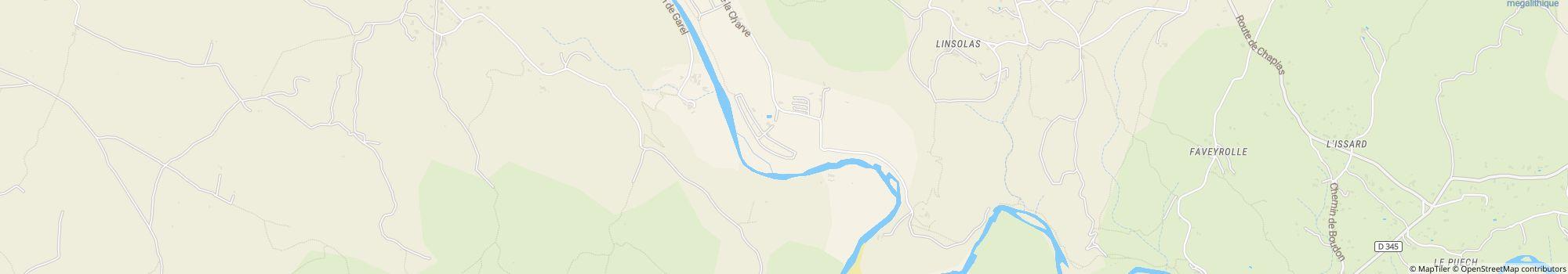
- Адрес: La Charve, 07260 Rosieres, Франция - Показать на карте
- Регион: АрдешЛаржантье́рПрива́Юг Франции
Рейтинги
Рейтинги в деталях
- Умиротворение4.5
- Еда / Магазины4.5
- Общая чистота4.5
- Чистота санитарных зон4.5
- Дружелюбие5.0
- Инфраструктура5.0
- Досуг4.5
- Место расположения4.0
- Соотношение цена/качество5.0
- Санитарные зоны4.5
Что гости пишут
%20-%20https://sketchapp.com%20--%3e%3ctitle%3e178342C7-E563-41CE-8EC0-A9A54298CB55%3c/title%3e%3cdesc%3eCreated%20with%20sketchtool.%3c/desc%3e%3cdefs%3e%3ccircle%20id='path-1'%20cx='25'%20cy='25'%20r='25'%3e%3c/circle%3e%3c/defs%3e%3cg%20id='Page-1'%20stroke='none'%20stroke-width='1'%20fill='none'%20fill-rule='evenodd'%3e%3cg%20id='Transparenz'%20transform='translate(-1158.000000,%20-29.000000)'%3e%3cg%20id='Header'%20transform='translate(108.000000,%2031.000000)'%3e%3cg%20id='Profile'%20transform='translate(1052.000000,%200.000000)'%3e%3cg%20id='CI-Placeholder'%3e%3cmask%20id='mask-2'%20fill='white'%3e%3cuse%20xlink:href='%23path-1'%3e%3c/use%3e%3c/mask%3e%3cuse%20id='Background'%20stroke='%239b9b9b'%20stroke-width='2.5'%20xlink:href='%23path-1'%3e%3c/use%3e%3cpath%20d='M24.9650909,39.2018953%20C22.42,39.2018953%2020.2218182,37.8707667%2019.6992727,36.1567717%20L20.7421818,36.1567717%20C21.1643636,36.1567717%2021.5058182,35.8072948%2021.5058182,35.3765701%20L21.5058182,32.1288835%20C22.5618182,32.6530989%2023.7465455,32.9491525%2025,32.9491525%20C26.2534545,32.9491525%2027.4381818,32.6530989%2028.4941818,32.1299965%20L28.4941818,35.3765701%20C28.4941818,35.8072948%2028.8367273,36.1567717%2029.2589091,36.1567717%20L30.232,36.1567717%20C29.7083636,37.8707667%2027.5101818,39.2018953%2024.9650909,39.2018953%20M18.58,25.4008967%20L18.0956364,20.5093332%20C18.0661818,20.2411041%2018.0465455,19.969536%2018.0465455,19.6924031%20C18.0465455,15.7591185%2021.1665455,12.5592902%2025,12.5592902%20C28.8345455,12.5592902%2031.9534545,15.7591185%2031.9534545,19.6924031%20C31.9534545,19.969536%2031.9349091,20.2411041%2031.9010909,20.5605304%20L31.4189091,25.4053487%20C31.1047273,28.8177569%2028.3458182,31.3898623%2025,31.3898623%20C21.6552727,31.3898623%2018.8963636,28.8177569%2018.58,25.4008967%20M32.6341818,34.5974815%20L30.0225455,34.5974815%20L30.0225455,31.1327631%20C31.6327273,29.7982955%2032.7290909,27.8305403%2032.9396364,25.5567145%20L33.4218182,20.6851846%20C33.4578182,20.3579674%2033.4818182,20.0274112%2033.4818182,19.6924031%20C33.4818182,14.8998951%2029.6767273,11%2025,11%20C20.3232727,11%2016.5192727,14.8998951%2016.5192727,19.6924031%20C16.5192727,20.0274112%2016.5421818,20.3579674%2016.5792727,20.7174611%20L17.0603636,25.5511496%20C17.2709091,27.8283143%2018.3672727,29.7971826%2019.9785455,31.1327631%20L19.9785455,34.5974815%20L17.3658182,34.5974815%20C11.6505455,34.5974815%207,39.3643909%207,45.2209114%20C7,45.6516361%207.34254545,46%207.76363636,46%20C8.18581818,46%208.52836364,45.6516361%208.52836364,45.2209114%20C8.52836364,40.2225014%2012.4916364,36.1567717%2017.3658182,36.1567717%20L18.1316364,36.1567717%20C18.6192727,38.7555888%2021.4938182,40.7600725%2024.9661818,40.7600725%20C28.4374545,40.7600725%2031.312,38.7555888%2031.7996364,36.1567717%20L32.6341818,36.1567717%20C37.5083636,36.1567717%2041.4727273,40.2225014%2041.4727273,45.2209114%20C41.4727273,45.6516361%2041.8141818,46%2042.2363636,46%20C42.6585455,46%2043,45.6516361%2043,45.2209114%20C43,39.3643909%2038.3505455,34.5974815%2032.6341818,34.5974815'%20id='Icon'%20fill='%239b9b9b'%20mask='url(%23mask-2)'%3e%3c/path%3e%3c/g%3e%3c/g%3e%3c/g%3e%3c/g%3e%3c/g%3e%3c/svg%3e)
Действия, рекомендованные гостями
Катание на горных велосипедах
(1 Гость)Релаксация
(1 Гость)Оценено гостями как "Подходит для"
Гости с палатками
Гости с собаками
Семьи с детьми до 12 лет
Семьи с детьми до 6 лет
Пары
Пожилые граждане
Семьи с детьми до 18 лет
Молодежь
Описание
Профиль
Welcome to Les Platanes Campsite Ardeche. Located on a riverbank in "La Beaume" canyon, our campsite is surrounded by exceptional natural beauty, vineyards and white limestone cliffs.
- Категория кемпинга:
- Размер сайта: 5 ha (Грунтовые условия: Трава)
- Общее количество шагов: 151
- Участки для автодомов перед воротами: Нет в наличии
- Площадки для остановки перед воротами также для караванов: Нет в наличии
Справочная цена
Высокий сезон 32,50 €*
Низкий сезон 18,40 €*
*Два взрослых, дом на колесах, автомобиль, электричество и местные налоги за ночь
Часы работы
01. апрель - 15. октябрь
Характеристики
Удобства
- Wi-Fi(Цена неизвестна)
- Автосервис для туристических автофургонов
- Индивидуальные моечные кабины(20)
- Интернет-терминал
- Обмен газовых баллонов(3 км)
- Стиральные машины
- Сушильные машины
- Дрова в наличии
- Есть возможность размещения мангала
На стоянке
- Есть возможность размещения автомобиля на территории
- Тень на участках(Наполовину в тени)
- Электричество
- Автомобили запрещены
- Газовое подключение на территории
- Есть возможность разжигания костра на территории
- Отдельное пространство для молодежи
- Подвод воды на участок
- Пункт утилизации химпродуктов на территории
- ТВ-подключение на территории
Домашние питомцы
- Зона для купания собак
- Пребывание с собаками разрешено в высокий сезон
- Пребывание с собаками разрешено в низкий сезон
- Душевые для собак
Семья и дети
- Детская площадка
- Детская развлекательная программа
- Комната для ухода за младенцем
- Игры внутри помещения
- Контактный зоопарк
Плавание и здоровье
- Открытый бассейн
- Нудистский пляж
Возможности для отдыха
- Гольф(20 км)
- Ловля рыбы
- Настольный теннис
- Теннис(1 км)
Стоимость проезда и питание
- Продуктовый магазин
- Ресторан
- Снэк-бар
- Хлеб продается на месте
Доступность
- Общедоступные санитарные зоны
- Пандусы для инвалидных колясок
Аренда жилья
- Бунгало
- Аренда караванов
- Аренда палаток
- Домики
- Квартиры для отпуска
Тип отпуска
- Зимний кемпинг
- Мини кемпинг-лагерь
- Нудизм
- Постоянный кемпинг
Место расположения
Направления
- Access to the campsite: From the North: From the A7 highway take Montelimar Nord exit, then direction "Le Teil" then Aubenas via the N102, then towards Alès and Rosières up to the D 104. From the highway A75: take …
- Река: На месте
- Высота (над уровнем моря): 130 m
- Следующий город: 20 km
- Следующий город/поселение: 4 km
- Железнодорожный или автобусный вокзал: 4 km