 Deutsch
 English
 Nederlands
 français
 italiano
 Español
 български
 босански
 čeština
 dansk
dansk Ελληνικά
 eesti
eesti suomi
suomi hrvatski
 magyar
 lietuvių
 latviešu
 norsk bokmål
 polski
 português
 română
 русский
 slovenčina
 slovenščina
 српски
 svenska
 Türkçe
%20-%20https://sketchapp.com%20--%3e%3ctitle%3e178342C7-E563-41CE-8EC0-A9A54298CB55%3c/title%3e%3cdesc%3eCreated%20with%20sketchtool.%3c/desc%3e%3cdefs%3e%3ccircle%20id='path-1'%20cx='25'%20cy='25'%20r='25'%3e%3c/circle%3e%3c/defs%3e%3cg%20id='Page-1'%20stroke='none'%20stroke-width='1'%20fill='none'%20fill-rule='evenodd'%3e%3cg%20id='Transparenz'%20transform='translate(-1158.000000,%20-29.000000)'%3e%3cg%20id='Header'%20transform='translate(108.000000,%2031.000000)'%3e%3cg%20id='Profile'%20transform='translate(1052.000000,%200.000000)'%3e%3cg%20id='CI-Placeholder'%3e%3cmask%20id='mask-2'%20fill='white'%3e%3cuse%20xlink:href='%23path-1'%3e%3c/use%3e%3c/mask%3e%3cuse%20id='Background'%20stroke='%23FFFFFF'%20stroke-width='2.5'%20xlink:href='%23path-1'%3e%3c/use%3e%3cpath%20d='M24.9650909,39.2018953%20C22.42,39.2018953%2020.2218182,37.8707667%2019.6992727,36.1567717%20L20.7421818,36.1567717%20C21.1643636,36.1567717%2021.5058182,35.8072948%2021.5058182,35.3765701%20L21.5058182,32.1288835%20C22.5618182,32.6530989%2023.7465455,32.9491525%2025,32.9491525%20C26.2534545,32.9491525%2027.4381818,32.6530989%2028.4941818,32.1299965%20L28.4941818,35.3765701%20C28.4941818,35.8072948%2028.8367273,36.1567717%2029.2589091,36.1567717%20L30.232,36.1567717%20C29.7083636,37.8707667%2027.5101818,39.2018953%2024.9650909,39.2018953%20M18.58,25.4008967%20L18.0956364,20.5093332%20C18.0661818,20.2411041%2018.0465455,19.969536%2018.0465455,19.6924031%20C18.0465455,15.7591185%2021.1665455,12.5592902%2025,12.5592902%20C28.8345455,12.5592902%2031.9534545,15.7591185%2031.9534545,19.6924031%20C31.9534545,19.969536%2031.9349091,20.2411041%2031.9010909,20.5605304%20L31.4189091,25.4053487%20C31.1047273,28.8177569%2028.3458182,31.3898623%2025,31.3898623%20C21.6552727,31.3898623%2018.8963636,28.8177569%2018.58,25.4008967%20M32.6341818,34.5974815%20L30.0225455,34.5974815%20L30.0225455,31.1327631%20C31.6327273,29.7982955%2032.7290909,27.8305403%2032.9396364,25.5567145%20L33.4218182,20.6851846%20C33.4578182,20.3579674%2033.4818182,20.0274112%2033.4818182,19.6924031%20C33.4818182,14.8998951%2029.6767273,11%2025,11%20C20.3232727,11%2016.5192727,14.8998951%2016.5192727,19.6924031%20C16.5192727,20.0274112%2016.5421818,20.3579674%2016.5792727,20.7174611%20L17.0603636,25.5511496%20C17.2709091,27.8283143%2018.3672727,29.7971826%2019.9785455,31.1327631%20L19.9785455,34.5974815%20L17.3658182,34.5974815%20C11.6505455,34.5974815%207,39.3643909%207,45.2209114%20C7,45.6516361%207.34254545,46%207.76363636,46%20C8.18581818,46%208.52836364,45.6516361%208.52836364,45.2209114%20C8.52836364,40.2225014%2012.4916364,36.1567717%2017.3658182,36.1567717%20L18.1316364,36.1567717%20C18.6192727,38.7555888%2021.4938182,40.7600725%2024.9661818,40.7600725%20C28.4374545,40.7600725%2031.312,38.7555888%2031.7996364,36.1567717%20L32.6341818,36.1567717%20C37.5083636,36.1567717%2041.4727273,40.2225014%2041.4727273,45.2209114%20C41.4727273,45.6516361%2041.8141818,46%2042.2363636,46%20C42.6585455,46%2043,45.6516361%2043,45.2209114%20C43,39.3643909%2038.3505455,34.5974815%2032.6341818,34.5974815'%20id='Icon'%20fill='%23FFFFFF'%20mask='url(%23mask-2)'%3e%3c/path%3e%3c/g%3e%3c/g%3e%3c/g%3e%3c/g%3e%3c/g%3e%3c/svg%3e)


Alkaen18,40€
Camping Les Platanes
- Toiminta-ajat: 01.04 - 15.10 - tällä hetkellä toiminnassa
- Osoite: route de La Charve 3600, 07260 Rosieres, Ranska - Näytä kartalla
- Alueella: ArdècheLargentièrePrivasEtelä-Ranska
Arviot
Arviot yksityiskohtaisesti
- Rauhallisuus4.5
- Ruoka/kaupat4.5
- Yleinen siisteystaso4.5
- Saniteettitilojen siisteys4.5
- Ystävällisyys5.0
- Infrastruktuuri5.0
- Vapaa-ajan aktiviteetit4.5
- Sijainti4.0
- Vastine rahalle5.0
- Saniteettitilat4.5
Mitä vieraat kirjoittavat
%20-%20https://sketchapp.com%20--%3e%3ctitle%3e178342C7-E563-41CE-8EC0-A9A54298CB55%3c/title%3e%3cdesc%3eCreated%20with%20sketchtool.%3c/desc%3e%3cdefs%3e%3ccircle%20id='path-1'%20cx='25'%20cy='25'%20r='25'%3e%3c/circle%3e%3c/defs%3e%3cg%20id='Page-1'%20stroke='none'%20stroke-width='1'%20fill='none'%20fill-rule='evenodd'%3e%3cg%20id='Transparenz'%20transform='translate(-1158.000000,%20-29.000000)'%3e%3cg%20id='Header'%20transform='translate(108.000000,%2031.000000)'%3e%3cg%20id='Profile'%20transform='translate(1052.000000,%200.000000)'%3e%3cg%20id='CI-Placeholder'%3e%3cmask%20id='mask-2'%20fill='white'%3e%3cuse%20xlink:href='%23path-1'%3e%3c/use%3e%3c/mask%3e%3cuse%20id='Background'%20stroke='%239b9b9b'%20stroke-width='2.5'%20xlink:href='%23path-1'%3e%3c/use%3e%3cpath%20d='M24.9650909,39.2018953%20C22.42,39.2018953%2020.2218182,37.8707667%2019.6992727,36.1567717%20L20.7421818,36.1567717%20C21.1643636,36.1567717%2021.5058182,35.8072948%2021.5058182,35.3765701%20L21.5058182,32.1288835%20C22.5618182,32.6530989%2023.7465455,32.9491525%2025,32.9491525%20C26.2534545,32.9491525%2027.4381818,32.6530989%2028.4941818,32.1299965%20L28.4941818,35.3765701%20C28.4941818,35.8072948%2028.8367273,36.1567717%2029.2589091,36.1567717%20L30.232,36.1567717%20C29.7083636,37.8707667%2027.5101818,39.2018953%2024.9650909,39.2018953%20M18.58,25.4008967%20L18.0956364,20.5093332%20C18.0661818,20.2411041%2018.0465455,19.969536%2018.0465455,19.6924031%20C18.0465455,15.7591185%2021.1665455,12.5592902%2025,12.5592902%20C28.8345455,12.5592902%2031.9534545,15.7591185%2031.9534545,19.6924031%20C31.9534545,19.969536%2031.9349091,20.2411041%2031.9010909,20.5605304%20L31.4189091,25.4053487%20C31.1047273,28.8177569%2028.3458182,31.3898623%2025,31.3898623%20C21.6552727,31.3898623%2018.8963636,28.8177569%2018.58,25.4008967%20M32.6341818,34.5974815%20L30.0225455,34.5974815%20L30.0225455,31.1327631%20C31.6327273,29.7982955%2032.7290909,27.8305403%2032.9396364,25.5567145%20L33.4218182,20.6851846%20C33.4578182,20.3579674%2033.4818182,20.0274112%2033.4818182,19.6924031%20C33.4818182,14.8998951%2029.6767273,11%2025,11%20C20.3232727,11%2016.5192727,14.8998951%2016.5192727,19.6924031%20C16.5192727,20.0274112%2016.5421818,20.3579674%2016.5792727,20.7174611%20L17.0603636,25.5511496%20C17.2709091,27.8283143%2018.3672727,29.7971826%2019.9785455,31.1327631%20L19.9785455,34.5974815%20L17.3658182,34.5974815%20C11.6505455,34.5974815%207,39.3643909%207,45.2209114%20C7,45.6516361%207.34254545,46%207.76363636,46%20C8.18581818,46%208.52836364,45.6516361%208.52836364,45.2209114%20C8.52836364,40.2225014%2012.4916364,36.1567717%2017.3658182,36.1567717%20L18.1316364,36.1567717%20C18.6192727,38.7555888%2021.4938182,40.7600725%2024.9661818,40.7600725%20C28.4374545,40.7600725%2031.312,38.7555888%2031.7996364,36.1567717%20L32.6341818,36.1567717%20C37.5083636,36.1567717%2041.4727273,40.2225014%2041.4727273,45.2209114%20C41.4727273,45.6516361%2041.8141818,46%2042.2363636,46%20C42.6585455,46%2043,45.6516361%2043,45.2209114%20C43,39.3643909%2038.3505455,34.5974815%2032.6341818,34.5974815'%20id='Icon'%20fill='%239b9b9b'%20mask='url(%23mask-2)'%3e%3c/path%3e%3c/g%3e%3c/g%3e%3c/g%3e%3c/g%3e%3c/g%3e%3c/svg%3e)
Vieraiden suosittelemia aktiviteetteja
Maastopyöräily
(1 Vieras)Rentoutuminen
(1 Vieras)Vieraiden arvioima "Sopii"
Telttailijat
Koiranomistajat
Perheet, lapset alle 12 v.
Perheet, lapset alle 6 v.
Pariskunnat
Eläkeläiset
Perheet, lapset alle 18 v.
Nuorisoryhmät
Kuvaus
Profiilini
Welcome to Les Platanes Campsite Ardeche. Located on a riverbank in "La Beaume" canyon, our campsite is surrounded by exceptional natural beauty, vineyards and white limestone cliffs.
- Leirintäalueen luokka:
- Sivuston koko: 5 ha (Maaolosuhteet: Grass)
- Pelipaikkojen kokonaismäärä: 151
- Matkailuautopaikkoja porttien edessä: Ei saatavilla
- Pysähdyspaikat porttien edessä myös matkailuvaunuille: Ei saatavilla
Viitehinta
Huippukausi 32,50 €*
Hiljainen kausi 18,40 €*
*Kaksi aikuista, asuntovaunu, auto, sähköt ja paikalliset verot per yö
Toiminta-ajat
01. huhtikuu - 15. lokakuu
Ominaisuudet
Tilat
- Internet-pääte
- Kaasupullojen vaihto(3 km)
- Kuivausrummut
- Matkailuautojen huoltopiste
- Pyykinpesukoneet
- Wi-Fi(Price unknown)
- Yksittäiset pesukaapit(20)
- Hiiligrilli sallittu
- Polttopuita saatavilla
Parkkipaikalla
- Auto sallittu leiriytymispaikalla
- Sähköliitäntä
- Varjoisia alueita(Half shaded)
- Autottomat leiriytymispaikat
- Erillinen tila nuorisoryhmille
- Kaasupulloliitäntä paikalla
- Kemikaali-wc:n tyhjennyspiste
- Leiritulen tekeminen sallittu
- TV-liitäntä paikalla
- Vesiliittymä paikalla
Lemmikit
- Koirat sallittuja hiljaisella kaudella
- Koirat sallittuja huippukaudella
- Koirien uimaranta
- Suihkut koirille
Perhe & Lapset
- Lastenhoitohuono
- Leikkipuisto
- Ohjelmaa lapsille
- Eläintarha
- Sisäleikkitilat
Uinti & Hyvinvointi
- Ulkouima-allas
- Nudistiranta
Vapaa-ajan mahdollisuudet
- Golf(20 km)
- Kalastus
- Pöytätennis
- Tennis(1 km)
Hinta ja ateriapalvelut
- Kioski
- Leipää myynnissä alueella
- Ravintola
- Ruokakauppa
Esteettömyys
- Esteettömät saniteettitilat
- Pyörätuoliluiskat
Vuokra-asunnot
- Mökkejä
- Asuntovaunujen vuokraus
- Loma-asunnot
- Mökit
- Vuokrateltat
Loman tyyppi
- Nudismi
- Pieni leirintäalue
- Pysyvä leiriytyminen
- Talvileiriytyminen
Sijainti
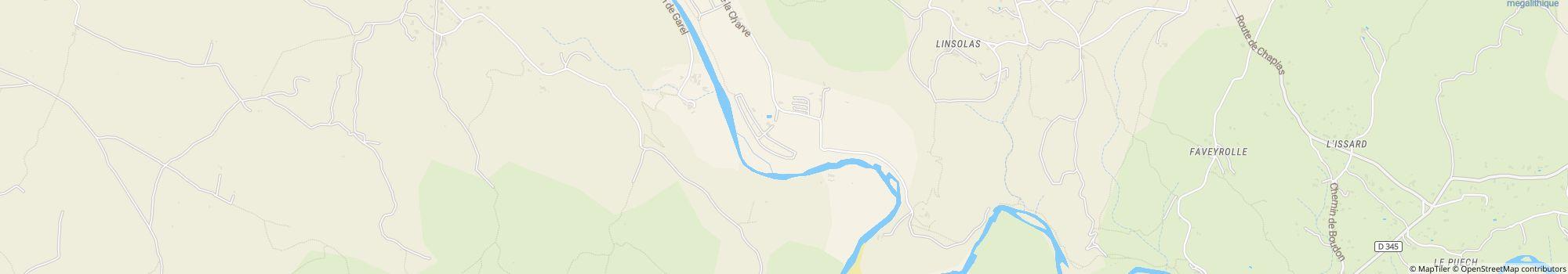
Ohjeet
- Access to the campsite: From the North: From the A7 highway take Montelimar Nord exit, then direction "Le Teil" then Aubenas via the N102, then towards Alès and Rosières up to the D 104. From the highway A75: take …
- River: Alueella
- Korkeus (merenpinnan yläpuolella): 130 m
- Seuraava kaupunki: 20 km
- Seuraava kaupunki/kylä: 4 km
- Rautatie- tai linja-autoasema: 4 km
Osoite
route de La Charve 360007260 Rosieres
Ranska
GPS-koordinaatit
Lat 44.45686397120186, Long 4.277338914010778
OhjeetYhteydenotto
Camping Les Platanes
Soita tai faksaa
Usein kysytyt kysymykset
Kuinka kaukana Camping Les Platanes on joesta?
Camping Les Platanes sijaitsee suoraan joen varrella. Lue lisää sijainnista
Ovatko koirat sallittuja leirintäalueella Camping Les Platanes?
Koirat ovat sallittuja sesonkiaikana ja sesongin ulkopuolella. Vieraat arvioivat kohteen Camping Les Platanes kategoriaan ”sopii koiran kanssa matkustaville” arvosanalla 5 / 5. Lue yksityiskohtaiset arviot nyt
Milloin Camping Les Platanes on avoinna?
Camping Les Platanes on auki 1. huhtikuu - 15. lokakuu. Näytä leirintäalueen tiedot
Onko Camping Les Platanes lapsiystävällinen?
Vieraat pitävät kohdetta Camping Les Platanes erityisen sopivana perheille, joissa on alle 6, 12 ja 18-vuotiaita lapsia. Vapaa-ajan viettoon leirintäalue Camping Les Platanes tarjoaa paljon mahdollisuuksia, kuten Leikkipuisto, Ulkouima-allas, Ohjelmaa lapsille ja paljon muuta.
Katso kaikki vapaa-ajanviettomahdollisuudet
Katso kaikki vapaa-ajanviettomahdollisuudet
Miten vieraat ja muut leiriytyjät arvioivat kohteen Camping Les Platanes?
Leiriytyjät arvioivat kohteen Camping Les Platanes arvosanalla 5 / 5.
Vieraat arvioivat seuraavat ominaisuudet erityisen hyviksi: Ystävällisyys, Infrastruktuuri, Vastine rahalle
Vieraidensa mukaan Camping Les Platanes sopii erityisen hyvin seuraaviin: Telttailijat ja Perheet, lapset alle 12 v.
Vieraidensa mukaan Camping Les Platanes on ihanteellinen seuraaviin: Vaellus ja Uinti
Lue kaikki leiriytyjien arviot
Onko kohteen Camping Les Platanes lähellä ostosmahdollisuuksia?
Ruokakauppa on suoraan leirintäalueella. Lisäksi Camping Les Platanes tarjoaa tuoreen leivän toimituspalvelun suoraan paikan päällä. Lähin pikkukaupunki on 4 km:n päässä, lähim kaupunki on 20 km:n päässä. Lue lisää sijainnista
Kuinka kaukana lähin kaupunki on kohteesta Camping Les Platanes?
Lähin pikkukaupunki on 4 km:n päässä, lähim kaupunki on 20 km:n päässä. Saavut bussi- tai junapysäkille 4 km:ssä. Lue lisää sijainnista
Mitä ruokailumahdollisuuksia Camping Les Platanes tarjaa?
Ruokapuoli on kunnossa, sillä suoraan alueella on ravintola. Lisäksi suoraan paikan päällä on välipalabaari.
Paikan päällä tarjottavan tuoreen leivän toimituspalvelun ansiosta voit aloittaa päiväsi rentoutuneesti.
Omatoimiseen kokkaukseen löytyy ruokakauppa suoraan paikan päältä.
Kaiken kaikkiaan vieraat arvioivat alueen ruoka- ja juomatarjonnan arvosanalla 4.5 / 5.
Kaasupullot voi muuten vaihtaa 3 km etäisyydellä.
Katso kaikki vaihtoehdot yksityiskohtaisesti
Onko leirintäalueella Camping Les Platanes wi-fi tai internet?
Leirintäalue Camping Les Platanes tarjoaa wi-fin. Lisäksi paikan päällä on internetpääte.
Onko Camping Les Platanes esteetön?
Pyörätuolin käyttäjille on saatavilla ramppeja. Saniteettitilat ovat esteettömät. Katso kaikki leirintäalueen mukavuudet
Kuinka monta paikkaa kohteessa Camping Les Platanes on?
Leirintäalue Camping Les Platanes ei valitettavasti ole vielä antanut tietoa matkailijapaikoista. Lähetä kysely nyt
Etsi muita leirintäalueita alueelta Auvergne-Rhône-Alpes
Etsi muita leirintäalueita alueelta Auvergne-Rhône-Alpes
Kuinka suuri Camping Les Platanes on?
Kohteen Camping Les Platanes pinta-ala on 5 hehtaaria. Maaston tyyppi on: Grass
Katso kaikki leirintäalueen tiedot nyt
Katso kaikki leirintäalueen tiedot nyt
Mitä yöpyminen kohteessa Camping Les Platanes maksaa?
Yöpyminen kohteessa Camping Les Platanes maksaa 18,40 € – 32,50 €, mutta hinnat vaihtelevat valitun ajankohdan, vieraiden määrän jne. mukaan. Voit lähettää camping.info-sivustolta sitoumuksettoman kyselyn kohteeseen Camping Les Platanes saadaksesi tietää ajantasaiset hinnat ja saatavuuden. Lähetä kysely nyt