 Deutsch
 English
 Nederlands
 français
 italiano
 Español
 български
 босански
 čeština
 dansk
dansk Ελληνικά
 eesti
eesti suomi
suomi hrvatski
 magyar
 lietuvių
 latviešu
 norsk bokmål
 polski
 português
 română
 русский
 slovenčina
 slovenščina
 српски
 svenska
 Türkçe
%20-%20https://sketchapp.com%20--%3e%3ctitle%3e178342C7-E563-41CE-8EC0-A9A54298CB55%3c/title%3e%3cdesc%3eCreated%20with%20sketchtool.%3c/desc%3e%3cdefs%3e%3ccircle%20id='path-1'%20cx='25'%20cy='25'%20r='25'%3e%3c/circle%3e%3c/defs%3e%3cg%20id='Page-1'%20stroke='none'%20stroke-width='1'%20fill='none'%20fill-rule='evenodd'%3e%3cg%20id='Transparenz'%20transform='translate(-1158.000000,%20-29.000000)'%3e%3cg%20id='Header'%20transform='translate(108.000000,%2031.000000)'%3e%3cg%20id='Profile'%20transform='translate(1052.000000,%200.000000)'%3e%3cg%20id='CI-Placeholder'%3e%3cmask%20id='mask-2'%20fill='white'%3e%3cuse%20xlink:href='%23path-1'%3e%3c/use%3e%3c/mask%3e%3cuse%20id='Background'%20stroke='%23FFFFFF'%20stroke-width='2.5'%20xlink:href='%23path-1'%3e%3c/use%3e%3cpath%20d='M24.9650909,39.2018953%20C22.42,39.2018953%2020.2218182,37.8707667%2019.6992727,36.1567717%20L20.7421818,36.1567717%20C21.1643636,36.1567717%2021.5058182,35.8072948%2021.5058182,35.3765701%20L21.5058182,32.1288835%20C22.5618182,32.6530989%2023.7465455,32.9491525%2025,32.9491525%20C26.2534545,32.9491525%2027.4381818,32.6530989%2028.4941818,32.1299965%20L28.4941818,35.3765701%20C28.4941818,35.8072948%2028.8367273,36.1567717%2029.2589091,36.1567717%20L30.232,36.1567717%20C29.7083636,37.8707667%2027.5101818,39.2018953%2024.9650909,39.2018953%20M18.58,25.4008967%20L18.0956364,20.5093332%20C18.0661818,20.2411041%2018.0465455,19.969536%2018.0465455,19.6924031%20C18.0465455,15.7591185%2021.1665455,12.5592902%2025,12.5592902%20C28.8345455,12.5592902%2031.9534545,15.7591185%2031.9534545,19.6924031%20C31.9534545,19.969536%2031.9349091,20.2411041%2031.9010909,20.5605304%20L31.4189091,25.4053487%20C31.1047273,28.8177569%2028.3458182,31.3898623%2025,31.3898623%20C21.6552727,31.3898623%2018.8963636,28.8177569%2018.58,25.4008967%20M32.6341818,34.5974815%20L30.0225455,34.5974815%20L30.0225455,31.1327631%20C31.6327273,29.7982955%2032.7290909,27.8305403%2032.9396364,25.5567145%20L33.4218182,20.6851846%20C33.4578182,20.3579674%2033.4818182,20.0274112%2033.4818182,19.6924031%20C33.4818182,14.8998951%2029.6767273,11%2025,11%20C20.3232727,11%2016.5192727,14.8998951%2016.5192727,19.6924031%20C16.5192727,20.0274112%2016.5421818,20.3579674%2016.5792727,20.7174611%20L17.0603636,25.5511496%20C17.2709091,27.8283143%2018.3672727,29.7971826%2019.9785455,31.1327631%20L19.9785455,34.5974815%20L17.3658182,34.5974815%20C11.6505455,34.5974815%207,39.3643909%207,45.2209114%20C7,45.6516361%207.34254545,46%207.76363636,46%20C8.18581818,46%208.52836364,45.6516361%208.52836364,45.2209114%20C8.52836364,40.2225014%2012.4916364,36.1567717%2017.3658182,36.1567717%20L18.1316364,36.1567717%20C18.6192727,38.7555888%2021.4938182,40.7600725%2024.9661818,40.7600725%20C28.4374545,40.7600725%2031.312,38.7555888%2031.7996364,36.1567717%20L32.6341818,36.1567717%20C37.5083636,36.1567717%2041.4727273,40.2225014%2041.4727273,45.2209114%20C41.4727273,45.6516361%2041.8141818,46%2042.2363636,46%20C42.6585455,46%2043,45.6516361%2043,45.2209114%20C43,39.3643909%2038.3505455,34.5974815%2032.6341818,34.5974815'%20id='Icon'%20fill='%23FFFFFF'%20mask='url(%23mask-2)'%3e%3c/path%3e%3c/g%3e%3c/g%3e%3c/g%3e%3c/g%3e%3c/g%3e%3c/svg%3e)


den başlayan19,00€
Camping du Pré Rolland
- Çalışma saatleri: 22.04 - 30.09 - şu anda operasyonda
- Adres: Place Richard Willm 1, 38710 Mens, Fransa - haritada göster
- Bölge: IsèreFransa'nın Güneyi
Derecelendirmeler
Açıklama
Profil
You are in search of quietness and authenticity, in a setting of greenery, close to the Mont Aiguille and the Obiou Mountain, close to the lakes of Monteynard and the Sautet. The Trièves thanks its charm to its landscape, both …
- Kamp alanı kategorisi:
- sitenin boyutu: 2 ha (zemin koşulları: Kaplanmış yol)
- Toplam saha sayısı: 77
- Kapıların önünde karavan sahaları: Mevcut
- Karavanlar için de kapı önlerinde mola yerleri: Mevcut
Referans fiyatı
Yoğun sezon €26,60*
Düşük sezon €19,00*
*İki yetişkin, karavan, araba, elektrik ve gecelik yerel vergi
Çalışma saatleri
22. Nisan - 30. Eylül
Özellikler
Tesisler
- Gaz şişesi değişimi(0,2 km)
- Kurutma Odası
- Masalar ve banklar
- Motokaravan hizmet noktası
- Salon
- Wi-Fi(Ödendi)
- Çamaşır kurutma makinesi
- Çamaşır makineleri
- İnternet terminali
- Kömürlü ızgaraya izin verilir
- Merkezi kamp ateşi alanı
- Soyunma Dolapları
- Yakacak odun mevcut
park yerinde
- Elektrik bağlantıları
- Gençlik grupları için ayrı alan
- Sahada arabaya izin verilir
- Sahalarda gölge(Yarı gölgeli)
- Arabasız sahalar
- Sahada gaz bağlantısı
- Sahada kamp ateşine izin verilir
- Sahada kimyasal imha noktası
- Sahada su bağlantısı
- Sahada TV bağlantısı
Evcil Hayvanlar
- Düşük sezonda köpeklere izin verilir
- Kiralık konaklamada köpeklere izin verilir
- Yoğun sezonda köpeklere izin verilir
- Köpek duşları
- Köpek parkı
- Köpek yüzme alanı
Aile ve Çocuklar
- Bebek Bakım Odası
- Çocuk eğlence programı
- Çocuk parkı
- Evcil hayvan çiftliği
- Kapalı alan oyun tesisleri
Yüzme ve Sağlık
- Açık havuz
- Su kaydırağı
- Kapalı havuz
- Sauna
Boş zaman fırsatları
- At binme(3 km)
- Balıkçılık(3 km)
- Bisiklet kiralama
- Kros kayağı(30 km)
- Masa tenisi
- Rüzgâr sörfü(20 km)
- Telesiyej(30 km)
- Tenis(0,1 km)
- Voleybol
- Yelkencilik(20 km)
- Dalış yeri
- Tekne kiralama
Ücret & İkram
- Bakkal dükkanı(0,1 km)
- Pişirme olanakları
- Restorant
- Snack bar
- Yerinde ekmek satılır
Ulaşılabilirlik
- Evrensel olarak erişilebilir hijyenik tesisler
- Genel olarak suya erişim
- Tekerlekli sandalye rampaları
- Yolların çoğu kaplanmıştır
Kiralık konaklama
- Bungalovlar
- Kabinler
- Tatil daireleri
- Kiralık karavanlar
- Kiralık çadırlar
tatil türü
- Kalıcı kamp
- Kış kampı
- Mini kamp alanı
- Çıplak dolaşma
Konum
Talimatlar
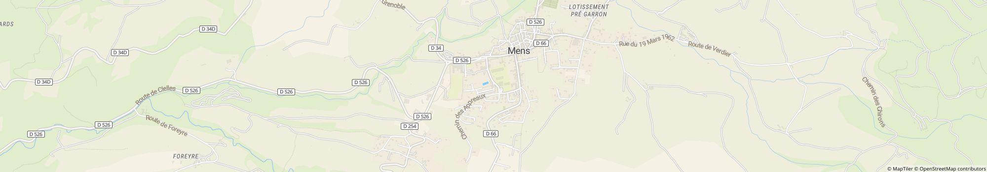
By car : From Grenoble 35 Km Motorway A51 / N75 / D526 From Nice, Marseille, Sisteron A51 / N75 / D526 GPS: 44° 48' 53.181"N 5° 44' 55.136"E Train/TGV : Railway station TGV SNCF Grenoble 35 Km The railway …
- Göl: 20 km
- Dağlarda: Evet
- Yükseklik (deniz seviyesinin üzerinde): 750 m
- Sonraki şehir: 15 km
- Sonraki kasaba/köy: 0,05 km
- Tren istasyonu veya otobüs terminali: Yerinde
- Otoban çıkışı: 19 km
Adres
Place Richard Willm 138710 Mens
Fransa
GPS koordinatları
Lat 44.81487, Long 5.74867
Yol tarifi alİletişim
Camping du Pré Rolland
Arama veya faks
Sıkça sorulan sorular
Camping du Pré Rolland göle ne kadar uzaklıkta?
Camping du Pré Rolland, göle 20 km uzaklıktadır. Konum hakkında daha fazla bilgi edin
¿Se permiten perros en el camping Camping du Pré Rolland?
Yüksek sezonda ve düşük sezonda köpeklere izin verilir. Kiralık konaklama birimlerinde de köpeklere izin verilir.
Camping du Pré Rolland ne zaman açık?
Camping du Pré Rolland, 22. Nisan ile 30. Eylül arası açık. Kamp alanı detaylarını göster
Camping du Pré Rolland aile dostu mu?
Boş zaman aktiviteleri için Camping du Pré Rolland kamp alanı, Çocuk parkı, At binme, Açık havuz, Su kaydırağı, Çocuk eğlence programı ve çok daha fazlası gibi birçok olanak sunmaktadır.
Tüm eğlence olanaklarını gör
Tüm eğlence olanaklarını gör
Misafirler ve diğer kampçılar Camping du Pré Rolland alanını nasıl değerlendiriyor?
Camping du Pré Rolland kamp alanı henüz diğer kampçılar tarafından puanlanmadı.
Camping du Pré Rolland alanını şimdi puanla
Auvergne-Rhône-Alpes bölgesindeki en iyi kamp alanlarını göster
Isère bölgesindeki en iyi kamp alanlarını göster
Fransa'nın Güneyi bölgesindeki en iyi kamp alanlarını göster
Camping du Pré Rolland alanını şimdi puanla
Auvergne-Rhône-Alpes bölgesindeki en iyi kamp alanlarını göster
Isère bölgesindeki en iyi kamp alanlarını göster
Fransa'nın Güneyi bölgesindeki en iyi kamp alanlarını göster
Camping du Pré Rolland yakınlarında alışveriş imkânı var mı?
0.1 km mesafede bir market bulunmaktadır. Ayrıca Camping du Pré Rolland, doğrudan tesiste ekmek servisi sunmaktadır. En yakın kasaba 0.1 km uzaklıktadır, en yakın şehir 15 km uzaklıktadır. Konum hakkında daha fazla bilgi edin
Camping du Pré Rolland alanına en yakın kasaba veya şehir ne kadar uzaklıkta?
En yakın kasaba 0.1 km uzaklıktadır, en yakın şehir 15 km uzaklıktadır. Doğrudan tesiste bir otobüs veya tren durağı bulunmaktadır. En yakın otoyol çıkışı 19 km uzaklıktadır. Konum hakkında daha fazla bilgi edin
Camping du Pré Rolland hangi yemek seçeneklerini sunuyor?
Doğrudan tesiste bir restoran bulunduğu için yemek konusunda kolaylık sağlanmaktadır. Ayrıca doğrudan tesiste bir büfe de bulunmaktadır.
Doğrudan tesiste sunulan ekmek servisiyle güne rahatça başlayabilirsin.
Kendi yemeğini hazırlamak isteyenler için 0.1 km mesafede bir market bulunmaktadır ve tesisteki yemek pişirme olanakları.
Bu arada, gaz tüpleri 0.2 km mesafede değiştirilebilir. Ayrıca masa veya bank ödünç almak isteyenler bunu tesiste yapabilirler.
Tüm seçenekleri detaylı olarak gör
Camping du Pré Rolland kamp alanında wi-fi veya internet var mı?
Camping du Pré Rolland kamp alanı Wi-Fi sunmaktadır. Bu ücrete tabidir.
Camping du Pré Rolland engelsiz (erişilebilir) mi?
Camping du Pré Rolland kamp alanındaki yolların çoğu asfaltlanmıştır. Tekerlekli sandalye kullanıcıları için rampalar mevcuttur. Sıhhi tesisler engelsizdir (erişilebilirdir). Yüzme eğlencesinin önünde hiçbir engel yok, çünkü suya erişim engelsizdir. Tüm kamp alanı özelliklerini gör
Camping du Pré Rolland alanında kaç parsel var?
Maalesef Camping du Pré Rolland kamp alanı henüz turistik parseller hakkında bilgi vermedi. Talebi şimdi gönder
Auvergne-Rhône-Alpes bölgesindeki diğer kamp alanlarını ara
Auvergne-Rhône-Alpes bölgesindeki diğer kamp alanlarını ara
Camping du Pré Rolland ne kadar büyüklükte?
Camping du Pré Rolland alanı 2 hektar büyüklüğündedir. Zemin durumu: Kaplanmış yol
Tüm kamp alanı bilgilerini şimdi gör
Tüm kamp alanı bilgilerini şimdi gör
Camping du Pré Rolland alanında konaklamak ne kadar tutuyor?
Camping du Pré Rolland alanında bir gecelik konaklama €19,00 - €26,60 tutmaktadır, ancak fiyatlar seçilen döneme, misafir sayısına vb. göre değişiklik gösterir. Güncel fiyatları ve müsaitlik durumunu öğrenmek için camping.info üzerinden Camping du Pré Rolland alanına taahhütsüz bir talep gönderebilirsin. Talebi şimdi gönder