 Deutsch
 English
 Nederlands
 français
 italiano
 Español
 български
 босански
 čeština
 dansk
dansk Ελληνικά
 eesti
eesti suomi
suomi hrvatski
 magyar
 lietuvių
 latviešu
 norsk bokmål
 polski
 português
 română
 русский
 slovenčina
 slovenščina
 српски
 svenska
 Türkçe
%20-%20https://sketchapp.com%20--%3e%3ctitle%3e178342C7-E563-41CE-8EC0-A9A54298CB55%3c/title%3e%3cdesc%3eCreated%20with%20sketchtool.%3c/desc%3e%3cdefs%3e%3ccircle%20id='path-1'%20cx='25'%20cy='25'%20r='25'%3e%3c/circle%3e%3c/defs%3e%3cg%20id='Page-1'%20stroke='none'%20stroke-width='1'%20fill='none'%20fill-rule='evenodd'%3e%3cg%20id='Transparenz'%20transform='translate(-1158.000000,%20-29.000000)'%3e%3cg%20id='Header'%20transform='translate(108.000000,%2031.000000)'%3e%3cg%20id='Profile'%20transform='translate(1052.000000,%200.000000)'%3e%3cg%20id='CI-Placeholder'%3e%3cmask%20id='mask-2'%20fill='white'%3e%3cuse%20xlink:href='%23path-1'%3e%3c/use%3e%3c/mask%3e%3cuse%20id='Background'%20stroke='%23FFFFFF'%20stroke-width='2.5'%20xlink:href='%23path-1'%3e%3c/use%3e%3cpath%20d='M24.9650909,39.2018953%20C22.42,39.2018953%2020.2218182,37.8707667%2019.6992727,36.1567717%20L20.7421818,36.1567717%20C21.1643636,36.1567717%2021.5058182,35.8072948%2021.5058182,35.3765701%20L21.5058182,32.1288835%20C22.5618182,32.6530989%2023.7465455,32.9491525%2025,32.9491525%20C26.2534545,32.9491525%2027.4381818,32.6530989%2028.4941818,32.1299965%20L28.4941818,35.3765701%20C28.4941818,35.8072948%2028.8367273,36.1567717%2029.2589091,36.1567717%20L30.232,36.1567717%20C29.7083636,37.8707667%2027.5101818,39.2018953%2024.9650909,39.2018953%20M18.58,25.4008967%20L18.0956364,20.5093332%20C18.0661818,20.2411041%2018.0465455,19.969536%2018.0465455,19.6924031%20C18.0465455,15.7591185%2021.1665455,12.5592902%2025,12.5592902%20C28.8345455,12.5592902%2031.9534545,15.7591185%2031.9534545,19.6924031%20C31.9534545,19.969536%2031.9349091,20.2411041%2031.9010909,20.5605304%20L31.4189091,25.4053487%20C31.1047273,28.8177569%2028.3458182,31.3898623%2025,31.3898623%20C21.6552727,31.3898623%2018.8963636,28.8177569%2018.58,25.4008967%20M32.6341818,34.5974815%20L30.0225455,34.5974815%20L30.0225455,31.1327631%20C31.6327273,29.7982955%2032.7290909,27.8305403%2032.9396364,25.5567145%20L33.4218182,20.6851846%20C33.4578182,20.3579674%2033.4818182,20.0274112%2033.4818182,19.6924031%20C33.4818182,14.8998951%2029.6767273,11%2025,11%20C20.3232727,11%2016.5192727,14.8998951%2016.5192727,19.6924031%20C16.5192727,20.0274112%2016.5421818,20.3579674%2016.5792727,20.7174611%20L17.0603636,25.5511496%20C17.2709091,27.8283143%2018.3672727,29.7971826%2019.9785455,31.1327631%20L19.9785455,34.5974815%20L17.3658182,34.5974815%20C11.6505455,34.5974815%207,39.3643909%207,45.2209114%20C7,45.6516361%207.34254545,46%207.76363636,46%20C8.18581818,46%208.52836364,45.6516361%208.52836364,45.2209114%20C8.52836364,40.2225014%2012.4916364,36.1567717%2017.3658182,36.1567717%20L18.1316364,36.1567717%20C18.6192727,38.7555888%2021.4938182,40.7600725%2024.9661818,40.7600725%20C28.4374545,40.7600725%2031.312,38.7555888%2031.7996364,36.1567717%20L32.6341818,36.1567717%20C37.5083636,36.1567717%2041.4727273,40.2225014%2041.4727273,45.2209114%20C41.4727273,45.6516361%2041.8141818,46%2042.2363636,46%20C42.6585455,46%2043,45.6516361%2043,45.2209114%20C43,39.3643909%2038.3505455,34.5974815%2032.6341818,34.5974815'%20id='Icon'%20fill='%23FFFFFF'%20mask='url(%23mask-2)'%3e%3c/path%3e%3c/g%3e%3c/g%3e%3c/g%3e%3c/g%3e%3c/g%3e%3c/svg%3e)


Alkaen19,00€
Camping du Pré Rolland
- Toiminta-ajat: 22.04 - 30.09 - tällä hetkellä toiminnassa
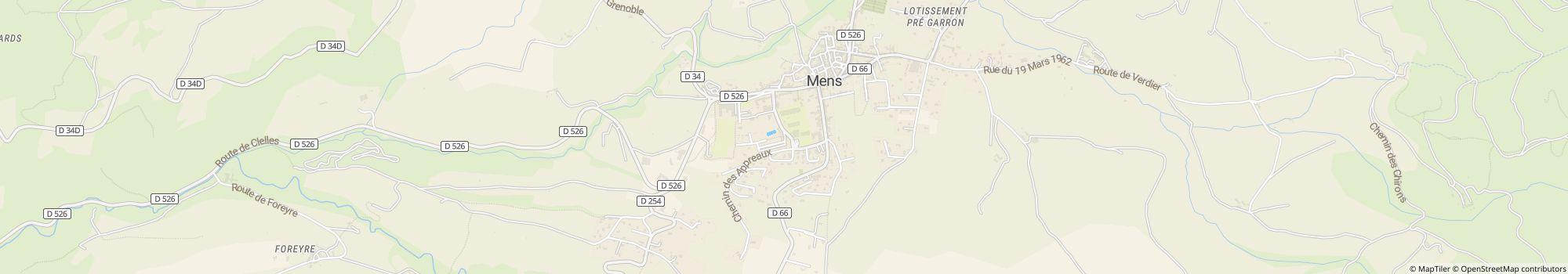
- Osoite: Place Richard Willm 1, 38710 Mens, Ranska - Näytä kartalla
- Alueella: IsèreEtelä-Ranska
Arviot
Kuvaus
Profiilini
You are in search of quietness and authenticity, in a setting of greenery, close to the Mont Aiguille and the Obiou Mountain, close to the lakes of Monteynard and the Sautet. The Trièves thanks its charm to its landscape, both …
- Leirintäalueen luokka:
- Sivuston koko: 2 ha (Maaolosuhteet: Paved)
- Pelipaikkojen kokonaismäärä: 77
- Matkailuautopaikkoja porttien edessä: Saatavilla
- Pysähdyspaikat porttien edessä myös matkailuvaunuille: Saatavilla
Viitehinta
Huippukausi 26,60 €*
Hiljainen kausi 19,00 €*
*Kaksi aikuista, asuntovaunu, auto, sähköt ja paikalliset verot per yö
Toiminta-ajat
22. huhtikuu - 30. syyskuu
Ominaisuudet
Tilat
- Kaasupullojen vaihto(0,2 km)
- Kuivaushuone
- Kuivausrummut
- Matkailuautojen huoltopiste
- Oleskelutilat
- Pyykinpesukoneet
- Pöytiä ja penkkejä
- Wi-Fi(Paid)
- Hiiligrilli sallittu
- Internet-pääte
- Polttopuita saatavilla
- Säilytyslokerot
- Yhteinen nuotiopaikka
Parkkipaikalla
- Auto sallittu leiriytymispaikalla
- Erillinen tila nuorisoryhmille
- Sähköliitäntä
- Varjoisia alueita(Half shaded)
- Autottomat leiriytymispaikat
- Kaasupulloliitäntä paikalla
- Kemikaali-wc:n tyhjennyspiste
- Leiritulen tekeminen sallittu
- TV-liitäntä paikalla
- Vesiliittymä paikalla
Lemmikit
- Koirat sallittuja hiljaisella kaudella
- Koirat sallittuja huippukaudella
- Koirat sallittuja vuokrattaviin majoitustiloihin
- Koirapuisto
- Koirien uimaranta
- Suihkut koirille
Perhe & Lapset
- Lastenhoitohuono
- Leikkipuisto
- Ohjelmaa lapsille
- Eläintarha
- Sisäleikkitilat
Uinti & Hyvinvointi
- Ulkouima-allas
- Vesiliukumäki
- Sauna
- Sisäuima-allas
Vapaa-ajan mahdollisuudet
- Hiihtohissi(30 km)
- Kalastus(3 km)
- Lentopallo
- Murtomaahiihto(30 km)
- Polkupyörävuokraus
- Purjehdus(20 km)
- Purjelautailu(20 km)
- Pöytätennis
- Ratsastus(3 km)
- Tennis(0,1 km)
- Sukelluspaikka
- Venevuokraus
Hinta ja ateriapalvelut
- Keittomahdollisuudet
- Kioski
- Leipää myynnissä alueella
- Ravintola
- Ruokakauppa(0,1 km)
Esteettömyys
- Esteettömät saniteettitilat
- Esteetön pääsy veteen
- Pyörätuoliluiskat
- Useimmat polut kivetty
Vuokra-asunnot
- Loma-asunnot
- Mökit
- Mökkejä
- Asuntovaunujen vuokraus
- Vuokrateltat
Loman tyyppi
- Nudismi
- Pieni leirintäalue
- Pysyvä leiriytyminen
- Talvileiriytyminen
Sijainti
Ohjeet
By car : From Grenoble 35 Km Motorway A51 / N75 / D526 From Nice, Marseille, Sisteron A51 / N75 / D526 GPS: 44° 48' 53.181"N 5° 44' 55.136"E Train/TGV : Railway station TGV SNCF Grenoble 35 Km The railway …
- Järvi: 20 km
- Vuoristossa: Joo
- Korkeus (merenpinnan yläpuolella): 750 m
- Seuraava kaupunki: 15 km
- Seuraava kaupunki/kylä: 0,05 km
- Rautatie- tai linja-autoasema: Alueella
- Moottoritien ramppi: 19 km
Yhteydenotto
Camping du Pré Rolland
Soita tai faksaa
Usein kysytyt kysymykset
Kuinka kaukana Camping du Pré Rolland on järvestä?
Camping du Pré Rolland on 20 km:n päässä järvestä. Lue lisää sijainnista
Ovatko koirat sallittuja leirintäalueella Camping du Pré Rolland?
Koirat ovat sallittuja sesonkiaikana ja sesongin ulkopuolella. Koirat ovat sallittuja myös vuokramajoituksissa.
Milloin Camping du Pré Rolland on avoinna?
Camping du Pré Rolland on auki 22. huhtikuu - 30. syyskuu. Näytä leirintäalueen tiedot
Onko Camping du Pré Rolland lapsiystävällinen?
Vapaa-ajan viettoon leirintäalue Camping du Pré Rolland tarjoaa paljon mahdollisuuksia, kuten Leikkipuisto, Ratsastus, Ulkouima-allas, Vesiliukumäki, Ohjelmaa lapsille ja paljon muuta.
Katso kaikki vapaa-ajanviettomahdollisuudet
Katso kaikki vapaa-ajanviettomahdollisuudet
Miten vieraat ja muut leiriytyjät arvioivat kohteen Camping du Pré Rolland?
Muut leiriytyjät eivät ole vielä arvioineet leirintäaluetta Camping du Pré Rolland.
Arvioi Camping du Pré Rolland nyt
Näytä parhaat leirintäalueet alueelta Auvergne-Rhône-Alpes
Näytä parhaat leirintäalueet alueelta Isère
Näytä parhaat leirintäalueet alueelta Etelä-Ranska
Arvioi Camping du Pré Rolland nyt
Näytä parhaat leirintäalueet alueelta Auvergne-Rhône-Alpes
Näytä parhaat leirintäalueet alueelta Isère
Näytä parhaat leirintäalueet alueelta Etelä-Ranska
Onko kohteen Camping du Pré Rolland lähellä ostosmahdollisuuksia?
Ruokakauppa on 0.1 km päässä. Lisäksi Camping du Pré Rolland tarjoaa tuoreen leivän toimituspalvelun suoraan paikan päällä. Lähin pikkukaupunki on 0.1 km:n päässä, lähim kaupunki on 15 km:n päässä. Lue lisää sijainnista
Kuinka kaukana lähin kaupunki on kohteesta Camping du Pré Rolland?
Lähin pikkukaupunki on 0.1 km:n päässä, lähim kaupunki on 15 km:n päässä. Suoraan alueella on bussi- tai junapysäkki. Lähin moottoritieliittymä on 19 km:n päässä. Lue lisää sijainnista
Mitä ruokailumahdollisuuksia Camping du Pré Rolland tarjaa?
Ruokapuoli on kunnossa, sillä suoraan alueella on ravintola. Lisäksi suoraan paikan päällä on välipalabaari.
Paikan päällä tarjottavan tuoreen leivän toimituspalvelun ansiosta voit aloittaa päiväsi rentoutuneesti.
Omatoimiseen kokkaukseen löytyy ruokakauppa 0.1 km etäisyydeltä sekä ruoanlaittomahdollisuudet alueella.
Kaasupullot voi muuten vaihtaa 0.2 km etäisyydellä. Ja ne, jotka haluavat lainata pöydän tai penkkejä, voivat tehdä sen paikan päällä.
Katso kaikki vaihtoehdot yksityiskohtaisesti
Onko leirintäalueella Camping du Pré Rolland wi-fi tai internet?
Leirintäalue Camping du Pré Rolland tarjoaa wi-fin. Tämä on maksullista.
Onko Camping du Pré Rolland esteetön?
Suurin osa leirintäalueen Camping du Pré Rolland teistä on päällystettyjä. Pyörätuolin käyttäjille on saatavilla ramppeja. Saniteettitilat ovat esteettömät. Mikään ei ole uimisen ilon tiellä, sillä kulku veteen on esteetön. Katso kaikki leirintäalueen mukavuudet
Kuinka monta paikkaa kohteessa Camping du Pré Rolland on?
Leirintäalue Camping du Pré Rolland ei valitettavasti ole vielä antanut tietoa matkailijapaikoista. Lähetä kysely nyt
Etsi muita leirintäalueita alueelta Auvergne-Rhône-Alpes
Etsi muita leirintäalueita alueelta Auvergne-Rhône-Alpes
Kuinka suuri Camping du Pré Rolland on?
Kohteen Camping du Pré Rolland pinta-ala on 2 hehtaaria. Maaston tyyppi on: Paved
Katso kaikki leirintäalueen tiedot nyt
Katso kaikki leirintäalueen tiedot nyt
Mitä yöpyminen kohteessa Camping du Pré Rolland maksaa?
Yöpyminen kohteessa Camping du Pré Rolland maksaa 19,00 € – 26,60 €, mutta hinnat vaihtelevat valitun ajankohdan, vieraiden määrän jne. mukaan. Voit lähettää camping.info-sivustolta sitoumuksettoman kyselyn kohteeseen Camping du Pré Rolland saadaksesi tietää ajantasaiset hinnat ja saatavuuden. Lähetä kysely nyt