 Deutsch
 English
 Nederlands
 français
 italiano
 Español
 български
 босански
 čeština
 dansk
dansk Ελληνικά
 eesti
eesti suomi
suomi hrvatski
 magyar
 lietuvių
 latviešu
 norsk bokmål
 polski
 português
 română
 русский
 slovenčina
 slovenščina
 српски
 svenska
 Türkçe
%20-%20https://sketchapp.com%20--%3e%3ctitle%3e178342C7-E563-41CE-8EC0-A9A54298CB55%3c/title%3e%3cdesc%3eCreated%20with%20sketchtool.%3c/desc%3e%3cdefs%3e%3ccircle%20id='path-1'%20cx='25'%20cy='25'%20r='25'%3e%3c/circle%3e%3c/defs%3e%3cg%20id='Page-1'%20stroke='none'%20stroke-width='1'%20fill='none'%20fill-rule='evenodd'%3e%3cg%20id='Transparenz'%20transform='translate(-1158.000000,%20-29.000000)'%3e%3cg%20id='Header'%20transform='translate(108.000000,%2031.000000)'%3e%3cg%20id='Profile'%20transform='translate(1052.000000,%200.000000)'%3e%3cg%20id='CI-Placeholder'%3e%3cmask%20id='mask-2'%20fill='white'%3e%3cuse%20xlink:href='%23path-1'%3e%3c/use%3e%3c/mask%3e%3cuse%20id='Background'%20stroke='%23FFFFFF'%20stroke-width='2.5'%20xlink:href='%23path-1'%3e%3c/use%3e%3cpath%20d='M24.9650909,39.2018953%20C22.42,39.2018953%2020.2218182,37.8707667%2019.6992727,36.1567717%20L20.7421818,36.1567717%20C21.1643636,36.1567717%2021.5058182,35.8072948%2021.5058182,35.3765701%20L21.5058182,32.1288835%20C22.5618182,32.6530989%2023.7465455,32.9491525%2025,32.9491525%20C26.2534545,32.9491525%2027.4381818,32.6530989%2028.4941818,32.1299965%20L28.4941818,35.3765701%20C28.4941818,35.8072948%2028.8367273,36.1567717%2029.2589091,36.1567717%20L30.232,36.1567717%20C29.7083636,37.8707667%2027.5101818,39.2018953%2024.9650909,39.2018953%20M18.58,25.4008967%20L18.0956364,20.5093332%20C18.0661818,20.2411041%2018.0465455,19.969536%2018.0465455,19.6924031%20C18.0465455,15.7591185%2021.1665455,12.5592902%2025,12.5592902%20C28.8345455,12.5592902%2031.9534545,15.7591185%2031.9534545,19.6924031%20C31.9534545,19.969536%2031.9349091,20.2411041%2031.9010909,20.5605304%20L31.4189091,25.4053487%20C31.1047273,28.8177569%2028.3458182,31.3898623%2025,31.3898623%20C21.6552727,31.3898623%2018.8963636,28.8177569%2018.58,25.4008967%20M32.6341818,34.5974815%20L30.0225455,34.5974815%20L30.0225455,31.1327631%20C31.6327273,29.7982955%2032.7290909,27.8305403%2032.9396364,25.5567145%20L33.4218182,20.6851846%20C33.4578182,20.3579674%2033.4818182,20.0274112%2033.4818182,19.6924031%20C33.4818182,14.8998951%2029.6767273,11%2025,11%20C20.3232727,11%2016.5192727,14.8998951%2016.5192727,19.6924031%20C16.5192727,20.0274112%2016.5421818,20.3579674%2016.5792727,20.7174611%20L17.0603636,25.5511496%20C17.2709091,27.8283143%2018.3672727,29.7971826%2019.9785455,31.1327631%20L19.9785455,34.5974815%20L17.3658182,34.5974815%20C11.6505455,34.5974815%207,39.3643909%207,45.2209114%20C7,45.6516361%207.34254545,46%207.76363636,46%20C8.18581818,46%208.52836364,45.6516361%208.52836364,45.2209114%20C8.52836364,40.2225014%2012.4916364,36.1567717%2017.3658182,36.1567717%20L18.1316364,36.1567717%20C18.6192727,38.7555888%2021.4938182,40.7600725%2024.9661818,40.7600725%20C28.4374545,40.7600725%2031.312,38.7555888%2031.7996364,36.1567717%20L32.6341818,36.1567717%20C37.5083636,36.1567717%2041.4727273,40.2225014%2041.4727273,45.2209114%20C41.4727273,45.6516361%2041.8141818,46%2042.2363636,46%20C42.6585455,46%2043,45.6516361%2043,45.2209114%20C43,39.3643909%2038.3505455,34.5974815%2032.6341818,34.5974815'%20id='Icon'%20fill='%23FFFFFF'%20mask='url(%23mask-2)'%3e%3c/path%3e%3c/g%3e%3c/g%3e%3c/g%3e%3c/g%3e%3c/g%3e%3c/svg%3e)


От19,00€
Camping du Pré Rolland
- Часы работы: 22.04 - 30.09 - в настоящее время закрыто
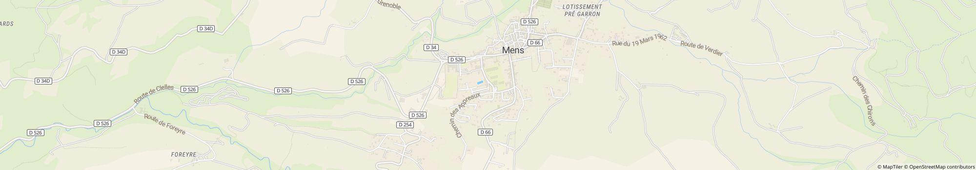
- Адрес: Place Richard Willm 1, 38710 Mens, Франция - Показать на карте
- Регион: ИзерЮг Франции
Рейтинги
Описание
Профиль
You are in search of quietness and authenticity, in a setting of greenery, close to the Mont Aiguille and the Obiou Mountain, close to the lakes of Monteynard and the Sautet. The Trièves thanks its charm to its landscape, both …
- Категория кемпинга:
- Размер сайта: 2 ha (Грунтовые условия: Дорожное покрытие)
- Общее количество шагов: 77
- Участки для автодомов перед воротами: Имеется в наличии
- Площадки для остановки перед воротами также для караванов: Имеется в наличии
Справочная цена
Высокий сезон 26,60 €*
Низкий сезон 19,00 €*
*Два взрослых, дом на колесах, автомобиль, электричество и местные налоги за ночь
Часы работы
22. апрель - 30. сентябрь
Характеристики
Удобства
- Wi-Fi(Платно)
- Автосервис для туристических автофургонов
- Все необходимое для сушки
- Комната отдыха
- Обмен газовых баллонов(0,2 км)
- Стиральные машины
- Столы и скамейки
- Сушильные машины
- Дрова в наличии
- Есть возможность размещения мангала
- Интернет-терминал
- Центральная зона для костра
- Шкафчики
На стоянке
- Есть возможность размещения автомобиля на территории
- Отдельное пространство для молодежи
- Тень на участках(Наполовину в тени)
- Электричество
- Автомобили запрещены
- Газовое подключение на территории
- Есть возможность разжигания костра на территории
- Подвод воды на участок
- Пункт утилизации химпродуктов на территории
- ТВ-подключение на территории
Домашние питомцы
- Пребывание с собаками разрешено в высокий сезон
- Пребывание с собаками разрешено в низкий сезон
- Собаки допускаются в съемное жилье
- Душевые для собак
- Зона для купания собак
- Парк для собак
Семья и дети
- Детская площадка
- Детская развлекательная программа
- Комната для ухода за младенцем
- Игры внутри помещения
- Контактный зоопарк
Плавание и здоровье
- Водная горка
- Открытый бассейн
- Крытый бассейн
- Сауна
Возможности для отдыха
- Виндсерфинг(20 км)
- Волейбол
- Езда на лошади(3 км)
- Ловля рыбы(3 км)
- Лыжный кросс(30 км)
- Настольный теннис
- Парусный спорт(20 км)
- Подъемник(30 км)
- Прокат велосипедов
- Теннис(0,1 км)
- Место для дайвинга
- Прокат лодок
Стоимость проезда и питание
- Кухня
- Продуктовый магазин(0,1 км)
- Ресторан
- Снэк-бар
- Хлеб продается на месте
Доступность
- Большинство путей проложены
- Общедоступные санитарные зоны
- Общий доступ к воде
- Пандусы для инвалидных колясок
Аренда жилья
- Бунгало
- Домики
- Квартиры для отпуска
- Аренда караванов
- Аренда палаток
Тип отпуска
- Зимний кемпинг
- Мини кемпинг-лагерь
- Нудизм
- Постоянный кемпинг
Место расположения
Направления
By car : From Grenoble 35 Km Motorway A51 / N75 / D526 From Nice, Marseille, Sisteron A51 / N75 / D526 GPS: 44° 48' 53.181"N 5° 44' 55.136"E Train/TGV : Railway station TGV SNCF Grenoble 35 Km The railway …
- Озеро: 20 km
- В горах: Да
- Высота (над уровнем моря): 750 m
- Следующий город: 15 km
- Следующий город/поселение: 0,05 km
- Железнодорожный или автобусный вокзал: На месте
- Съезд с автомагистрали: 19 km
Адрес
Place Richard Willm 138710 Mens
Франция
GPS координаты
Lat 44.81487, Long 5.74867
Получить инструкцииКонтакты
Camping du Pré Rolland
Звонок или факс