 Deutsch
 English
 Nederlands
 français
 italiano
 Español
 български
 босански
 čeština
 dansk
dansk Ελληνικά
 eesti
eesti suomi
suomi hrvatski
 magyar
 lietuvių
 latviešu
 norsk bokmål
 polski
 português
 română
 русский
 slovenčina
 slovenščina
 српски
 svenska
 Türkçe
%20-%20https://sketchapp.com%20--%3e%3ctitle%3e178342C7-E563-41CE-8EC0-A9A54298CB55%3c/title%3e%3cdesc%3eCreated%20with%20sketchtool.%3c/desc%3e%3cdefs%3e%3ccircle%20id='path-1'%20cx='25'%20cy='25'%20r='25'%3e%3c/circle%3e%3c/defs%3e%3cg%20id='Page-1'%20stroke='none'%20stroke-width='1'%20fill='none'%20fill-rule='evenodd'%3e%3cg%20id='Transparenz'%20transform='translate(-1158.000000,%20-29.000000)'%3e%3cg%20id='Header'%20transform='translate(108.000000,%2031.000000)'%3e%3cg%20id='Profile'%20transform='translate(1052.000000,%200.000000)'%3e%3cg%20id='CI-Placeholder'%3e%3cmask%20id='mask-2'%20fill='white'%3e%3cuse%20xlink:href='%23path-1'%3e%3c/use%3e%3c/mask%3e%3cuse%20id='Background'%20stroke='%23FFFFFF'%20stroke-width='2.5'%20xlink:href='%23path-1'%3e%3c/use%3e%3cpath%20d='M24.9650909,39.2018953%20C22.42,39.2018953%2020.2218182,37.8707667%2019.6992727,36.1567717%20L20.7421818,36.1567717%20C21.1643636,36.1567717%2021.5058182,35.8072948%2021.5058182,35.3765701%20L21.5058182,32.1288835%20C22.5618182,32.6530989%2023.7465455,32.9491525%2025,32.9491525%20C26.2534545,32.9491525%2027.4381818,32.6530989%2028.4941818,32.1299965%20L28.4941818,35.3765701%20C28.4941818,35.8072948%2028.8367273,36.1567717%2029.2589091,36.1567717%20L30.232,36.1567717%20C29.7083636,37.8707667%2027.5101818,39.2018953%2024.9650909,39.2018953%20M18.58,25.4008967%20L18.0956364,20.5093332%20C18.0661818,20.2411041%2018.0465455,19.969536%2018.0465455,19.6924031%20C18.0465455,15.7591185%2021.1665455,12.5592902%2025,12.5592902%20C28.8345455,12.5592902%2031.9534545,15.7591185%2031.9534545,19.6924031%20C31.9534545,19.969536%2031.9349091,20.2411041%2031.9010909,20.5605304%20L31.4189091,25.4053487%20C31.1047273,28.8177569%2028.3458182,31.3898623%2025,31.3898623%20C21.6552727,31.3898623%2018.8963636,28.8177569%2018.58,25.4008967%20M32.6341818,34.5974815%20L30.0225455,34.5974815%20L30.0225455,31.1327631%20C31.6327273,29.7982955%2032.7290909,27.8305403%2032.9396364,25.5567145%20L33.4218182,20.6851846%20C33.4578182,20.3579674%2033.4818182,20.0274112%2033.4818182,19.6924031%20C33.4818182,14.8998951%2029.6767273,11%2025,11%20C20.3232727,11%2016.5192727,14.8998951%2016.5192727,19.6924031%20C16.5192727,20.0274112%2016.5421818,20.3579674%2016.5792727,20.7174611%20L17.0603636,25.5511496%20C17.2709091,27.8283143%2018.3672727,29.7971826%2019.9785455,31.1327631%20L19.9785455,34.5974815%20L17.3658182,34.5974815%20C11.6505455,34.5974815%207,39.3643909%207,45.2209114%20C7,45.6516361%207.34254545,46%207.76363636,46%20C8.18581818,46%208.52836364,45.6516361%208.52836364,45.2209114%20C8.52836364,40.2225014%2012.4916364,36.1567717%2017.3658182,36.1567717%20L18.1316364,36.1567717%20C18.6192727,38.7555888%2021.4938182,40.7600725%2024.9661818,40.7600725%20C28.4374545,40.7600725%2031.312,38.7555888%2031.7996364,36.1567717%20L32.6341818,36.1567717%20C37.5083636,36.1567717%2041.4727273,40.2225014%2041.4727273,45.2209114%20C41.4727273,45.6516361%2041.8141818,46%2042.2363636,46%20C42.6585455,46%2043,45.6516361%2043,45.2209114%20C43,39.3643909%2038.3505455,34.5974815%2032.6341818,34.5974815'%20id='Icon'%20fill='%23FFFFFF'%20mask='url(%23mask-2)'%3e%3c/path%3e%3c/g%3e%3c/g%3e%3c/g%3e%3c/g%3e%3c/g%3e%3c/svg%3e)


Από19,00€
Camping du Pré Rolland
- Ωρες λειτουργίας: 22.04 - 30.09 - επί του παρόντος κλειστή
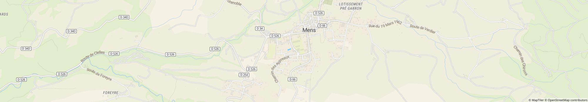
- Διεύθυνση: Place Richard Willm 1, 38710 Mens, Γαλλία - Εμφάνιση στον χάρτη
- Περιοχή: ΙσερέΝότια Γαλλία
Ακροαματικότητα
Περιγραφή
Προφίλ
You are in search of quietness and authenticity, in a setting of greenery, close to the Mont Aiguille and the Obiou Mountain, close to the lakes of Monteynard and the Sautet. The Trièves thanks its charm to its landscape, both …
- Κατηγορία κάμπινγκ:
- Το μέγεθος του ιστότοπου: 2 ha (Συνθήκες εδάφους: Πλακόστρωτο)
- Συνολικός αριθμός γηπέδων: 77
- Γήπεδα τροχόσπιτου μπροστά από τις πύλες: Διαθέσιμος
- Γήπεδα ενδιάμεσης στάσης μπροστά από τις πύλες και για τροχόσπιτα: Διαθέσιμος
Τιμή αναφοράς
Περίοδος αιχμής 26,60 €*
Περίοδος χαμηλής ζήτησης 19,00 €*
*Δύο ενήλικες, τροχόσπιτο, αυτοκίνητο, ηλεκτρική ενέργεια και τοπικοί φόροι ανά βραδιά
Ωρες λειτουργίας
22. Απρίλιος - 30. Σεπτέμβριος
Ιδιότητες
Εγκαταστάσεις
- Wi-Fi(Επί πληρωμή)
- Ανταλλαγή φιαλών αερίου(0,2 χλμ.)
- Δωμάτιο στεγνώματος
- Πλυντήρια
- Σαλόνι
- Σημείο εξυπηρέτησης αυτοκινούμενων
- Στεγνωτήρια
- Τραπέζια και πάγκοι
- Επιτρέπεται ψησταριά με κάρβουνο
- Ερμάρια
- Καυσόξυλα διαθέσιμα
- Κεντρική περιοχή φωτιάς
- Τερματικό Διαδικτύου
Στη θέση στάθμευσης
- Επιτρέπεται αυτοκίνητο στο σημείο
- Ηλεκτρικές συνδέσεις
- Ξεχωριστός χώρος για ομάδες νέων
- Σκιά στις θέσεις(Σκιά κατά το ήμισυ)
- Επιτρέπεται η φωτιά στη θέση
- Σημεία χωρίς αυτοκίνητο
- Σημείο διάθεσης χημικών ουσιών στη θέση
- Σύνδεση αερίου στη θέση
- Σύνδεση νερού στη θέση
- Σύνδεση τηλεόρασης στη θέση
Κατοικίδια
- Επιτρέπονται οι σκύλοι κατά την περίοδο αιχμής
- Επιτρέπονται οι σκύλοι κατά την περίοδο χαμηλής ζήτησης
- Επιτρέπονται οι σκύλοι στα ενοικιαζόμενα καταλύματα
- Ντους σκύλων
- Πάρκο σκύλων
- Περιοχή κολύμβησης σκύλων
Οικογένεια & Παιδιά
- Δωμάτιο με αλλαξιέρα
- Παιδική χαρά
- Πρόγραμμα ψυχαγωγίας παιδιών
- Εσωτερικές εγκαταστάσεις παιχνιδιού
- Ζωολογικός κήπος
Κολύμβηση & Ευεξία
- Εξωτερική πισίνα
- Νεροτσουλήθρα
- Εσωτερική πισίνα
- Σάουνα
Ευκαιρίες αναψυχής
- Βόλεϊ
- Ενοικίαση ποδηλάτου
- Ιππασία(3 χλμ.)
- Ιστιοπλοΐα(20 χλμ.)
- Ιστιοσανίδα(20 χλμ.)
- Πινγκ πονγκ
- Σκι αντοχής(30 χλμ.)
- Τένις(0,1 χλμ.)
- Τελεφερίκ(30 χλμ.)
- Ψάρεμα(3 χλμ.)
- Ενοικίαση σκάφους
- Τοποθεσία κατάδυσης
Ναύλος & Catering
- Αναψυκτήριο
- Εγκαταστάσεις μαγειρέματος
- Εστιατόριο
- Μπακάλικο(0,1 χλμ.)
- Πώληση ψωμιού στην τοποθεσία
Προσιτότητα
- Καθολικά προσβάσιμες εγκαταστάσεις υγιεινής
- Καθολική πρόσβαση στο νερό
- Ράμπες για αναπηρικά αμαξίδια
- Τα περισσότερα μονοπάτια είναι πλακόστρωτα
Ενοικιαζόμενα καταλύματα
- Καμπίνες
- Μπανγκαλόου
- Παραθεριστικά διαμερίσματα
- Ενοικίαση σκηνών
- Ενοικίαση τροχόσπιτα
Τύπος διακοπών
- Γυμνισμός
- Μίνι θέση κάμπινγκ
- Μόνιμο κάμπινγκ
- Χειμερινό κάμπινγκ
Τοποθεσία
Κατευθύνσεις
By car : From Grenoble 35 Km Motorway A51 / N75 / D526 From Nice, Marseille, Sisteron A51 / N75 / D526 GPS: 44° 48' 53.181"N 5° 44' 55.136"E Train/TGV : Railway station TGV SNCF Grenoble 35 Km The railway …
- Λίμνη: 20 km
- Στα βουνά: Ναί
- Ύψος (πάνω από την επιφάνεια της θάλασσας): 750 m
- Επόμενη πόλη: 15 km
- Επόμενη πόλη/χωριό: 0,05 km
- Σταθμός τρένου ή λεωφορείων: Επιτόπου
- Έξοδος αυτοκινητοδρόμου: 19 km
Διεύθυνση
Place Richard Willm 138710 Mens
Γαλλία
Συντεταγμένες GPS
Lat 44.81487, Long 5.74867
Λήψη οδηγιώνΕπικοινωνία
Camping du Pré Rolland
Καλέστε ή φαξ