 Deutsch
 English
 Nederlands
 français
 italiano
 Español
 български
 босански
 čeština
 dansk
dansk Ελληνικά
 eesti
eesti suomi
suomi hrvatski
 magyar
 lietuvių
 latviešu
 norsk bokmål
 polski
 português
 română
 русский
 slovenčina
 slovenščina
 српски
 svenska
 Türkçe
%20-%20https://sketchapp.com%20--%3e%3ctitle%3e178342C7-E563-41CE-8EC0-A9A54298CB55%3c/title%3e%3cdesc%3eCreated%20with%20sketchtool.%3c/desc%3e%3cdefs%3e%3ccircle%20id='path-1'%20cx='25'%20cy='25'%20r='25'%3e%3c/circle%3e%3c/defs%3e%3cg%20id='Page-1'%20stroke='none'%20stroke-width='1'%20fill='none'%20fill-rule='evenodd'%3e%3cg%20id='Transparenz'%20transform='translate(-1158.000000,%20-29.000000)'%3e%3cg%20id='Header'%20transform='translate(108.000000,%2031.000000)'%3e%3cg%20id='Profile'%20transform='translate(1052.000000,%200.000000)'%3e%3cg%20id='CI-Placeholder'%3e%3cmask%20id='mask-2'%20fill='white'%3e%3cuse%20xlink:href='%23path-1'%3e%3c/use%3e%3c/mask%3e%3cuse%20id='Background'%20stroke='%23FFFFFF'%20stroke-width='2.5'%20xlink:href='%23path-1'%3e%3c/use%3e%3cpath%20d='M24.9650909,39.2018953%20C22.42,39.2018953%2020.2218182,37.8707667%2019.6992727,36.1567717%20L20.7421818,36.1567717%20C21.1643636,36.1567717%2021.5058182,35.8072948%2021.5058182,35.3765701%20L21.5058182,32.1288835%20C22.5618182,32.6530989%2023.7465455,32.9491525%2025,32.9491525%20C26.2534545,32.9491525%2027.4381818,32.6530989%2028.4941818,32.1299965%20L28.4941818,35.3765701%20C28.4941818,35.8072948%2028.8367273,36.1567717%2029.2589091,36.1567717%20L30.232,36.1567717%20C29.7083636,37.8707667%2027.5101818,39.2018953%2024.9650909,39.2018953%20M18.58,25.4008967%20L18.0956364,20.5093332%20C18.0661818,20.2411041%2018.0465455,19.969536%2018.0465455,19.6924031%20C18.0465455,15.7591185%2021.1665455,12.5592902%2025,12.5592902%20C28.8345455,12.5592902%2031.9534545,15.7591185%2031.9534545,19.6924031%20C31.9534545,19.969536%2031.9349091,20.2411041%2031.9010909,20.5605304%20L31.4189091,25.4053487%20C31.1047273,28.8177569%2028.3458182,31.3898623%2025,31.3898623%20C21.6552727,31.3898623%2018.8963636,28.8177569%2018.58,25.4008967%20M32.6341818,34.5974815%20L30.0225455,34.5974815%20L30.0225455,31.1327631%20C31.6327273,29.7982955%2032.7290909,27.8305403%2032.9396364,25.5567145%20L33.4218182,20.6851846%20C33.4578182,20.3579674%2033.4818182,20.0274112%2033.4818182,19.6924031%20C33.4818182,14.8998951%2029.6767273,11%2025,11%20C20.3232727,11%2016.5192727,14.8998951%2016.5192727,19.6924031%20C16.5192727,20.0274112%2016.5421818,20.3579674%2016.5792727,20.7174611%20L17.0603636,25.5511496%20C17.2709091,27.8283143%2018.3672727,29.7971826%2019.9785455,31.1327631%20L19.9785455,34.5974815%20L17.3658182,34.5974815%20C11.6505455,34.5974815%207,39.3643909%207,45.2209114%20C7,45.6516361%207.34254545,46%207.76363636,46%20C8.18581818,46%208.52836364,45.6516361%208.52836364,45.2209114%20C8.52836364,40.2225014%2012.4916364,36.1567717%2017.3658182,36.1567717%20L18.1316364,36.1567717%20C18.6192727,38.7555888%2021.4938182,40.7600725%2024.9661818,40.7600725%20C28.4374545,40.7600725%2031.312,38.7555888%2031.7996364,36.1567717%20L32.6341818,36.1567717%20C37.5083636,36.1567717%2041.4727273,40.2225014%2041.4727273,45.2209114%20C41.4727273,45.6516361%2041.8141818,46%2042.2363636,46%20C42.6585455,46%2043,45.6516361%2043,45.2209114%20C43,39.3643909%2038.3505455,34.5974815%2032.6341818,34.5974815'%20id='Icon'%20fill='%23FFFFFF'%20mask='url(%23mask-2)'%3e%3c/path%3e%3c/g%3e%3c/g%3e%3c/g%3e%3c/g%3e%3c/g%3e%3c/svg%3e)


From25.20€
Höhen-Camping Langenbrand
- Operating hours: 01.01 - 31.12 - currently in operation
- Address: Schömbergerstr. 32, 75328 Schömberg, Germany - Show on map
- Region: Suttgart / Electoral Palatinate / OdenwaldBlack ForestSouth GermanyNorthern Black Forest
Ratings
Ratings in detail
- Tranquillity4.5
- Food / Shops2.7
- Overall cleanliness4.5
- Cleanliness of sanitary facilities4.5
- Friendliness4.6
- Infrastructure4.1
- Leisure activities4.2
- Location4.3
- Value for money4.2
- Sanitary facilities4.1
What guests write

%20-%20https://sketchapp.com%20--%3e%3ctitle%3e178342C7-E563-41CE-8EC0-A9A54298CB55%3c/title%3e%3cdesc%3eCreated%20with%20sketchtool.%3c/desc%3e%3cdefs%3e%3ccircle%20id='path-1'%20cx='25'%20cy='25'%20r='25'%3e%3c/circle%3e%3c/defs%3e%3cg%20id='Page-1'%20stroke='none'%20stroke-width='1'%20fill='none'%20fill-rule='evenodd'%3e%3cg%20id='Transparenz'%20transform='translate(-1158.000000,%20-29.000000)'%3e%3cg%20id='Header'%20transform='translate(108.000000,%2031.000000)'%3e%3cg%20id='Profile'%20transform='translate(1052.000000,%200.000000)'%3e%3cg%20id='CI-Placeholder'%3e%3cmask%20id='mask-2'%20fill='white'%3e%3cuse%20xlink:href='%23path-1'%3e%3c/use%3e%3c/mask%3e%3cuse%20id='Background'%20stroke='%239b9b9b'%20stroke-width='2.5'%20xlink:href='%23path-1'%3e%3c/use%3e%3cpath%20d='M24.9650909,39.2018953%20C22.42,39.2018953%2020.2218182,37.8707667%2019.6992727,36.1567717%20L20.7421818,36.1567717%20C21.1643636,36.1567717%2021.5058182,35.8072948%2021.5058182,35.3765701%20L21.5058182,32.1288835%20C22.5618182,32.6530989%2023.7465455,32.9491525%2025,32.9491525%20C26.2534545,32.9491525%2027.4381818,32.6530989%2028.4941818,32.1299965%20L28.4941818,35.3765701%20C28.4941818,35.8072948%2028.8367273,36.1567717%2029.2589091,36.1567717%20L30.232,36.1567717%20C29.7083636,37.8707667%2027.5101818,39.2018953%2024.9650909,39.2018953%20M18.58,25.4008967%20L18.0956364,20.5093332%20C18.0661818,20.2411041%2018.0465455,19.969536%2018.0465455,19.6924031%20C18.0465455,15.7591185%2021.1665455,12.5592902%2025,12.5592902%20C28.8345455,12.5592902%2031.9534545,15.7591185%2031.9534545,19.6924031%20C31.9534545,19.969536%2031.9349091,20.2411041%2031.9010909,20.5605304%20L31.4189091,25.4053487%20C31.1047273,28.8177569%2028.3458182,31.3898623%2025,31.3898623%20C21.6552727,31.3898623%2018.8963636,28.8177569%2018.58,25.4008967%20M32.6341818,34.5974815%20L30.0225455,34.5974815%20L30.0225455,31.1327631%20C31.6327273,29.7982955%2032.7290909,27.8305403%2032.9396364,25.5567145%20L33.4218182,20.6851846%20C33.4578182,20.3579674%2033.4818182,20.0274112%2033.4818182,19.6924031%20C33.4818182,14.8998951%2029.6767273,11%2025,11%20C20.3232727,11%2016.5192727,14.8998951%2016.5192727,19.6924031%20C16.5192727,20.0274112%2016.5421818,20.3579674%2016.5792727,20.7174611%20L17.0603636,25.5511496%20C17.2709091,27.8283143%2018.3672727,29.7971826%2019.9785455,31.1327631%20L19.9785455,34.5974815%20L17.3658182,34.5974815%20C11.6505455,34.5974815%207,39.3643909%207,45.2209114%20C7,45.6516361%207.34254545,46%207.76363636,46%20C8.18581818,46%208.52836364,45.6516361%208.52836364,45.2209114%20C8.52836364,40.2225014%2012.4916364,36.1567717%2017.3658182,36.1567717%20L18.1316364,36.1567717%20C18.6192727,38.7555888%2021.4938182,40.7600725%2024.9661818,40.7600725%20C28.4374545,40.7600725%2031.312,38.7555888%2031.7996364,36.1567717%20L32.6341818,36.1567717%20C37.5083636,36.1567717%2041.4727273,40.2225014%2041.4727273,45.2209114%20C41.4727273,45.6516361%2041.8141818,46%2042.2363636,46%20C42.6585455,46%2043,45.6516361%2043,45.2209114%20C43,39.3643909%2038.3505455,34.5974815%2032.6341818,34.5974815'%20id='Icon'%20fill='%239b9b9b'%20mask='url(%23mask-2)'%3e%3c/path%3e%3c/g%3e%3c/g%3e%3c/g%3e%3c/g%3e%3c/g%3e%3c/svg%3e)


Activities recommended by guests
Mountain biking
(6 Guests)Motorcycle
(2 Guests)Leisurely walks
(2 Guests)Cross-country skiing
(1 Guest)Culture
(1 Guest)Sightseeing
(1 Guest)Rated by guests as "Suitable for"
Senior citizens
Couples
Guests with tents
Guests with dogs
Families with children under 6
Families with children under 12
Families with children under 18
Youth groups
Description
Profile
Direkt am Waldrand und doch unmittelbar in der Nähe zum Dorf. 5-Sterne Bewertung vom DTV. Wandern, Biken oder einfach nur spazieren gehen durch unendlich Wälder. Beschildertes Wander- und Radwegenetz das seinesgleichen sucht! Ausgangspunk für Ausflüge in den Schwarzwald, Raum Stuttgartund …
- Campsite category:
- Size of the site: 1.6 ha (Ground conditions: Grass)
- Total number of pitches: 80
- Number of tourist pitches: 40 (Of which parcels: 40)
- Motorhome pitches in front of the gates: Not available
Reference price
Peak season €25.20*
Low season €25.20*
*Two adults, caravan, car, electricity and local taxes per night
Operating hours
01. gennaio - 31. dicembre
Properties
Equipment
- Charcoal grill allowed
- Drying room
- Gas bottle exchange
- Individual washing cubicles(8)
- Lounge
- Motorhome service point
- Tables and benches
- Tumble dryers
- Washing machines
- Wi-Fi(Paid)
At the parking place
- Campfire permitted on pitch
- Car permitted on pitch
- Electric hook-ups
- Shade on pitches(Half shaded)
- TV hook-up on pitch
- Waste water drainage on pitch
- Water hook-up on pitch
- Car-free pitches
- Gas hook-up on pitch
- Separate space for youth groups
Pets
- Dog park
- Dogs allowed in low season
- Dogs allowed in peak season
Family & Children
- Baby changing room
- Indoor play facilities
- Playground
- Kids entertainment programme
- Petting zoo
Swimming & Wellness
- Hot springs(10 km)
- Indoor pool(10 km)
- Outdoor pool(4 km)
- Sauna(10 km)
- Swimming in natural waters(30 km, Lake)
Leisure opportunities
- Bicycle hire(0.8 km)
- Golf(12 km)
- Miniature golf(2 km)
- Ski lift(1 km)
- Table tennis
- Tennis(0.5 km)
Fare & Catering
- Bread sold on-site
- Cooking facilities
- Restaurant(0.5 km)
- Snack(0.2 km)
Accessibility
- Most paths are paved
- Universally accessible sanitary facilities
- Wheelchair ramps
Rental accommodations
- Bungalows
- Cabins
- Holiday apartments
- Rental caravans
- Rental tents
Vacation type
- Permanent camping
- Winter camping
- Mini campsite
- Nudism
Location
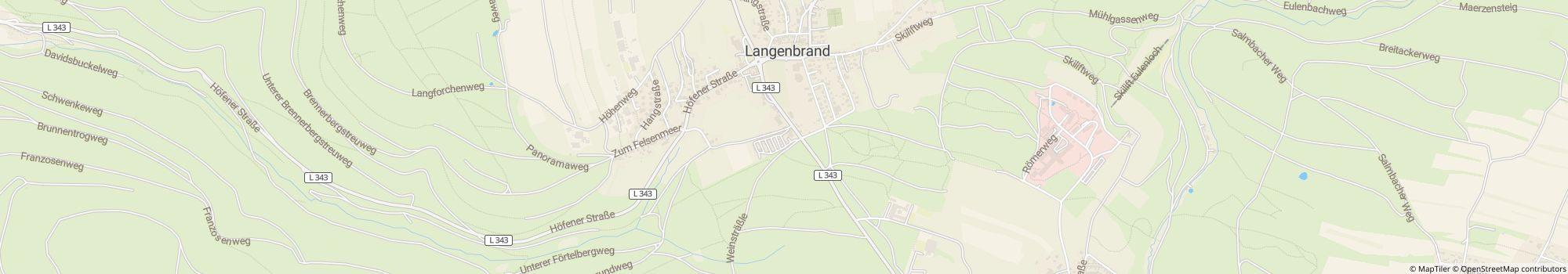
Directions
Von Karlsruhe A8 Ausfahrt Pforzheim West-Büchenbronn-Schömberg. Von München A8 Ausfahrt Leonberg-Richtung Calw-Weil der Stadt- Bad Liebenzell- Schömberg.
- River: 4 km
- In the mountains: Yes
- Height (above sea level): 630 m
- Next city: 2 km
- Next town/village: 0.2 km
- Train or bus station: 0.2 km
- Motorway exit: 15 km
Address
Schömbergerstr. 3275328 Schömberg
Germany
GPS Coordinates
Lat 48.7984, Long 8.63537
Get directionsContact
Höhen-Camping Langenbrand
Call or fax
Frequently asked questions
How far from the river is Höhen-Camping Langenbrand?
Höhen-Camping Langenbrand is 4 km away from the river. Learn more about the location
Are dogs allowed at the campsite Höhen-Camping Langenbrand?
Dogs are allowed in high season and low season. Guests rate Höhen-Camping Langenbrand as "suitable for guests with dogs" with 4.1 out of 5. Read reviews in detail now
When is Höhen-Camping Langenbrand open?
Höhen-Camping Langenbrand is open from gennaio 1 until dicembre 31. Show campsite details
Is Höhen-Camping Langenbrand family friendly?
For leisure activities, the campsite Höhen-Camping Langenbrand offers many possibilities, such as Playground, Outdoor pool and much more. In case of bad weather you can use the indoor pool (10 km away) and the indoor play facilities.
View all recreational opportunities
View all recreational opportunities
How do guests and other campers rate Höhen-Camping Langenbrand?
Campers rate Höhen-Camping Langenbrand 3.9 out of 5.
Guests rate the following properties particularly well: Friendliness, Tranquillity, Overall cleanliness
According to its guests Höhen-Camping Langenbrand is particularly suitable for: Senior citizens and Couples
According to its guests Höhen-Camping Langenbrand is ideal for: Hiking and Cycling
Read all camper reviews
Are there shopping facilities near Höhen-Camping Langenbrand?
Sorry, the campsite Höhen-Camping Langenbrand has not yet provided any details about shopping facilities, but you can request the info directly from the campsite. Send request now
Search for other campsites in Baden-Württemberg with shopping facilities
Search for other campsites in Baden-Württemberg with shopping facilities
How far is the nearest town or city from Höhen-Camping Langenbrand?
The nearest town is 0.2 km away, the nearest city is 2 km away. You can reach a bus or train stop in 0.2 km. The nearest highway exit is 15 km away. Learn more about the location
What food options does Höhen-Camping Langenbrand offer?
Food is well taken care of, because there is a restaurant in 0.5 km distance. Furthermore, there is also a snack bar at a distance of 0.2 km.
With the bread service directly at the site you can start the day relaxed.
Cooking facilities on the site are also available. Real barbecue fans may even fire up the charcoal grill.
Overall, guests rate the food and beverage at the site 2.7 out of 5.
By the way, gas bottles can be exchanged directly at the site. And those who want to borrow a table or benches can also do so on site.
View all options in detail
Is there wifi or internet at the campsite Höhen-Camping Langenbrand?
The campsite Höhen-Camping Langenbrand offers wifi. This is chargeable.
Is Höhen-Camping Langenbrand barrier-free?
Most of the paths at campsite Höhen-Camping Langenbrand are paved. Ramps are available for wheelchair users. The sanitary facilities are barrier-free. View all campsite features
How many pitches does Höhen-Camping Langenbrand have?
Höhen-Camping Langenbrand has 40 pitches for tourists and 40 pitches for permanent campers.
View all campsite information now
View all campsite information now
How big is Höhen-Camping Langenbrand?
Höhen-Camping Langenbrand has a size of 1.6 hectares. Ground condition is: Grass
View all campsite information now
View all campsite information now
How much does it cost to stay at Höhen-Camping Langenbrand?
An overnight stay at Höhen-Camping Langenbrand costs from €25.20, but prices vary depending on the chosen period, guests, etc. At camping.info you can send a no-obligation request to Höhen-Camping Langenbrand to find out current prices and availability. Send request now