 Deutsch
 English
 Nederlands
 français
 italiano
 Español
 български
 босански
 čeština
 dansk
dansk Ελληνικά
 eesti
eesti suomi
suomi hrvatski
 magyar
 lietuvių
 latviešu
 norsk bokmål
 polski
 português
 română
 русский
 slovenčina
 slovenščina
 српски
 svenska
 Türkçe
%20-%20https://sketchapp.com%20--%3e%3ctitle%3e178342C7-E563-41CE-8EC0-A9A54298CB55%3c/title%3e%3cdesc%3eCreated%20with%20sketchtool.%3c/desc%3e%3cdefs%3e%3ccircle%20id='path-1'%20cx='25'%20cy='25'%20r='25'%3e%3c/circle%3e%3c/defs%3e%3cg%20id='Page-1'%20stroke='none'%20stroke-width='1'%20fill='none'%20fill-rule='evenodd'%3e%3cg%20id='Transparenz'%20transform='translate(-1158.000000,%20-29.000000)'%3e%3cg%20id='Header'%20transform='translate(108.000000,%2031.000000)'%3e%3cg%20id='Profile'%20transform='translate(1052.000000,%200.000000)'%3e%3cg%20id='CI-Placeholder'%3e%3cmask%20id='mask-2'%20fill='white'%3e%3cuse%20xlink:href='%23path-1'%3e%3c/use%3e%3c/mask%3e%3cuse%20id='Background'%20stroke='%23FFFFFF'%20stroke-width='2.5'%20xlink:href='%23path-1'%3e%3c/use%3e%3cpath%20d='M24.9650909,39.2018953%20C22.42,39.2018953%2020.2218182,37.8707667%2019.6992727,36.1567717%20L20.7421818,36.1567717%20C21.1643636,36.1567717%2021.5058182,35.8072948%2021.5058182,35.3765701%20L21.5058182,32.1288835%20C22.5618182,32.6530989%2023.7465455,32.9491525%2025,32.9491525%20C26.2534545,32.9491525%2027.4381818,32.6530989%2028.4941818,32.1299965%20L28.4941818,35.3765701%20C28.4941818,35.8072948%2028.8367273,36.1567717%2029.2589091,36.1567717%20L30.232,36.1567717%20C29.7083636,37.8707667%2027.5101818,39.2018953%2024.9650909,39.2018953%20M18.58,25.4008967%20L18.0956364,20.5093332%20C18.0661818,20.2411041%2018.0465455,19.969536%2018.0465455,19.6924031%20C18.0465455,15.7591185%2021.1665455,12.5592902%2025,12.5592902%20C28.8345455,12.5592902%2031.9534545,15.7591185%2031.9534545,19.6924031%20C31.9534545,19.969536%2031.9349091,20.2411041%2031.9010909,20.5605304%20L31.4189091,25.4053487%20C31.1047273,28.8177569%2028.3458182,31.3898623%2025,31.3898623%20C21.6552727,31.3898623%2018.8963636,28.8177569%2018.58,25.4008967%20M32.6341818,34.5974815%20L30.0225455,34.5974815%20L30.0225455,31.1327631%20C31.6327273,29.7982955%2032.7290909,27.8305403%2032.9396364,25.5567145%20L33.4218182,20.6851846%20C33.4578182,20.3579674%2033.4818182,20.0274112%2033.4818182,19.6924031%20C33.4818182,14.8998951%2029.6767273,11%2025,11%20C20.3232727,11%2016.5192727,14.8998951%2016.5192727,19.6924031%20C16.5192727,20.0274112%2016.5421818,20.3579674%2016.5792727,20.7174611%20L17.0603636,25.5511496%20C17.2709091,27.8283143%2018.3672727,29.7971826%2019.9785455,31.1327631%20L19.9785455,34.5974815%20L17.3658182,34.5974815%20C11.6505455,34.5974815%207,39.3643909%207,45.2209114%20C7,45.6516361%207.34254545,46%207.76363636,46%20C8.18581818,46%208.52836364,45.6516361%208.52836364,45.2209114%20C8.52836364,40.2225014%2012.4916364,36.1567717%2017.3658182,36.1567717%20L18.1316364,36.1567717%20C18.6192727,38.7555888%2021.4938182,40.7600725%2024.9661818,40.7600725%20C28.4374545,40.7600725%2031.312,38.7555888%2031.7996364,36.1567717%20L32.6341818,36.1567717%20C37.5083636,36.1567717%2041.4727273,40.2225014%2041.4727273,45.2209114%20C41.4727273,45.6516361%2041.8141818,46%2042.2363636,46%20C42.6585455,46%2043,45.6516361%2043,45.2209114%20C43,39.3643909%2038.3505455,34.5974815%2032.6341818,34.5974815'%20id='Icon'%20fill='%23FFFFFF'%20mask='url(%23mask-2)'%3e%3c/path%3e%3c/g%3e%3c/g%3e%3c/g%3e%3c/g%3e%3c/g%3e%3c/svg%3e)


From25.90€
Erholungsgebiet Dingdener Heide
Very good
495 ratings

Award
2026
- Operating hours: 01.04 - 31.10 - currently in operation
- Address: Busster Weg 100, 46499 Hamminkeln, Germany - Show on map
- Region: Lower RhineRuhrMünsterland
- Website: dingdener-heide.de
'%3e%3cpath%20d='M24.985%2044.265c10.608%200%2019.21-8.596%2019.21-19.203S35.593%205.858%2024.985%205.858c-10.61%200-19.21%208.599-19.21%2019.204s8.6%2019.203%2019.21%2019.203Z'%20fill='%2354C100'%20stroke='%23fff'%20stroke-width='.5'/%3e%3c/g%3e%3cmask%20id='b'%20style='mask-type:luminance'%20maskUnits='userSpaceOnUse'%20x='5'%20y='5'%20width='40'%20height='40'%3e%3cpath%20d='M44.132%205.963H5.838v38.074h38.294V5.963Z'%20fill='%23fff'/%3e%3c/mask%3e%3cg%20mask='url(%23b)'%3e%3cpath%20d='M24.397%2043.11C33.567%2043.11%2041%2035.68%2041%2026.511S33.566%209.916%2024.397%209.916c-9.17%200-16.603%207.431-16.603%2016.597s7.432%2016.598%2016.603%2016.598'%20fill='%234D7D34'/%3e%3c/g%3e%3cpath%20d='M25%2039c7.18%200%2013-5.82%2013-13s-5.82-13-13-13-13%205.82-13%2013%205.82%2013%2013%2013Z'%20fill='%23fff'/%3e%3cpath%20d='m49.41%2022.845.001-.017v-.017c.006-.656-.3-1.384-.716-1.953-.411-.561-1.02-1.09-1.72-1.19-21.477-3.114-38.928.754-44.432%202.188h-.001c-.661.174-1.173.663-1.495%201.262a3.712%203.712%200%200%200-.397%202.107l.001.009.001.009%201.17%208.61c.085.823.42%201.547.927%202.033.513.492%201.213.744%201.949.547%205.481-1.468%2020.472-5.038%2041.378-1.952.766.112%201.452-.238%201.923-.796.466-.553.747-1.328.757-2.177l.654-8.663Z'%20fill='%23EF970B'%20stroke='%23fff'/%3e%3cpath%20d='m2.962%2025.771%204.936-.854.255%201.538-3.225.559.178%201.076%202.918-.504.242%201.456-2.918.506.373%202.262-1.71.294-1.047-6.328-.002-.005Zm7.323-1.229%201.657-.225%203.472%206.051-1.844.25-.591-1.085-2.402.325-.295%201.205-1.798.244%201.8-6.765Zm2.011%203.685-.925-1.706-.467%201.895%201.39-.189h.002Zm3.089-4.302%201.61-.151%202.87%203.137-.306-3.378%201.71-.162.58%206.392-1.504.142-2.988-3.254.318%203.506-1.71.162-.58-6.392v-.002Zm7.315%202.577v-.018c-.1-1.821%201.149-3.389%203.03-3.498%201.16-.066%201.879.307%202.508.859l-.66.873c-.534-.448-1.078-.728-1.8-.688-1.178.067-1.998%201.115-1.93%202.368v.017c.07%201.255.993%202.222%202.188%202.155.768-.043%201.242-.383%201.75-.928l.744.693c-.613.733-1.302%201.213-2.472%201.28-1.829.104-3.258-1.274-3.36-3.115l.003.002Zm6.858-3.587%201.1-.023.123%205.388%203.29-.077.021%201.026-4.386.103-.148-6.417Zm5.372%203.584.033-3.696%201.1.012-.032%203.65c-.01%201.192.584%201.83%201.568%201.84.975.01%201.578-.579%201.59-1.762l.032-3.697%201.1.012-.031%203.641c-.017%201.917-1.08%202.869-2.716%202.853-1.627-.016-2.656-.99-2.64-2.85l-.004-.003Zm7.081-3.589%202.806.137c.715.035%201.269.264%201.608.648.265.296.391.662.372%201.082v.018c-.035.769-.482%201.16-.958%201.385.721.291%201.21.746%201.171%201.617v.018c-.052%201.144-1%201.714-2.394%201.645l-2.894-.142.291-6.412-.002.004Zm2.658%203.793-1.741-.084-.079%201.76%201.823.088c.741.037%201.22-.244%201.246-.821v-.018c.025-.541-.38-.881-1.247-.925h-.002Zm1.02-1.796c.024-.504-.355-.836-1.062-.87l-1.582-.076-.077%201.704%201.5.074c.706.033%201.191-.227%201.217-.812v-.018l.004-.002Z'%20fill='%23fff'/%3e%3c/svg%3e)
My FANCLUB benefits on site
Just show your FANCLUB card when you arrive and enjoy these benefits!

10% discount
on the pitch fees outside the NRW vacations from 04/12/2026 to 05/25/2026, from 05/27/2026 to 07/19/2026 and from 09/02/2026 to 10/16/2026
Ratings
Ratings in detail
- Tranquillity4.4
- Food / Shops4.3
- Overall cleanliness4.9
- Cleanliness of sanitary facilities4.9
- Condition of rental accommodation4.7
- Friendliness4.9
- Infrastructure4.7
- Leisure activities4.7
- Location4.6
- Value for money4.6
- Sanitary facilities4.8
What guests write
%20-%20https://sketchapp.com%20--%3e%3ctitle%3e178342C7-E563-41CE-8EC0-A9A54298CB55%3c/title%3e%3cdesc%3eCreated%20with%20sketchtool.%3c/desc%3e%3cdefs%3e%3ccircle%20id='path-1'%20cx='25'%20cy='25'%20r='25'%3e%3c/circle%3e%3c/defs%3e%3cg%20id='Page-1'%20stroke='none'%20stroke-width='1'%20fill='none'%20fill-rule='evenodd'%3e%3cg%20id='Transparenz'%20transform='translate(-1158.000000,%20-29.000000)'%3e%3cg%20id='Header'%20transform='translate(108.000000,%2031.000000)'%3e%3cg%20id='Profile'%20transform='translate(1052.000000,%200.000000)'%3e%3cg%20id='CI-Placeholder'%3e%3cmask%20id='mask-2'%20fill='white'%3e%3cuse%20xlink:href='%23path-1'%3e%3c/use%3e%3c/mask%3e%3cuse%20id='Background'%20stroke='%239b9b9b'%20stroke-width='2.5'%20xlink:href='%23path-1'%3e%3c/use%3e%3cpath%20d='M24.9650909,39.2018953%20C22.42,39.2018953%2020.2218182,37.8707667%2019.6992727,36.1567717%20L20.7421818,36.1567717%20C21.1643636,36.1567717%2021.5058182,35.8072948%2021.5058182,35.3765701%20L21.5058182,32.1288835%20C22.5618182,32.6530989%2023.7465455,32.9491525%2025,32.9491525%20C26.2534545,32.9491525%2027.4381818,32.6530989%2028.4941818,32.1299965%20L28.4941818,35.3765701%20C28.4941818,35.8072948%2028.8367273,36.1567717%2029.2589091,36.1567717%20L30.232,36.1567717%20C29.7083636,37.8707667%2027.5101818,39.2018953%2024.9650909,39.2018953%20M18.58,25.4008967%20L18.0956364,20.5093332%20C18.0661818,20.2411041%2018.0465455,19.969536%2018.0465455,19.6924031%20C18.0465455,15.7591185%2021.1665455,12.5592902%2025,12.5592902%20C28.8345455,12.5592902%2031.9534545,15.7591185%2031.9534545,19.6924031%20C31.9534545,19.969536%2031.9349091,20.2411041%2031.9010909,20.5605304%20L31.4189091,25.4053487%20C31.1047273,28.8177569%2028.3458182,31.3898623%2025,31.3898623%20C21.6552727,31.3898623%2018.8963636,28.8177569%2018.58,25.4008967%20M32.6341818,34.5974815%20L30.0225455,34.5974815%20L30.0225455,31.1327631%20C31.6327273,29.7982955%2032.7290909,27.8305403%2032.9396364,25.5567145%20L33.4218182,20.6851846%20C33.4578182,20.3579674%2033.4818182,20.0274112%2033.4818182,19.6924031%20C33.4818182,14.8998951%2029.6767273,11%2025,11%20C20.3232727,11%2016.5192727,14.8998951%2016.5192727,19.6924031%20C16.5192727,20.0274112%2016.5421818,20.3579674%2016.5792727,20.7174611%20L17.0603636,25.5511496%20C17.2709091,27.8283143%2018.3672727,29.7971826%2019.9785455,31.1327631%20L19.9785455,34.5974815%20L17.3658182,34.5974815%20C11.6505455,34.5974815%207,39.3643909%207,45.2209114%20C7,45.6516361%207.34254545,46%207.76363636,46%20C8.18581818,46%208.52836364,45.6516361%208.52836364,45.2209114%20C8.52836364,40.2225014%2012.4916364,36.1567717%2017.3658182,36.1567717%20L18.1316364,36.1567717%20C18.6192727,38.7555888%2021.4938182,40.7600725%2024.9661818,40.7600725%20C28.4374545,40.7600725%2031.312,38.7555888%2031.7996364,36.1567717%20L32.6341818,36.1567717%20C37.5083636,36.1567717%2041.4727273,40.2225014%2041.4727273,45.2209114%20C41.4727273,45.6516361%2041.8141818,46%2042.2363636,46%20C42.6585455,46%2043,45.6516361%2043,45.2209114%20C43,39.3643909%2038.3505455,34.5974815%2032.6341818,34.5974815'%20id='Icon'%20fill='%239b9b9b'%20mask='url(%23mask-2)'%3e%3c/path%3e%3c/g%3e%3c/g%3e%3c/g%3e%3c/g%3e%3c/g%3e%3c/svg%3e)
Activities recommended by guests
Swimming
(26 Guests)Kayaking
(9 Guests)Leisurely walks
(8 Guests)Fishing
(5 Guests)Mountain biking
(5 Guests)Sightseeing
(2 Guests)Cross-country skiing
(1 Guest)Food/Drink
(1 Guest)Rated by guests as "Suitable for"
Couples
Families with children under 12
Families with children under 6
Senior citizens
Guests with tents
Guests with dogs
Families with children under 18
Youth groups
Awards

camping.info Award 2026

camping.info Award 2025

camping.info Award 2024

camping.info Award 2023

camping.info Award 2022

camping.info Award 2021
Description
Profile
In the midst of the nature reserve, the Hohenheide and the parklands of the Hohe Mark, in Hamminkeln on the Lower Rhine, is idyllically surrounded by spruce and deciduous forests, the holiday and recreation area Dingdener Heath. With its two …
- Campsite category:
- Size of the site: 21 ha (Ground conditions: Grass)
- Total number of pitches: 435
- Number of tourist pitches: 35 (Of which parcels: 35)
- Motorhome pitches in front of the gates: 0
Reference price
Peak season €28.90*
Low season €25.90*
*Two adults, caravan, car, electricity and local taxes per night
Operating hours
01. April - 31. October
Properties
Equipment
- Drying room
- Gas bottle exchange
- Individual washing cubicles(3)
- Lockers
- Lounge
- Motorhome service point
- Tables and benches
- Tumble dryers
- Washing machines
- Wi-Fi
- Baths for hire
- Central campfire area
- Charcoal grill allowed
- Firewood available
- Internet terminal
At the parking place
- Electric hook-ups
- Shade on pitches(Little shade)
- TV hook-up on pitch
- Campfire permitted on pitch
- Car permitted on pitch
- Car-free pitches
- Gas hook-up on pitch
- Separate space for youth groups
- Waste water drainage on pitch
- Water hook-up on pitch
Pets
- Dog showers
- Dog swimming area(3 km)
- Dogs allowed in low season
- Dogs allowed in peak season
- Dog park
- Dogs allowed in rental accommodation
Family & Children
- Baby changing room
- Indoor play facilities
- Kids entertainment programme
- Playground
- Petting zoo
Swimming & Wellness
- Hot springs(15 km)
- Indoor pool(15 km)
- Outdoor pool(3 km)
- Sandy beach
- Sauna(15 km)
- Water slide(3 km)
- Nudist beach
- Swimming in natural waters
Leisure opportunities
- Bicycle hire
- Boat hire
- Fishing
- Golf(20 km)
- Horse riding(3 km)
- Miniature golf(15 km)
- Table tennis
- Tennis(10 km)
- Volleyball
- Cross-country skiing
- Dive site
- Kitesurfing
- Sailing
- Ski lift
- Slipway
- Wave surfing
- Windsurfing
Fare & Catering
- Bread sold on-site
- Cooking facilities
- Grocery shop
- Restaurant(3 km)
- Snack
Accessibility
- Most paths are paved
- Universal access to the water
- Universally accessible sanitary facilities
- Wheelchair ramps
Rental accommodations
- Bungalows
- Cabins
- Rental tents
- Holiday apartments
- Rental caravans
Vacation type
- Permanent camping
- Mini campsite
- Nudism
- Winter camping
Location
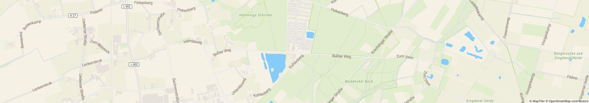

Directions
It's easy to find us: A3, exit Hamminkeln / Bocholt exit, direction Bocholt, next traffic light turn right, about 3-4 km to the intersection, go straight into the Rheder road from there to international camping information signs (black caravan, black …
- Lake: On site
- In the mountains: No
- Height (above sea level): 21 m
- Next city: 10 km
- Next town/village: 3 km
- Train or bus station: 1.6 km
- Motorway exit: 8.7 km
Address
Busster Weg 10046499 Hamminkeln
Germany
GPS Coordinates
Lat 51.783, Long 6.63418
Get directionsContact
Erholungsgebiet Dingdener Heide
Call or fax
Frequently asked questions
What camping.info FANCLUB benefits does Erholungsgebiet Dingdener Heide offer?
As a camping.info FANCLUB member, you'll receive these exclusive FANCLUB benefits at Erholungsgebiet Dingdener Heide:
Learn more about the camping.info FANCLUB
- 10% discount - on the pitch fees outside the NRW vacations from 04/12/2026 to 05/25/2026, from 05/27/2026 to 07/19/2026 and from 09/02/2026 to 10/16/2026
Not a FANCLUB member yet?
Get exclusive discounts and perks at Erholungsgebiet Dingdener Heide and at over 1000 other campsites and parking spots throughout Europe!
Learn more about the camping.info FANCLUB
How far from the beach is Erholungsgebiet Dingdener Heide?
Erholungsgebiet Dingdener Heide is located directly at the beach. Learn more about the location
Are dogs allowed at the campsite Erholungsgebiet Dingdener Heide?
Dogs are allowed in high season and low season. Dogs are not allowed in rental accommodations. Guests rate Erholungsgebiet Dingdener Heide as "suitable for guests with dogs" with 4.2 out of 5. Read reviews in detail now
When is Erholungsgebiet Dingdener Heide open?
Erholungsgebiet Dingdener Heide is open from April 1 until October 31. Show campsite details
Is Erholungsgebiet Dingdener Heide family friendly?
Guests rate Erholungsgebiet Dingdener Heide as particularly suitable for families with children under 6, 12 and 18 years. For leisure activities, the campsite Erholungsgebiet Dingdener Heide offers many possibilities, such as Playground, Horse riding, Outdoor pool, Water slide, Kids entertainment programme and much more. In case of bad weather you can use the indoor pool (15 km away) and the indoor play facilities.
View all recreational opportunities
View all recreational opportunities
How do guests and other campers rate Erholungsgebiet Dingdener Heide?
Campers rate Erholungsgebiet Dingdener Heide 4.9 out of 5. This makes Erholungsgebiet Dingdener Heide one of the top rated campsites in federal state North Rhine-Westphalia.
Guests rate the following properties particularly well: Overall cleanliness, Cleanliness of sanitary facilities, Friendliness
According to its guests Erholungsgebiet Dingdener Heide is particularly suitable for: Couples and Families with children under 12
According to its guests Erholungsgebiet Dingdener Heide is ideal for: Cycling and Hiking
Read all camper reviews
Are there shopping facilities near Erholungsgebiet Dingdener Heide?
There is a grocery store directly on the campsite. In addition, Erholungsgebiet Dingdener Heide offers a bread service directly at the site. The nearest town is 3 km away, the nearest city is 10 km away. Learn more about the location
How far is the nearest town or city from Erholungsgebiet Dingdener Heide?
The nearest town is 3 km away, the nearest city is 10 km away. You can reach a bus or train stop in 1.6 km. The nearest highway exit is 8.7 km away. Learn more about the location
What food options does Erholungsgebiet Dingdener Heide offer?
Food is well taken care of, because there is a restaurant in 3 km distance. Furthermore, there is also a snack bar directly at the site.
With the bread service directly at the site you can start the day relaxed.
For self-catering there is a grocery store directly at the site as well as cooking facilities on the site.
Overall, guests rate the food and beverage at the site 4.3 out of 5.
By the way, gas bottles can be exchanged directly at the site. And those who want to borrow a table or benches can also do so on site.
View all options in detail
Is there wifi or internet at the campsite Erholungsgebiet Dingdener Heide?
The campsite Erholungsgebiet Dingdener Heide offers wifi. This is free.
Is Erholungsgebiet Dingdener Heide barrier-free?
Most of the paths at campsite Erholungsgebiet Dingdener Heide are paved. Ramps are available for wheelchair users. The sanitary facilities are barrier-free. Nothing stands in the way of swimming fun, because access to the water is barrier-free. View all campsite features
How many pitches does Erholungsgebiet Dingdener Heide have?
Erholungsgebiet Dingdener Heide has 35 pitches for tourists and 400 pitches for permanent campers.
View all campsite information now
View all campsite information now
How big is Erholungsgebiet Dingdener Heide?
Erholungsgebiet Dingdener Heide has a size of 21 hectares. Ground condition is: Grass
View all campsite information now
View all campsite information now
How much does it cost to stay at Erholungsgebiet Dingdener Heide?
An overnight stay at Erholungsgebiet Dingdener Heide costs €25.90 - €28.90, but prices vary depending on the chosen period, guests, etc. At camping.info you can send a no-obligation request to Erholungsgebiet Dingdener Heide to find out current prices and availability. Send request now