 Deutsch
 English
 Nederlands
 français
 italiano
 Español
 български
 босански
 čeština
 dansk
dansk Ελληνικά
 eesti
eesti suomi
suomi hrvatski
 magyar
 lietuvių
 latviešu
 norsk bokmål
 polski
 português
 română
 русский
 slovenčina
 slovenščina
 српски
 svenska
 Türkçe
%20-%20https://sketchapp.com%20--%3e%3ctitle%3e178342C7-E563-41CE-8EC0-A9A54298CB55%3c/title%3e%3cdesc%3eCreated%20with%20sketchtool.%3c/desc%3e%3cdefs%3e%3ccircle%20id='path-1'%20cx='25'%20cy='25'%20r='25'%3e%3c/circle%3e%3c/defs%3e%3cg%20id='Page-1'%20stroke='none'%20stroke-width='1'%20fill='none'%20fill-rule='evenodd'%3e%3cg%20id='Transparenz'%20transform='translate(-1158.000000,%20-29.000000)'%3e%3cg%20id='Header'%20transform='translate(108.000000,%2031.000000)'%3e%3cg%20id='Profile'%20transform='translate(1052.000000,%200.000000)'%3e%3cg%20id='CI-Placeholder'%3e%3cmask%20id='mask-2'%20fill='white'%3e%3cuse%20xlink:href='%23path-1'%3e%3c/use%3e%3c/mask%3e%3cuse%20id='Background'%20stroke='%23FFFFFF'%20stroke-width='2.5'%20xlink:href='%23path-1'%3e%3c/use%3e%3cpath%20d='M24.9650909,39.2018953%20C22.42,39.2018953%2020.2218182,37.8707667%2019.6992727,36.1567717%20L20.7421818,36.1567717%20C21.1643636,36.1567717%2021.5058182,35.8072948%2021.5058182,35.3765701%20L21.5058182,32.1288835%20C22.5618182,32.6530989%2023.7465455,32.9491525%2025,32.9491525%20C26.2534545,32.9491525%2027.4381818,32.6530989%2028.4941818,32.1299965%20L28.4941818,35.3765701%20C28.4941818,35.8072948%2028.8367273,36.1567717%2029.2589091,36.1567717%20L30.232,36.1567717%20C29.7083636,37.8707667%2027.5101818,39.2018953%2024.9650909,39.2018953%20M18.58,25.4008967%20L18.0956364,20.5093332%20C18.0661818,20.2411041%2018.0465455,19.969536%2018.0465455,19.6924031%20C18.0465455,15.7591185%2021.1665455,12.5592902%2025,12.5592902%20C28.8345455,12.5592902%2031.9534545,15.7591185%2031.9534545,19.6924031%20C31.9534545,19.969536%2031.9349091,20.2411041%2031.9010909,20.5605304%20L31.4189091,25.4053487%20C31.1047273,28.8177569%2028.3458182,31.3898623%2025,31.3898623%20C21.6552727,31.3898623%2018.8963636,28.8177569%2018.58,25.4008967%20M32.6341818,34.5974815%20L30.0225455,34.5974815%20L30.0225455,31.1327631%20C31.6327273,29.7982955%2032.7290909,27.8305403%2032.9396364,25.5567145%20L33.4218182,20.6851846%20C33.4578182,20.3579674%2033.4818182,20.0274112%2033.4818182,19.6924031%20C33.4818182,14.8998951%2029.6767273,11%2025,11%20C20.3232727,11%2016.5192727,14.8998951%2016.5192727,19.6924031%20C16.5192727,20.0274112%2016.5421818,20.3579674%2016.5792727,20.7174611%20L17.0603636,25.5511496%20C17.2709091,27.8283143%2018.3672727,29.7971826%2019.9785455,31.1327631%20L19.9785455,34.5974815%20L17.3658182,34.5974815%20C11.6505455,34.5974815%207,39.3643909%207,45.2209114%20C7,45.6516361%207.34254545,46%207.76363636,46%20C8.18581818,46%208.52836364,45.6516361%208.52836364,45.2209114%20C8.52836364,40.2225014%2012.4916364,36.1567717%2017.3658182,36.1567717%20L18.1316364,36.1567717%20C18.6192727,38.7555888%2021.4938182,40.7600725%2024.9661818,40.7600725%20C28.4374545,40.7600725%2031.312,38.7555888%2031.7996364,36.1567717%20L32.6341818,36.1567717%20C37.5083636,36.1567717%2041.4727273,40.2225014%2041.4727273,45.2209114%20C41.4727273,45.6516361%2041.8141818,46%2042.2363636,46%20C42.6585455,46%2043,45.6516361%2043,45.2209114%20C43,39.3643909%2038.3505455,34.5974815%2032.6341818,34.5974815'%20id='Icon'%20fill='%23FFFFFF'%20mask='url(%23mask-2)'%3e%3c/path%3e%3c/g%3e%3c/g%3e%3c/g%3e%3c/g%3e%3c/g%3e%3c/svg%3e)


From31.60€
Camping Hochschwarzwald
- Operating hours: 01.01 - 31.12 - currently in operation
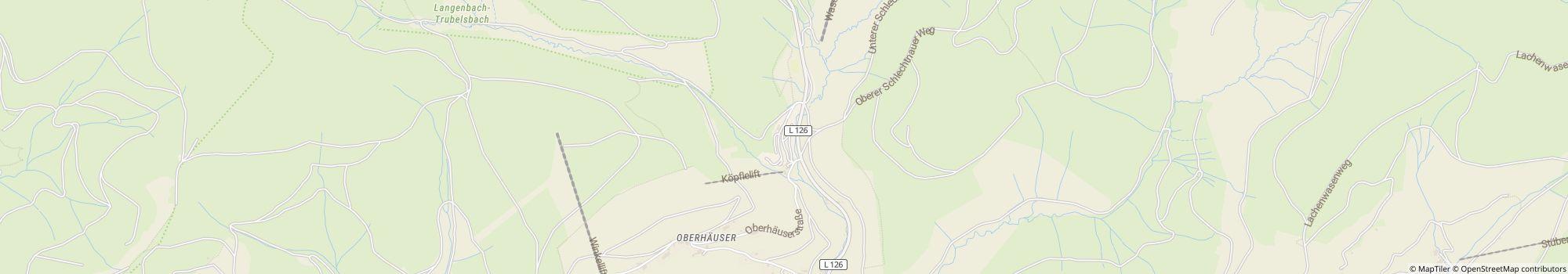
- Address: Oberhäuserstraße 6, 79674 Todtnau-Muggenbrunn, Germany - Show on map
- Region: Black ForestFreiburgSouth Germany
Ratings
Ratings in detail
- Tranquillity4.1
- Food / Shops3.3
- Overall cleanliness4.6
- Cleanliness of sanitary facilities4.5
- Condition of rental accommodation3.0
- Friendliness4.4
- Infrastructure3.9
- Leisure activities4.1
- Location4.4
- Value for money4.4
- Sanitary facilities4.1
What guests write


%20-%20https://sketchapp.com%20--%3e%3ctitle%3e178342C7-E563-41CE-8EC0-A9A54298CB55%3c/title%3e%3cdesc%3eCreated%20with%20sketchtool.%3c/desc%3e%3cdefs%3e%3ccircle%20id='path-1'%20cx='25'%20cy='25'%20r='25'%3e%3c/circle%3e%3c/defs%3e%3cg%20id='Page-1'%20stroke='none'%20stroke-width='1'%20fill='none'%20fill-rule='evenodd'%3e%3cg%20id='Transparenz'%20transform='translate(-1158.000000,%20-29.000000)'%3e%3cg%20id='Header'%20transform='translate(108.000000,%2031.000000)'%3e%3cg%20id='Profile'%20transform='translate(1052.000000,%200.000000)'%3e%3cg%20id='CI-Placeholder'%3e%3cmask%20id='mask-2'%20fill='white'%3e%3cuse%20xlink:href='%23path-1'%3e%3c/use%3e%3c/mask%3e%3cuse%20id='Background'%20stroke='%239b9b9b'%20stroke-width='2.5'%20xlink:href='%23path-1'%3e%3c/use%3e%3cpath%20d='M24.9650909,39.2018953%20C22.42,39.2018953%2020.2218182,37.8707667%2019.6992727,36.1567717%20L20.7421818,36.1567717%20C21.1643636,36.1567717%2021.5058182,35.8072948%2021.5058182,35.3765701%20L21.5058182,32.1288835%20C22.5618182,32.6530989%2023.7465455,32.9491525%2025,32.9491525%20C26.2534545,32.9491525%2027.4381818,32.6530989%2028.4941818,32.1299965%20L28.4941818,35.3765701%20C28.4941818,35.8072948%2028.8367273,36.1567717%2029.2589091,36.1567717%20L30.232,36.1567717%20C29.7083636,37.8707667%2027.5101818,39.2018953%2024.9650909,39.2018953%20M18.58,25.4008967%20L18.0956364,20.5093332%20C18.0661818,20.2411041%2018.0465455,19.969536%2018.0465455,19.6924031%20C18.0465455,15.7591185%2021.1665455,12.5592902%2025,12.5592902%20C28.8345455,12.5592902%2031.9534545,15.7591185%2031.9534545,19.6924031%20C31.9534545,19.969536%2031.9349091,20.2411041%2031.9010909,20.5605304%20L31.4189091,25.4053487%20C31.1047273,28.8177569%2028.3458182,31.3898623%2025,31.3898623%20C21.6552727,31.3898623%2018.8963636,28.8177569%2018.58,25.4008967%20M32.6341818,34.5974815%20L30.0225455,34.5974815%20L30.0225455,31.1327631%20C31.6327273,29.7982955%2032.7290909,27.8305403%2032.9396364,25.5567145%20L33.4218182,20.6851846%20C33.4578182,20.3579674%2033.4818182,20.0274112%2033.4818182,19.6924031%20C33.4818182,14.8998951%2029.6767273,11%2025,11%20C20.3232727,11%2016.5192727,14.8998951%2016.5192727,19.6924031%20C16.5192727,20.0274112%2016.5421818,20.3579674%2016.5792727,20.7174611%20L17.0603636,25.5511496%20C17.2709091,27.8283143%2018.3672727,29.7971826%2019.9785455,31.1327631%20L19.9785455,34.5974815%20L17.3658182,34.5974815%20C11.6505455,34.5974815%207,39.3643909%207,45.2209114%20C7,45.6516361%207.34254545,46%207.76363636,46%20C8.18581818,46%208.52836364,45.6516361%208.52836364,45.2209114%20C8.52836364,40.2225014%2012.4916364,36.1567717%2017.3658182,36.1567717%20L18.1316364,36.1567717%20C18.6192727,38.7555888%2021.4938182,40.7600725%2024.9661818,40.7600725%20C28.4374545,40.7600725%2031.312,38.7555888%2031.7996364,36.1567717%20L32.6341818,36.1567717%20C37.5083636,36.1567717%2041.4727273,40.2225014%2041.4727273,45.2209114%20C41.4727273,45.6516361%2041.8141818,46%2042.2363636,46%20C42.6585455,46%2043,45.6516361%2043,45.2209114%20C43,39.3643909%2038.3505455,34.5974815%2032.6341818,34.5974815'%20id='Icon'%20fill='%239b9b9b'%20mask='url(%23mask-2)'%3e%3c/path%3e%3c/g%3e%3c/g%3e%3c/g%3e%3c/g%3e%3c/g%3e%3c/svg%3e)

There are 3 more camper reviews.
Show all reviewsActivities recommended by guests
Cross-country skiing
(5 Guests)Mountain biking
(5 Guests)Motorcycle
(2 Guests)Climbing
(1 Guest)Culture
(1 Guest)Cycling
(1 Guest)Sightseeing
(1 Guest)Rated by guests as "Suitable for"
Senior citizens
Guests with tents
Couples
Guests with dogs
Families with children under 12
Families with children under 18
Families with children under 6
Youth groups
Description
Profile
Der terrassenförmig angelegte Platz ist nicht auf "Masse" ausgerichtet, sondern bieter eine individuelle und persönliche Note. Er liegt auf 1.050 m. Direkt am Rande eines Naturschutzgebietes zwischen den Feldberg und Belchen, locken im Sommer Wiesen, Weiden und Wälder zum Wandern, …
- Campsite category:
- Size of the site: 2.2 ha (Ground conditions: Gravel)
- Total number of pitches: 80
- Number of tourist pitches: 50
- Motorhome pitches in front of the gates: 0
- Stopover pitches in front of the gates also for caravans: Not available
Reference price
Peak season €33.10*
Low season €31.60*
*Two adults, caravan, car, electricity and local taxes per night
Operating hours
01. January - 31. December
Properties
Equipment
- Charcoal grill allowed
- Drying room
- Gas bottle exchange
- Individual washing cubicles(2)
- Motorhome service point
- Tumble dryers
- Washing machines
- Wi-Fi(Paid)
- Baths for hire
- Central campfire area
- Firewood available
- Internet terminal
- Lockers
- Lounge
- Tables and benches
At the parking place
- Car permitted on pitch
- Electric hook-ups
- Shade on pitches(Little shade)
- Campfire permitted on pitch
- Car-free pitches
- Gas hook-up on pitch
- Separate space for youth groups
- TV hook-up on pitch
- Waste water drainage on pitch
- Water hook-up on pitch
Pets
- Dogs allowed in low season
- Dogs allowed in peak season
- Dog park
- Dog showers
- Dog swimming area
Family & Children
- Baby changing room
- Playground
- Indoor play facilities
- Kids entertainment programme
- Petting zoo
Swimming & Wellness
- Hot springs(35 km)
- Indoor pool(1.5 km)
- Outdoor pool(7 km)
- Sauna(1.5 km)
- Swimming in natural waters(35 km, Lake)
- Water slide(35 km)
- Nudist beach
- Sandy beach
Leisure opportunities
- Bicycle hire(7 km)
- Cross-country skiing
- Golf(15 km)
- Ski lift
- Table tennis
- Boat hire
- Dive site
- Fishing
- Horse riding
- Kitesurfing
- Miniature golf
- Sailing
- Slipway
- Tennis
- Volleyball
- Wave surfing
- Windsurfing
Fare & Catering
- Bread sold on-site
- Grocery shop(7 km)
- Cooking facilities
Accessibility
- Most paths are paved
- Universally accessible sanitary facilities
Rental accommodations
- Bungalows
- Cabins
- Holiday apartments
- Rental caravans
- Rental tents
Vacation type
- Permanent camping
- Winter camping
- Mini campsite
- Nudism
Location
Directions
Hauptzufahrt: A5 Ausfahrt Freiburg-Mitte, A31 bis Kirchzarten, Oberried, Notschrei und Muggenbrunn.
- Lake: 35 km
- In the mountains: Yes
- Height (above sea level): 1050 m
- Next city: 7 km
- Next town/village: 1 km
- Train or bus station: 0.5 km
- Motorway exit: 30 km
Address
Oberhäuserstraße 679674 Todtnau-Muggenbrunn
Germany
GPS Coordinates
Lat 47.86478, Long 7.91598
Get directionsContact
Camping Hochschwarzwald
Call or fax
Frequently asked questions
How far from the lake is Camping Hochschwarzwald?
Camping Hochschwarzwald is 35 km away from the lake. Learn more about the location
Are dogs allowed at the campsite Camping Hochschwarzwald?
Dogs are allowed in high season and low season. Guests rate Camping Hochschwarzwald as "suitable for guests with dogs" with 4.5 out of 5. Read reviews in detail now
When is Camping Hochschwarzwald open?
Camping Hochschwarzwald is open from January 1 until December 31. Show campsite details
Is Camping Hochschwarzwald family friendly?
For leisure activities, the campsite Camping Hochschwarzwald offers many possibilities, such as Playground, Outdoor pool, Water slide and much more. In case of bad weather you can use the indoor pool (1.5 km away).
View all recreational opportunities
View all recreational opportunities
How do guests and other campers rate Camping Hochschwarzwald?
Campers rate Camping Hochschwarzwald 4.1 out of 5.
Guests rate the following properties particularly well: Overall cleanliness, Cleanliness of sanitary facilities, Friendliness
According to its guests Camping Hochschwarzwald is particularly suitable for: Senior citizens and Guests with tents
According to its guests Camping Hochschwarzwald is ideal for: Hiking and Relaxing
Read all camper reviews
Are there shopping facilities near Camping Hochschwarzwald?
There is a grocery store 7 km away. In addition, Camping Hochschwarzwald offers a bread service directly at the site. The nearest town is 1 km away, the nearest city is 7 km away. Learn more about the location
How far is the nearest town or city from Camping Hochschwarzwald?
The nearest town is 1 km away, the nearest city is 7 km away. You can reach a bus or train stop in 0.5 km. The nearest highway exit is 30 km away. Learn more about the location
What food options does Camping Hochschwarzwald offer?
Unfortunately, the campsite Camping Hochschwarzwald has not yet provided any information about dining options, but you can request the info directly from the campsite. Send request now
Overall, guests rate the food and beverage at the site with 3.3 out of 5.
Search for other campsites with restaurant in Baden-WürttembergFor self-catering there is a grocery store at a distance of 7 km.
Overall, guests rate the food and beverage at the site with 3.3 out of 5.
Search for other campsites with restaurant in Baden-WürttembergFor self-catering there is a grocery store at a distance of 7 km.
Is there wifi or internet at the campsite Camping Hochschwarzwald?
The campsite Camping Hochschwarzwald offers wifi. This is chargeable.
Is Camping Hochschwarzwald barrier-free?
Most of the paths at campsite Camping Hochschwarzwald are paved. The sanitary facilities are barrier-free. View all campsite features
How many pitches does Camping Hochschwarzwald have?
Camping Hochschwarzwald has 50 pitches for tourists and 30 pitches for permanent campers.
View all campsite information now
View all campsite information now
How big is Camping Hochschwarzwald?
Camping Hochschwarzwald has a size of 2.2 hectares. Ground condition is: Gravel
View all campsite information now
View all campsite information now
How much does it cost to stay at Camping Hochschwarzwald?
An overnight stay at Camping Hochschwarzwald costs €31.60 - €33.10, but prices vary depending on the chosen period, guests, etc. At camping.info you can send a no-obligation request to Camping Hochschwarzwald to find out current prices and availability. Send request now