 Deutsch
 English
 Nederlands
 français
 italiano
 Español
 български
 босански
 čeština
 dansk
dansk Ελληνικά
 eesti
eesti suomi
suomi hrvatski
 magyar
 lietuvių
 latviešu
 norsk bokmål
 polski
 português
 română
 русский
 slovenčina
 slovenščina
 српски
 svenska
 Türkçe
%20-%20https://sketchapp.com%20--%3e%3ctitle%3e178342C7-E563-41CE-8EC0-A9A54298CB55%3c/title%3e%3cdesc%3eCreated%20with%20sketchtool.%3c/desc%3e%3cdefs%3e%3ccircle%20id='path-1'%20cx='25'%20cy='25'%20r='25'%3e%3c/circle%3e%3c/defs%3e%3cg%20id='Page-1'%20stroke='none'%20stroke-width='1'%20fill='none'%20fill-rule='evenodd'%3e%3cg%20id='Transparenz'%20transform='translate(-1158.000000,%20-29.000000)'%3e%3cg%20id='Header'%20transform='translate(108.000000,%2031.000000)'%3e%3cg%20id='Profile'%20transform='translate(1052.000000,%200.000000)'%3e%3cg%20id='CI-Placeholder'%3e%3cmask%20id='mask-2'%20fill='white'%3e%3cuse%20xlink:href='%23path-1'%3e%3c/use%3e%3c/mask%3e%3cuse%20id='Background'%20stroke='%23FFFFFF'%20stroke-width='2.5'%20xlink:href='%23path-1'%3e%3c/use%3e%3cpath%20d='M24.9650909,39.2018953%20C22.42,39.2018953%2020.2218182,37.8707667%2019.6992727,36.1567717%20L20.7421818,36.1567717%20C21.1643636,36.1567717%2021.5058182,35.8072948%2021.5058182,35.3765701%20L21.5058182,32.1288835%20C22.5618182,32.6530989%2023.7465455,32.9491525%2025,32.9491525%20C26.2534545,32.9491525%2027.4381818,32.6530989%2028.4941818,32.1299965%20L28.4941818,35.3765701%20C28.4941818,35.8072948%2028.8367273,36.1567717%2029.2589091,36.1567717%20L30.232,36.1567717%20C29.7083636,37.8707667%2027.5101818,39.2018953%2024.9650909,39.2018953%20M18.58,25.4008967%20L18.0956364,20.5093332%20C18.0661818,20.2411041%2018.0465455,19.969536%2018.0465455,19.6924031%20C18.0465455,15.7591185%2021.1665455,12.5592902%2025,12.5592902%20C28.8345455,12.5592902%2031.9534545,15.7591185%2031.9534545,19.6924031%20C31.9534545,19.969536%2031.9349091,20.2411041%2031.9010909,20.5605304%20L31.4189091,25.4053487%20C31.1047273,28.8177569%2028.3458182,31.3898623%2025,31.3898623%20C21.6552727,31.3898623%2018.8963636,28.8177569%2018.58,25.4008967%20M32.6341818,34.5974815%20L30.0225455,34.5974815%20L30.0225455,31.1327631%20C31.6327273,29.7982955%2032.7290909,27.8305403%2032.9396364,25.5567145%20L33.4218182,20.6851846%20C33.4578182,20.3579674%2033.4818182,20.0274112%2033.4818182,19.6924031%20C33.4818182,14.8998951%2029.6767273,11%2025,11%20C20.3232727,11%2016.5192727,14.8998951%2016.5192727,19.6924031%20C16.5192727,20.0274112%2016.5421818,20.3579674%2016.5792727,20.7174611%20L17.0603636,25.5511496%20C17.2709091,27.8283143%2018.3672727,29.7971826%2019.9785455,31.1327631%20L19.9785455,34.5974815%20L17.3658182,34.5974815%20C11.6505455,34.5974815%207,39.3643909%207,45.2209114%20C7,45.6516361%207.34254545,46%207.76363636,46%20C8.18581818,46%208.52836364,45.6516361%208.52836364,45.2209114%20C8.52836364,40.2225014%2012.4916364,36.1567717%2017.3658182,36.1567717%20L18.1316364,36.1567717%20C18.6192727,38.7555888%2021.4938182,40.7600725%2024.9661818,40.7600725%20C28.4374545,40.7600725%2031.312,38.7555888%2031.7996364,36.1567717%20L32.6341818,36.1567717%20C37.5083636,36.1567717%2041.4727273,40.2225014%2041.4727273,45.2209114%20C41.4727273,45.6516361%2041.8141818,46%2042.2363636,46%20C42.6585455,46%2043,45.6516361%2043,45.2209114%20C43,39.3643909%2038.3505455,34.5974815%2032.6341818,34.5974815'%20id='Icon'%20fill='%23FFFFFF'%20mask='url(%23mask-2)'%3e%3c/path%3e%3c/g%3e%3c/g%3e%3c/g%3e%3c/g%3e%3c/g%3e%3c/svg%3e)


Od13,30€
Stapagljúfur Canyon Campsite
- Godziny pracy: 01.04 - 31.10 - obecnie zamknięte
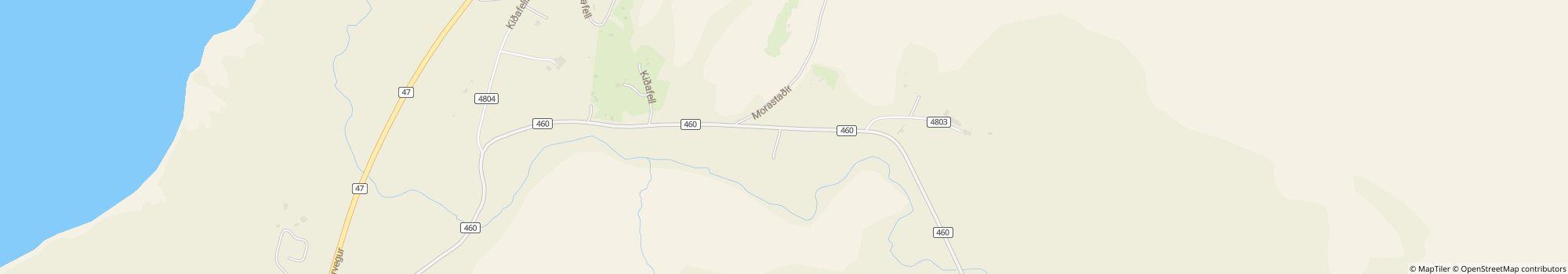
- Adres: Stapagljúfur, 276 Mosfellsbær, Islandia - Pokaż na mapie
- Region: Atlantic
Oceny
Opis
Profil
Stapagljúfur Canyon Campsite is a simple wilderness campsite located just north of Reykjavík - as close as one can be to town without seeing it or being embedded in urban sprawl. The small canyon Stapagljúfur cuts through the property, carved …
- Rozmiar witryny: 8 ha (Warunki gruntowe: Trawa)
Cena referencyjna
Sezon szczytowy 13,30 €*
Poza sezonem 13,30 €*
*Dwie osoby dorosłe, przyczepa kempingowa, samochód, prąd i podatki lokalne za noc.
Godziny pracy
01. kwiecień - 31. październik
Nieruchomości
Udogodnienia
- Grill na węgiel drzewny jest dozwolony
- Wymiana butli gazowych(30 km)
- Drewno opałowe jest dostępne
- Indywidualne kabiny do mycia
- Poczekalnia
- Pralki
- Punkt serwisowy dla samochodów kempingowych
- Stoły i ławki
- Suszarki bębnowe
- Suszarnia
- Szafki
- Terminal internetowy
- Wi-Fi
- Łazienki do wypożyczenia
Na miejscu parkingowym
- Cień na polach(W połowie zacienione)
- Oddzielna przestrzeń dla grup młodzieżowych
- Ognisko na polu jest dozwolone
- Podłączenie elektryczne
- Podłączenie dla telewizora na polu
- Podłączenie gazu na polu
- Podłączenie wody na polu
- Pola bez samochodów
- Punkt usuwania substancji chemicznych na polu
Zwierzęta
- Kąpielisko dla psów(30 km)
- Park dla psów
- Psy dozwolone w wynajmowanych apartamentach
- Psy są dozwolone poza sezonem
- Psy są dozwolone w sezonie szczytowym
- Prysznice dla psów
Rodzina i dzieci
- Mini zoo
- Plac zabaw
- Pomieszczenie do zmiany pieluszki
- Program rozrywkowy dla dzieci
- Udogodnienia do zabawy w pomieszczeniu
Pływanie i odnowa biologiczna
- Basen wewnętrzny(9 km)
- Basen zewnętrzny(9 km)
- Dzikie kąpieliska(Rzeka)
- Gorące źródła(9 km)
- Piaszczysta plaża(5 km)
- Sauna(9 km)
- Plaża nudystów
- Zjeżdżalnia wodna
Możliwości spędzania wolnego czasu
- Mini golf
- Rybołówstwo
- Siatkówka
- Tenis
- Tenis stołowy
Ceny i catering
- Restauracja(15 km)
- Sklep spożywczy(9 km)
- Snack bar(9 km)
- Chleb sprzedawany na miejscu
- Urządzenia do gotowania
Dostępność
- Ogólny dostęp do wody
- Ogólnie dostępne urządzenia sanitarne
- Podjazdy dla wózków inwalidzkich
- Większość ścieżek jest utwardzona
Wynajem mieszkań
- Wynajem namiotów
- Apartamenty wakacyjne
- Domy jednopiętrowe
- Kabiny
- Wynajem przyczep kempingowych
Typ wakacji
- Kemping zimowy
- Nudyzm(Częściowa nagość dozwolona)
- Stałe miejsce kempingowe
- Mini miejsce kempingowe
Lokalizacja
Kierunki
Directions from Reykjavík: * By car: Leave town heading east towards Mosfellsbær on Vesturlandsvegur; this turns north and becomes the Ring Road (Hringvegurinn / Þjóðvegur 1). You'll wrap around Esja (Reykjavík's "city mountain", past Grundarhverfi, and right before you get …
- Morze: 1 km
- Jezioro: 8 km
- Wysokość nad poziomem morza): 100 m
- Następne miasto: 30 km
- Następne miasto/wieś: 9 km
- Dworzec kolejowy lub autobusowy: 9 km
- Zjazd z autostrady: 7 km
Adres
Stapagljúfur276 Mosfellsbær
Islandia
Współrzędne GPS
Lat 64.30242, Long -21.76549
Uzyskaj wskazówki, jak to zrobić.