 Deutsch
 English
 Nederlands
 français
 italiano
 Español
 български
 босански
 čeština
 dansk
dansk Ελληνικά
 eesti
eesti suomi
suomi hrvatski
 magyar
 lietuvių
 latviešu
 norsk bokmål
 polski
 português
 română
 русский
 slovenčina
 slovenščina
 српски
 svenska
 Türkçe
%20-%20https://sketchapp.com%20--%3e%3ctitle%3e178342C7-E563-41CE-8EC0-A9A54298CB55%3c/title%3e%3cdesc%3eCreated%20with%20sketchtool.%3c/desc%3e%3cdefs%3e%3ccircle%20id='path-1'%20cx='25'%20cy='25'%20r='25'%3e%3c/circle%3e%3c/defs%3e%3cg%20id='Page-1'%20stroke='none'%20stroke-width='1'%20fill='none'%20fill-rule='evenodd'%3e%3cg%20id='Transparenz'%20transform='translate(-1158.000000,%20-29.000000)'%3e%3cg%20id='Header'%20transform='translate(108.000000,%2031.000000)'%3e%3cg%20id='Profile'%20transform='translate(1052.000000,%200.000000)'%3e%3cg%20id='CI-Placeholder'%3e%3cmask%20id='mask-2'%20fill='white'%3e%3cuse%20xlink:href='%23path-1'%3e%3c/use%3e%3c/mask%3e%3cuse%20id='Background'%20stroke='%23FFFFFF'%20stroke-width='2.5'%20xlink:href='%23path-1'%3e%3c/use%3e%3cpath%20d='M24.9650909,39.2018953%20C22.42,39.2018953%2020.2218182,37.8707667%2019.6992727,36.1567717%20L20.7421818,36.1567717%20C21.1643636,36.1567717%2021.5058182,35.8072948%2021.5058182,35.3765701%20L21.5058182,32.1288835%20C22.5618182,32.6530989%2023.7465455,32.9491525%2025,32.9491525%20C26.2534545,32.9491525%2027.4381818,32.6530989%2028.4941818,32.1299965%20L28.4941818,35.3765701%20C28.4941818,35.8072948%2028.8367273,36.1567717%2029.2589091,36.1567717%20L30.232,36.1567717%20C29.7083636,37.8707667%2027.5101818,39.2018953%2024.9650909,39.2018953%20M18.58,25.4008967%20L18.0956364,20.5093332%20C18.0661818,20.2411041%2018.0465455,19.969536%2018.0465455,19.6924031%20C18.0465455,15.7591185%2021.1665455,12.5592902%2025,12.5592902%20C28.8345455,12.5592902%2031.9534545,15.7591185%2031.9534545,19.6924031%20C31.9534545,19.969536%2031.9349091,20.2411041%2031.9010909,20.5605304%20L31.4189091,25.4053487%20C31.1047273,28.8177569%2028.3458182,31.3898623%2025,31.3898623%20C21.6552727,31.3898623%2018.8963636,28.8177569%2018.58,25.4008967%20M32.6341818,34.5974815%20L30.0225455,34.5974815%20L30.0225455,31.1327631%20C31.6327273,29.7982955%2032.7290909,27.8305403%2032.9396364,25.5567145%20L33.4218182,20.6851846%20C33.4578182,20.3579674%2033.4818182,20.0274112%2033.4818182,19.6924031%20C33.4818182,14.8998951%2029.6767273,11%2025,11%20C20.3232727,11%2016.5192727,14.8998951%2016.5192727,19.6924031%20C16.5192727,20.0274112%2016.5421818,20.3579674%2016.5792727,20.7174611%20L17.0603636,25.5511496%20C17.2709091,27.8283143%2018.3672727,29.7971826%2019.9785455,31.1327631%20L19.9785455,34.5974815%20L17.3658182,34.5974815%20C11.6505455,34.5974815%207,39.3643909%207,45.2209114%20C7,45.6516361%207.34254545,46%207.76363636,46%20C8.18581818,46%208.52836364,45.6516361%208.52836364,45.2209114%20C8.52836364,40.2225014%2012.4916364,36.1567717%2017.3658182,36.1567717%20L18.1316364,36.1567717%20C18.6192727,38.7555888%2021.4938182,40.7600725%2024.9661818,40.7600725%20C28.4374545,40.7600725%2031.312,38.7555888%2031.7996364,36.1567717%20L32.6341818,36.1567717%20C37.5083636,36.1567717%2041.4727273,40.2225014%2041.4727273,45.2209114%20C41.4727273,45.6516361%2041.8141818,46%2042.2363636,46%20C42.6585455,46%2043,45.6516361%2043,45.2209114%20C43,39.3643909%2038.3505455,34.5974815%2032.6341818,34.5974815'%20id='Icon'%20fill='%23FFFFFF'%20mask='url(%23mask-2)'%3e%3c/path%3e%3c/g%3e%3c/g%3e%3c/g%3e%3c/g%3e%3c/g%3e%3c/svg%3e)


Ettől32,00€
Storängens Camping
- Üzemidő: 30.04 - 20.09 - jelenleg üzemel
- Cím: Erlandervägen 2, 68493 Ransäter, Svédország - Megjelenítés a térképen
- Régió: Värmland
'%3e%3cpath%20d='M24.985%2044.265c10.608%200%2019.21-8.596%2019.21-19.203S35.593%205.858%2024.985%205.858c-10.61%200-19.21%208.599-19.21%2019.204s8.6%2019.203%2019.21%2019.203Z'%20fill='%2354C100'%20stroke='%23fff'%20stroke-width='.5'/%3e%3c/g%3e%3cmask%20id='b'%20style='mask-type:luminance'%20maskUnits='userSpaceOnUse'%20x='5'%20y='5'%20width='40'%20height='40'%3e%3cpath%20d='M44.132%205.963H5.838v38.074h38.294V5.963Z'%20fill='%23fff'/%3e%3c/mask%3e%3cg%20mask='url(%23b)'%3e%3cpath%20d='M24.397%2043.11C33.567%2043.11%2041%2035.68%2041%2026.511S33.566%209.916%2024.397%209.916c-9.17%200-16.603%207.431-16.603%2016.597s7.432%2016.598%2016.603%2016.598'%20fill='%234D7D34'/%3e%3c/g%3e%3cpath%20d='M25%2039c7.18%200%2013-5.82%2013-13s-5.82-13-13-13-13%205.82-13%2013%205.82%2013%2013%2013Z'%20fill='%23fff'/%3e%3cpath%20d='m49.41%2022.845.001-.017v-.017c.006-.656-.3-1.384-.716-1.953-.411-.561-1.02-1.09-1.72-1.19-21.477-3.114-38.928.754-44.432%202.188h-.001c-.661.174-1.173.663-1.495%201.262a3.712%203.712%200%200%200-.397%202.107l.001.009.001.009%201.17%208.61c.085.823.42%201.547.927%202.033.513.492%201.213.744%201.949.547%205.481-1.468%2020.472-5.038%2041.378-1.952.766.112%201.452-.238%201.923-.796.466-.553.747-1.328.757-2.177l.654-8.663Z'%20fill='%23EF970B'%20stroke='%23fff'/%3e%3cpath%20d='m2.962%2025.771%204.936-.854.255%201.538-3.225.559.178%201.076%202.918-.504.242%201.456-2.918.506.373%202.262-1.71.294-1.047-6.328-.002-.005Zm7.323-1.229%201.657-.225%203.472%206.051-1.844.25-.591-1.085-2.402.325-.295%201.205-1.798.244%201.8-6.765Zm2.011%203.685-.925-1.706-.467%201.895%201.39-.189h.002Zm3.089-4.302%201.61-.151%202.87%203.137-.306-3.378%201.71-.162.58%206.392-1.504.142-2.988-3.254.318%203.506-1.71.162-.58-6.392v-.002Zm7.315%202.577v-.018c-.1-1.821%201.149-3.389%203.03-3.498%201.16-.066%201.879.307%202.508.859l-.66.873c-.534-.448-1.078-.728-1.8-.688-1.178.067-1.998%201.115-1.93%202.368v.017c.07%201.255.993%202.222%202.188%202.155.768-.043%201.242-.383%201.75-.928l.744.693c-.613.733-1.302%201.213-2.472%201.28-1.829.104-3.258-1.274-3.36-3.115l.003.002Zm6.858-3.587%201.1-.023.123%205.388%203.29-.077.021%201.026-4.386.103-.148-6.417Zm5.372%203.584.033-3.696%201.1.012-.032%203.65c-.01%201.192.584%201.83%201.568%201.84.975.01%201.578-.579%201.59-1.762l.032-3.697%201.1.012-.031%203.641c-.017%201.917-1.08%202.869-2.716%202.853-1.627-.016-2.656-.99-2.64-2.85l-.004-.003Zm7.081-3.589%202.806.137c.715.035%201.269.264%201.608.648.265.296.391.662.372%201.082v.018c-.035.769-.482%201.16-.958%201.385.721.291%201.21.746%201.171%201.617v.018c-.052%201.144-1%201.714-2.394%201.645l-2.894-.142.291-6.412-.002.004Zm2.658%203.793-1.741-.084-.079%201.76%201.823.088c.741.037%201.22-.244%201.246-.821v-.018c.025-.541-.38-.881-1.247-.925h-.002Zm1.02-1.796c.024-.504-.355-.836-1.062-.87l-1.582-.076-.077%201.704%201.5.074c.706.033%201.191-.227%201.217-.812v-.018l.004-.002Z'%20fill='%23fff'/%3e%3c/svg%3e)
A FANCLUB-előnyeim a helyszínen
Érkezéskor csak mutasd be a FANCLUB-igazolványodat, és élvezd ezeket az előnyöket!

5% kedvezmény
a pályadíjakon a április 30. és a június 9., valamint a augusztus 26. és a között szeptember 20.
Pékség meglepetés
egy további pékáru meglepetés minden zsemle rendelés mellé
Szabad kempinghely-választás
(Ha rendelkezésre áll)
Értékelések
Értékelések részletesen
- Nyugalom4.8
- Élelmiszer / Boltok3.3
- Általános tisztaság5.0
- Higiéniai létesítmények tisztasága4.3
- Kedvesség5.0
- Infrastruktúra3.5
- Szabadidős tevékenységek3.5
- Elhelyezkedés4.0
- Érték-ár arány4.7
- Higiéniai létesítmények4.3
Amit a vendégek írnak
%20-%20https://sketchapp.com%20--%3e%3ctitle%3e178342C7-E563-41CE-8EC0-A9A54298CB55%3c/title%3e%3cdesc%3eCreated%20with%20sketchtool.%3c/desc%3e%3cdefs%3e%3ccircle%20id='path-1'%20cx='25'%20cy='25'%20r='25'%3e%3c/circle%3e%3c/defs%3e%3cg%20id='Page-1'%20stroke='none'%20stroke-width='1'%20fill='none'%20fill-rule='evenodd'%3e%3cg%20id='Transparenz'%20transform='translate(-1158.000000,%20-29.000000)'%3e%3cg%20id='Header'%20transform='translate(108.000000,%2031.000000)'%3e%3cg%20id='Profile'%20transform='translate(1052.000000,%200.000000)'%3e%3cg%20id='CI-Placeholder'%3e%3cmask%20id='mask-2'%20fill='white'%3e%3cuse%20xlink:href='%23path-1'%3e%3c/use%3e%3c/mask%3e%3cuse%20id='Background'%20stroke='%239b9b9b'%20stroke-width='2.5'%20xlink:href='%23path-1'%3e%3c/use%3e%3cpath%20d='M24.9650909,39.2018953%20C22.42,39.2018953%2020.2218182,37.8707667%2019.6992727,36.1567717%20L20.7421818,36.1567717%20C21.1643636,36.1567717%2021.5058182,35.8072948%2021.5058182,35.3765701%20L21.5058182,32.1288835%20C22.5618182,32.6530989%2023.7465455,32.9491525%2025,32.9491525%20C26.2534545,32.9491525%2027.4381818,32.6530989%2028.4941818,32.1299965%20L28.4941818,35.3765701%20C28.4941818,35.8072948%2028.8367273,36.1567717%2029.2589091,36.1567717%20L30.232,36.1567717%20C29.7083636,37.8707667%2027.5101818,39.2018953%2024.9650909,39.2018953%20M18.58,25.4008967%20L18.0956364,20.5093332%20C18.0661818,20.2411041%2018.0465455,19.969536%2018.0465455,19.6924031%20C18.0465455,15.7591185%2021.1665455,12.5592902%2025,12.5592902%20C28.8345455,12.5592902%2031.9534545,15.7591185%2031.9534545,19.6924031%20C31.9534545,19.969536%2031.9349091,20.2411041%2031.9010909,20.5605304%20L31.4189091,25.4053487%20C31.1047273,28.8177569%2028.3458182,31.3898623%2025,31.3898623%20C21.6552727,31.3898623%2018.8963636,28.8177569%2018.58,25.4008967%20M32.6341818,34.5974815%20L30.0225455,34.5974815%20L30.0225455,31.1327631%20C31.6327273,29.7982955%2032.7290909,27.8305403%2032.9396364,25.5567145%20L33.4218182,20.6851846%20C33.4578182,20.3579674%2033.4818182,20.0274112%2033.4818182,19.6924031%20C33.4818182,14.8998951%2029.6767273,11%2025,11%20C20.3232727,11%2016.5192727,14.8998951%2016.5192727,19.6924031%20C16.5192727,20.0274112%2016.5421818,20.3579674%2016.5792727,20.7174611%20L17.0603636,25.5511496%20C17.2709091,27.8283143%2018.3672727,29.7971826%2019.9785455,31.1327631%20L19.9785455,34.5974815%20L17.3658182,34.5974815%20C11.6505455,34.5974815%207,39.3643909%207,45.2209114%20C7,45.6516361%207.34254545,46%207.76363636,46%20C8.18581818,46%208.52836364,45.6516361%208.52836364,45.2209114%20C8.52836364,40.2225014%2012.4916364,36.1567717%2017.3658182,36.1567717%20L18.1316364,36.1567717%20C18.6192727,38.7555888%2021.4938182,40.7600725%2024.9661818,40.7600725%20C28.4374545,40.7600725%2031.312,38.7555888%2031.7996364,36.1567717%20L32.6341818,36.1567717%20C37.5083636,36.1567717%2041.4727273,40.2225014%2041.4727273,45.2209114%20C41.4727273,45.6516361%2041.8141818,46%2042.2363636,46%20C42.6585455,46%2043,45.6516361%2043,45.2209114%20C43,39.3643909%2038.3505455,34.5974815%2032.6341818,34.5974815'%20id='Icon'%20fill='%239b9b9b'%20mask='url(%23mask-2)'%3e%3c/path%3e%3c/g%3e%3c/g%3e%3c/g%3e%3c/g%3e%3c/g%3e%3c/svg%3e)

A vendégek által javasolt tevékenységek
Városnézés
(1 Vendég)Úszás
(1 Vendég)Vendégek értékelése „Alkalmas”
Párok
Vendégek kutyával
Idősek
Ifjúsági csoportok
Vendégek sátorral
Családok 18 évnél fiatalabb gyerekekkel
Családok 12 évnél fiatalabb gyerekekkel
Családok 6 évnél fiatalabb gyerekekkel
Leírás
Profil
Storängens Camping is a peaceful family campsite in the heart of Värmland, beautifully located along the Klarälven river in Ransäter, Sweden. Surrounded by forests and nature, it is the perfect place to relax and enjoy the Swedish countryside. We offer …
- Kemping kategória:
- Az oldal mérete: 15 ha (Talajviszonyok: Fű)
- A pályák teljes száma: 49
- Turisztikai helyek száma: 49 (Ebből a csomagok: 40)
- Lakóautó helyek a kapuk előtt: 0
- Leállóhelyek a kapuk előtt lakókocsik számára is: Nem elérhető
Referencia ár
Főszezon 36,00 EUR*
Elő- és utószezon 32,00 EUR*
*Két felnőtt, lakókocsi, autó, elektromos áram és helyi adók / éjszaka
Üzemidő
30. aprīlis - 20. septembris
Tulajdonságok
Felszerelések
- Asztalok és padok
- Egyedi mosófülkék(9)
- Faszén grill használható
- Gázpalack csere(9 km)
- Internetes terminál
- Központi tábortűz terület
- Lakóautó szervízpont
- Mosógépek
- Szárítógépek
- Társalgó
- Tűzifa rendelkezésre áll
- WiFi
- Szekrények
- Szárító helyiség
A parkolóban
- Autó engedélyezve a helyen
- Elektronikus kapcsolatok
- Árnyék a táborozási helyen(Kevés árnyék)
- Autómentes helyek
- Gázcsatlakozás a táborozási helyen
- Különálló terület fiataloknak
- TV-csatlakozók a táborozó helyen
- Tábortűz a kijelölt helyen engedélyezett
- Vegyi hulladék gyűjtőhely a táborozási helyen
- Vízcsatlakozás a táborozó helyen
Háziállatok
- Kutyapark
- Kutyaúsztató terület
- Kutyák bevihetők a bérelt szállásra
- Kutyák bevihetők a főszezonban
- Kutyák bevihetők az elő- és utószezonban
- Kutyazuhanyzó
Család és gyerekek
- Beltéri játszólétesítmények
- Játszótér
- Pelenkázó helyiség
- Állatsimogató
Úszás és Wellness
- Beltéri medence(9 km)
- Homokos strand
- Kültéri medence(30 km)
- Szauna(9 km)
- Termálvizek(30 km)
- Vizicsúszda(30 km)
- Úszás a természetben(Folyó)
- Nudista strand
Szabadidős lehetőségek
- Asztalitenisz
- Golf(30 km)
- Horgászat
- Kerékpár bérlés
- Lovaglás(8 km)
- Minigolf
- Csónak bérlés
- Kitesurfing
- Merülési helyszín
- Röplabda
- Szörfözés
- Sífutás
- Sílift
- Sólyatér
- Tenisz
- Vitorlázás
Viteldíj és vendéglátás
- Főzési felszerelések
- Pékáru a helyszínen vásárolható
- Snackbár(10.06.-25.08.)
- Élelmiszerbolt(10.05.-20.09.)
- Étterem(10.06.-25.08.)
Megközelíthetőség
- Az utak többsége kövezett
- Mindenhonnan elérhető higiéniai létesítmények
- Mindenhonnan elérhető víz
- Rámpa kerekesszékhez
Bérelt szálláshelyek
- Bérelhető sátrak
- Kabinok
- Apartmanok üdüléshez
- Bungalók
- Lakókocsik bérlése
Nyaralás típusa
- Állandó kemping
- Mini táborhely
- Nudizmus
- Téli kempingezés
Helyszín
Útvonalak
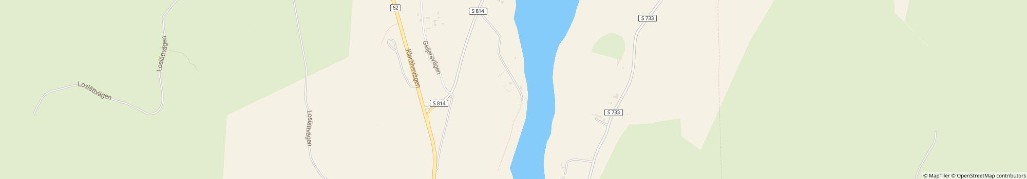
Storängens Camping is located in Ransäter, Värmland, along road 62 between Karlstad and Hagfors. From Karlstad, follow road 62 north for about 50 km towards Hagfors. Take the first exit to Ransäter (Erlandergården), marked “Camping 1 km”. Continue on Erlandervägen …
- Tó: 9 km
- Folyó: Helyszínen
- A hegyekben: Nem
- Magasság (tengerszint felett): 88 m
- Következő város: 50 km
- Következő helység/falu: 9 km
- Vonat- vagy buszállomás: 1 km
- Autópálya kijárat: 1 km
Cím
Erlandervägen 268493 Ransäter
Svédország
GPS-koordináták
Lat 59.763501945690074, Long 13.448721661376947
Útvonalak kereséseKapcsolat
Storängens Camping
Hívjon vagy faxoljon
Gyakran ismételt kérdések
Milyen camping.info FANCLUB-előnyöket kínál a Storängens Camping?
A camping.info FANCLUB tagjaként a következő exkluzív FANCLUB-előnyöket élvezheti a Storängens Camping kempingben:
Tudjon meg többet a camping.info FANCLUB-ról
- 5% kedvezmény - a pályadíjakon a április 30. és a június 9., valamint a augusztus 26. és a között szeptember 20.
- Pékség meglepetés - egy további pékáru meglepetés minden zsemle rendelés mellé
- Szabad kempinghely-választás - (Ha rendelkezésre áll)
Még nem vagy a FANCLUB tagja?
Szerezz exkluzív kedvezményeket és előnyöket a Storängens Camping kempingben, valamint több mint 1000 további kempingben és parkolóhelyen szerte Európában!
Tudjon meg többet a camping.info FANCLUB-ról
Milyen messze van a strandtól a(z) Storängens Camping?
A(z) Storängens Camping közvetlenül a strandon található. Tudj meg többet a helyszínről
Megengedettek a kutyák a(z) Storängens Camping kempingben?
Kutyák a főszezonban és a mellékszezonban is bevihetők. Kutyák a bérelhető szállásokon is engedélyezettek. A vendégek a(z) Storängens Camping kempinget „kutyás vendégeknek alkalmas” kategóriában 5-ből 5 pontra értékelik. Olvasd el most részletesen az értékeléseket
Mikor van nyitva a(z) Storängens Camping?
Storängens Camping nyitva van: 30. aprīlis és 20. septembris között. Kemping részleteinek mutatása
Családbarát a(z) Storängens Camping?
A vendégek a(z) Storängens Camping kempinget különösen alkalmasnak tartják a 18 év alatti gyermekes családok számára. A szabadidős tevékenységekhez a(z) Storängens Camping kemping számos lehetőséget kínál, mint például a(z) Játszótér, Lovaglás, Kültéri medence, Vizicsúszda és még sok más. Rossz idő esetén igénybe veheted a fedett medencét (9 km távolságra) és a fedett játszóhelyeket.
Összes szabadidős lehetőség megtekintése
Összes szabadidős lehetőség megtekintése
Hogyan értékelik a vendégek és más kempingezők a(z) Storängens Camping kempinget?
A kempingezők 5-ből 4 pontra értékelik a(z) Storängens Camping kempinget.
A vendégek a következő tulajdonságokat értékelik különösen jól: Általános tisztaság, Kedvesség, Nyugalom
A vendégek szerint a(z) Storängens Camping különösen alkalmas a következőkhöz: Párok és Vendégek kutyával
A vendégek szerint a(z) Storängens Camping ideális a következőkhöz: Kerékpározás és Kajakozás
Olvasd el az összes kempingezői értékelést
Vannak vásárlási lehetőségek a(z) Storängens Camping közelében?
Egy élelmiszerbolt található közvetlenül a kempingben. Ez 10. maijs és 20. septembris között van nyitva. Emellett a(z) Storängens Camping friss pékáru-szolgáltatást is kínál közvetlenül a helyszínen. A legközelebbi kisváros 9 km-re található, a legközelebbi nagyváros 50 km-re található. Tudj meg többet a helyszínről
Milyen messze van a legközelebbi város a(z) Storängens Camping kempingtől?
A legközelebbi kisváros 9 km-re található, a legközelebbi nagyváros 50 km-re található. 1 km távolságon belül elérhetsz egy busz- vagy vonatmegállót. A legközelebbi autópálya-kijárat 1 km-re található. Tudj meg többet a helyszínről
Milyen étkezési lehetőségeket kínál a(z) Storängens Camping?
Az ellátásról jól gondoskodnak, mivel közvetlenül a helyszínen található egy étterem. Nyitva van 10. jūnijs és 25. augusts között. Emellett egy büfé is található közvetlenül a helyszínen (nyitva 10. jūnijs és 25. augusts között).
A közvetlenül a helyszínen elérhető friss pékáru-szolgáltatással pihentetően indíthatod a napot.
Az önellátáshoz egy élelmiszerbolt található közvetlenül a helyszínen (nyitva 10. maijs és 20. septembris között) valamint főzési lehetőségek a helyszínen. Az igazi grillrajongók akár a faszenes grillt is begyújthatják.
Összességében a vendégek 5-ből 3.3 pontra értékelik a helyszíni étel- és italkínálatot.
Mellesleg a gázpalackok 9 km távolságra cserélhetők. Aki pedig asztalt vagy padokat szeretne kölcsönözni, a helyszínen ezt is megteheti.
Összes lehetőség részletes megtekintése
Van wi-fi vagy internet a(z) Storängens Camping kempingben?
A(z) Storängens Camping kemping kínál wi-fit. Ez ingyenes. Ezenkívül egy internetterminál is található a helyszínen.
Akadálymentesített a(z) Storängens Camping?
A(z) Storängens Camping kempingben az utak többsége burkolt. Kerekesszékesek számára nincsenek rámpák. A szaniter helyiségek akadálymentesítettek. Semmi sem áll a fürdőzés örömének útjába, mivel a vízbe jutás akadálymentesített. Összes kempingjellemző megtekintése
Hány parcellával rendelkezik a(z) Storängens Camping?
A(z) Storängens Camping 49 turistahelyet és 0 állandó kempingezőhelyet kínál.
Összes kempinginformáció megtekintése most
Összes kempinginformáció megtekintése most
Mekkora a(z) Storängens Camping?
A(z) Storängens Camping mérete 15 hektár. A talajviszonyok: Fű
Összes kempinginformáció megtekintése most
Összes kempinginformáció megtekintése most
Mennyibe kerül a tartózkodás a(z) Storängens Camping kempingben?
Egy éjszaka a(z) Storängens Camping kempingben 32,00 EUR - 36,00 EUR összegbe kerül, de az árak a választott időszaktól, a vendégek számától stb. függően változnak. A camping.info oldalon kötelezettségmentes ajánlatkérést küldhetsz a(z) Storängens Camping kempingnek, hogy megtudd az aktuális árakat és a szabad helyeket. Kérés küldése most