 Deutsch
 English
 Nederlands
 français
 italiano
 Español
 български
 босански
 čeština
 dansk
dansk Ελληνικά
 eesti
eesti suomi
suomi hrvatski
 magyar
 lietuvių
 latviešu
 norsk bokmål
 polski
 português
 română
 русский
 slovenčina
 slovenščina
 српски
 svenska
 Türkçe
%20-%20https://sketchapp.com%20--%3e%3ctitle%3e178342C7-E563-41CE-8EC0-A9A54298CB55%3c/title%3e%3cdesc%3eCreated%20with%20sketchtool.%3c/desc%3e%3cdefs%3e%3ccircle%20id='path-1'%20cx='25'%20cy='25'%20r='25'%3e%3c/circle%3e%3c/defs%3e%3cg%20id='Page-1'%20stroke='none'%20stroke-width='1'%20fill='none'%20fill-rule='evenodd'%3e%3cg%20id='Transparenz'%20transform='translate(-1158.000000,%20-29.000000)'%3e%3cg%20id='Header'%20transform='translate(108.000000,%2031.000000)'%3e%3cg%20id='Profile'%20transform='translate(1052.000000,%200.000000)'%3e%3cg%20id='CI-Placeholder'%3e%3cmask%20id='mask-2'%20fill='white'%3e%3cuse%20xlink:href='%23path-1'%3e%3c/use%3e%3c/mask%3e%3cuse%20id='Background'%20stroke='%23FFFFFF'%20stroke-width='2.5'%20xlink:href='%23path-1'%3e%3c/use%3e%3cpath%20d='M24.9650909,39.2018953%20C22.42,39.2018953%2020.2218182,37.8707667%2019.6992727,36.1567717%20L20.7421818,36.1567717%20C21.1643636,36.1567717%2021.5058182,35.8072948%2021.5058182,35.3765701%20L21.5058182,32.1288835%20C22.5618182,32.6530989%2023.7465455,32.9491525%2025,32.9491525%20C26.2534545,32.9491525%2027.4381818,32.6530989%2028.4941818,32.1299965%20L28.4941818,35.3765701%20C28.4941818,35.8072948%2028.8367273,36.1567717%2029.2589091,36.1567717%20L30.232,36.1567717%20C29.7083636,37.8707667%2027.5101818,39.2018953%2024.9650909,39.2018953%20M18.58,25.4008967%20L18.0956364,20.5093332%20C18.0661818,20.2411041%2018.0465455,19.969536%2018.0465455,19.6924031%20C18.0465455,15.7591185%2021.1665455,12.5592902%2025,12.5592902%20C28.8345455,12.5592902%2031.9534545,15.7591185%2031.9534545,19.6924031%20C31.9534545,19.969536%2031.9349091,20.2411041%2031.9010909,20.5605304%20L31.4189091,25.4053487%20C31.1047273,28.8177569%2028.3458182,31.3898623%2025,31.3898623%20C21.6552727,31.3898623%2018.8963636,28.8177569%2018.58,25.4008967%20M32.6341818,34.5974815%20L30.0225455,34.5974815%20L30.0225455,31.1327631%20C31.6327273,29.7982955%2032.7290909,27.8305403%2032.9396364,25.5567145%20L33.4218182,20.6851846%20C33.4578182,20.3579674%2033.4818182,20.0274112%2033.4818182,19.6924031%20C33.4818182,14.8998951%2029.6767273,11%2025,11%20C20.3232727,11%2016.5192727,14.8998951%2016.5192727,19.6924031%20C16.5192727,20.0274112%2016.5421818,20.3579674%2016.5792727,20.7174611%20L17.0603636,25.5511496%20C17.2709091,27.8283143%2018.3672727,29.7971826%2019.9785455,31.1327631%20L19.9785455,34.5974815%20L17.3658182,34.5974815%20C11.6505455,34.5974815%207,39.3643909%207,45.2209114%20C7,45.6516361%207.34254545,46%207.76363636,46%20C8.18581818,46%208.52836364,45.6516361%208.52836364,45.2209114%20C8.52836364,40.2225014%2012.4916364,36.1567717%2017.3658182,36.1567717%20L18.1316364,36.1567717%20C18.6192727,38.7555888%2021.4938182,40.7600725%2024.9661818,40.7600725%20C28.4374545,40.7600725%2031.312,38.7555888%2031.7996364,36.1567717%20L32.6341818,36.1567717%20C37.5083636,36.1567717%2041.4727273,40.2225014%2041.4727273,45.2209114%20C41.4727273,45.6516361%2041.8141818,46%2042.2363636,46%20C42.6585455,46%2043,45.6516361%2043,45.2209114%20C43,39.3643909%2038.3505455,34.5974815%2032.6341818,34.5974815'%20id='Icon'%20fill='%23FFFFFF'%20mask='url(%23mask-2)'%3e%3c/path%3e%3c/g%3e%3c/g%3e%3c/g%3e%3c/g%3e%3c/g%3e%3c/svg%3e)


Alkaen20,00€
Camping Les Loges ***
- Toiminta-ajat: 01.04 - 21.06, 03.05 - 30.09 - tällä hetkellä toiminnassa
- Osoite: Les Loges, 63340 Nonette-Orsonnette, Ranska - Näytä kartalla
- Alueella: Puy-de-DômeHaute-Loire
Arviot
Arviot yksityiskohtaisesti
- Yleinen siisteystaso4.6
- Vapaa-ajan aktiviteetit4.4
- Sijainti4.6
- Vastine rahalle4.5
Mitä vieraat kirjoittavat
%20-%20https://sketchapp.com%20--%3e%3ctitle%3e178342C7-E563-41CE-8EC0-A9A54298CB55%3c/title%3e%3cdesc%3eCreated%20with%20sketchtool.%3c/desc%3e%3cdefs%3e%3ccircle%20id='path-1'%20cx='25'%20cy='25'%20r='25'%3e%3c/circle%3e%3c/defs%3e%3cg%20id='Page-1'%20stroke='none'%20stroke-width='1'%20fill='none'%20fill-rule='evenodd'%3e%3cg%20id='Transparenz'%20transform='translate(-1158.000000,%20-29.000000)'%3e%3cg%20id='Header'%20transform='translate(108.000000,%2031.000000)'%3e%3cg%20id='Profile'%20transform='translate(1052.000000,%200.000000)'%3e%3cg%20id='CI-Placeholder'%3e%3cmask%20id='mask-2'%20fill='white'%3e%3cuse%20xlink:href='%23path-1'%3e%3c/use%3e%3c/mask%3e%3cuse%20id='Background'%20stroke='%239b9b9b'%20stroke-width='2.5'%20xlink:href='%23path-1'%3e%3c/use%3e%3cpath%20d='M24.9650909,39.2018953%20C22.42,39.2018953%2020.2218182,37.8707667%2019.6992727,36.1567717%20L20.7421818,36.1567717%20C21.1643636,36.1567717%2021.5058182,35.8072948%2021.5058182,35.3765701%20L21.5058182,32.1288835%20C22.5618182,32.6530989%2023.7465455,32.9491525%2025,32.9491525%20C26.2534545,32.9491525%2027.4381818,32.6530989%2028.4941818,32.1299965%20L28.4941818,35.3765701%20C28.4941818,35.8072948%2028.8367273,36.1567717%2029.2589091,36.1567717%20L30.232,36.1567717%20C29.7083636,37.8707667%2027.5101818,39.2018953%2024.9650909,39.2018953%20M18.58,25.4008967%20L18.0956364,20.5093332%20C18.0661818,20.2411041%2018.0465455,19.969536%2018.0465455,19.6924031%20C18.0465455,15.7591185%2021.1665455,12.5592902%2025,12.5592902%20C28.8345455,12.5592902%2031.9534545,15.7591185%2031.9534545,19.6924031%20C31.9534545,19.969536%2031.9349091,20.2411041%2031.9010909,20.5605304%20L31.4189091,25.4053487%20C31.1047273,28.8177569%2028.3458182,31.3898623%2025,31.3898623%20C21.6552727,31.3898623%2018.8963636,28.8177569%2018.58,25.4008967%20M32.6341818,34.5974815%20L30.0225455,34.5974815%20L30.0225455,31.1327631%20C31.6327273,29.7982955%2032.7290909,27.8305403%2032.9396364,25.5567145%20L33.4218182,20.6851846%20C33.4578182,20.3579674%2033.4818182,20.0274112%2033.4818182,19.6924031%20C33.4818182,14.8998951%2029.6767273,11%2025,11%20C20.3232727,11%2016.5192727,14.8998951%2016.5192727,19.6924031%20C16.5192727,20.0274112%2016.5421818,20.3579674%2016.5792727,20.7174611%20L17.0603636,25.5511496%20C17.2709091,27.8283143%2018.3672727,29.7971826%2019.9785455,31.1327631%20L19.9785455,34.5974815%20L17.3658182,34.5974815%20C11.6505455,34.5974815%207,39.3643909%207,45.2209114%20C7,45.6516361%207.34254545,46%207.76363636,46%20C8.18581818,46%208.52836364,45.6516361%208.52836364,45.2209114%20C8.52836364,40.2225014%2012.4916364,36.1567717%2017.3658182,36.1567717%20L18.1316364,36.1567717%20C18.6192727,38.7555888%2021.4938182,40.7600725%2024.9661818,40.7600725%20C28.4374545,40.7600725%2031.312,38.7555888%2031.7996364,36.1567717%20L32.6341818,36.1567717%20C37.5083636,36.1567717%2041.4727273,40.2225014%2041.4727273,45.2209114%20C41.4727273,45.6516361%2041.8141818,46%2042.2363636,46%20C42.6585455,46%2043,45.6516361%2043,45.2209114%20C43,39.3643909%2038.3505455,34.5974815%2032.6341818,34.5974815'%20id='Icon'%20fill='%239b9b9b'%20mask='url(%23mask-2)'%3e%3c/path%3e%3c/g%3e%3c/g%3e%3c/g%3e%3c/g%3e%3c/g%3e%3c/svg%3e)
Frederik P.
Majoitusaika: elo 2025
"Beautiful place te relax - Find a spot you like anywhere on the site3 arvostelua lisää
Näytä kaikki arvostelutKuvaus
Profiilini
On the banks of the Allier River, in the hilly surroundings of Auvergne, you will find Les Loges campsite. Here you can camp on a flat and quiet campsite not far from the A75. This makes camping Les Loges a …
- Leirintäalueen luokka:
- Sivuston koko: 3 ha (Maaolosuhteet: Grass)
- Pelipaikkojen kokonaismäärä: 143
- Turistipaikkojen määrä: 143
Viitehinta
Huippukausi 23,00 €*
Hiljainen kausi 20,00 €*
*Kaksi aikuista, asuntovaunu, auto, sähköt ja paikalliset verot per yö
Toiminta-ajat
01. huhtikuu - 21. kesäkuu
03. toukokuu - 30. syyskuu
Ominaisuudet
Tilat
- Hiiligrilli sallittu
- Kuivausrummut
- Matkailuautojen huoltopiste
- Pyykinpesukoneet
- Yksittäiset pesukaapit(10)
- Internet-pääte
- Wi-Fi
Parkkipaikalla
- Auto sallittu leiriytymispaikalla
- Erillinen tila nuorisoryhmille
- Sähköliitäntä
- Varjoisia alueita(Half shaded)
- Autottomat leiriytymispaikat
Lemmikit
- Koirat sallittuja hiljaisella kaudella
- Koirat sallittuja huippukaudella
Perhe & Lapset
- Lastenhoitohuono
- Leikkipuisto
- Ohjelmaa lapsille
Uinti & Hyvinvointi
- Avovesiuinti(River)
- Ulkouima-allas
- Vesiliukumäki
- Kuumia lähteitä
- Sisäuima-allas
Vapaa-ajan mahdollisuudet
- Kalastus
- Lentopallo
- Pöytätennis
- Golf
- Hiihtohissi
- Minigolf
- Polkupyörävuokraus
- Purjehdus
- Purjelautailu
- Tennis
Hinta ja ateriapalvelut
- Kioski
- Leipää myynnissä alueella
- Ravintola
Esteettömyys
- Esteettömät saniteettitilat
- Pyörätuoliluiskat
Vuokra-asunnot
- Mökkejä
- Vuokrateltat
- Asuntovaunujen vuokraus
- Loma-asunnot
- Mökit
Loman tyyppi
- Nudismi
- Pieni leirintäalue
- Pysyvä leiriytyminen
- Talvileiriytyminen
Sijainti
Ohjeet
A75, from Clermont-Ferrand exit 17 Nonette, then turn left following the campsite signs (approx. 5 km).
- River: Alueella
- Vuoristossa: Ei
- Korkeus (merenpinnan yläpuolella): 330 m
- Seuraava kaupunki/kylä: 5 km
- Moottoritien ramppi: 5 km
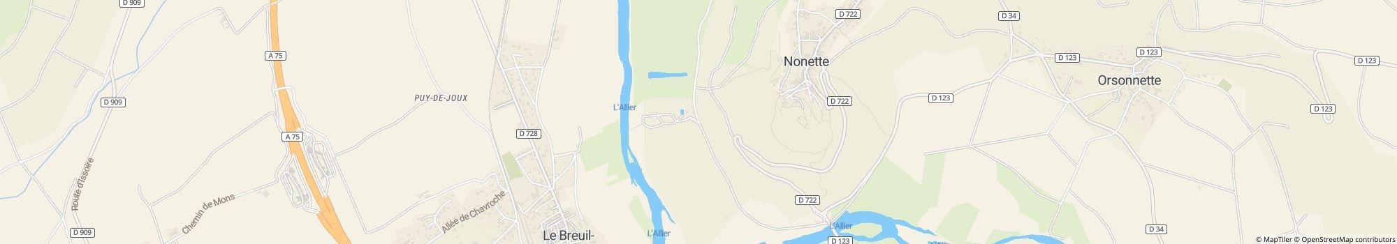
Osoite
Les Loges63340 Nonette-Orsonnette
Ranska
GPS-koordinaatit
Lat 45.473251724643205, Long 3.27215667724611
OhjeetYhteydenotto
Camping Les Loges ***
Soita tai faksaa
Usein kysytyt kysymykset
Kuinka kaukana Camping Les Loges *** on joesta?
Camping Les Loges *** sijaitsee suoraan joen varrella. Lue lisää sijainnista
Ovatko koirat sallittuja leirintäalueella Camping Les Loges ***?
Koirat ovat sallittuja sesonkiaikana ja sesongin ulkopuolella.
Milloin Camping Les Loges *** on avoinna?
Camping Les Loges *** on auki 1. huhtikuu - 21. kesäkuu ja 3. toukokuu - 30. syyskuu. Tarkista saatavuus nyt
Onko Camping Les Loges *** lapsiystävällinen?
Vapaa-ajan viettoon leirintäalue Camping Les Loges *** tarjoaa paljon mahdollisuuksia, kuten Leikkipuisto, Ulkouima-allas, Vesiliukumäki, Ohjelmaa lapsille ja paljon muuta.
Katso kaikki vapaa-ajanviettomahdollisuudet
Katso kaikki vapaa-ajanviettomahdollisuudet
Miten vieraat ja muut leiriytyjät arvioivat kohteen Camping Les Loges ***?
Leiriytyjät arvioivat kohteen Camping Les Loges *** arvosanalla 4.4 / 5. Tämä tekee kohteesta Camping Les Loges *** yhden parhaat arviot saaneista leirintäalueista alueella Puy-de-Dôme.
Vieraat arvioivat seuraavat ominaisuudet erityisen hyviksi: Yleinen siisteystaso, Sijainti, Vastine rahalle
Lue kaikki leiriytyjien arviot
Vieraat arvioivat seuraavat ominaisuudet erityisen hyviksi: Yleinen siisteystaso, Sijainti, Vastine rahalle
Lue kaikki leiriytyjien arviot
Onko kohteen Camping Les Loges *** lähellä ostosmahdollisuuksia?
Valitettavasti leirintäalue Camping Les Loges *** ei ole vielä ilmoittanut tietoja ostosmahdollisuuksista, mutta voit kysyä tietoja suoraan leirintäalueelta. Lähetä kysely nyt
Etsi muita leirintäalueita alueelta Auvergne-Rhône-Alpes, joiden lähellä on ostosmahdollisuuksia
Etsi muita leirintäalueita alueelta Auvergne-Rhône-Alpes, joiden lähellä on ostosmahdollisuuksia
Kuinka kaukana lähin kaupunki on kohteesta Camping Les Loges ***?
Lähin pikkukaupunki on 5 km:n päässä. Lähin moottoritieliittymä on 5 km:n päässä. Lue lisää sijainnista
Mitä ruokailumahdollisuuksia Camping Les Loges *** tarjaa?
Ruokapuoli on kunnossa, sillä suoraan alueella on ravintola. Lisäksi suoraan paikan päällä on välipalabaari.
Paikan päällä tarjottavan tuoreen leivän toimituspalvelun ansiosta voit aloittaa päiväsi rentoutuneesti. Todelliset grillauksen ystävät voivat jopa sytyttää hiiligrillin.
Katso kaikki vaihtoehdot yksityiskohtaisesti
Paikan päällä tarjottavan tuoreen leivän toimituspalvelun ansiosta voit aloittaa päiväsi rentoutuneesti. Todelliset grillauksen ystävät voivat jopa sytyttää hiiligrillin.
Katso kaikki vaihtoehdot yksityiskohtaisesti
Onko leirintäalueella Camping Les Loges *** wi-fi tai internet?
Leirintäalue Camping Les Loges *** ei valitettavasti tarjoa wi-fiä.
Onko Camping Les Loges *** esteetön?
Pyörätuolin käyttäjille on saatavilla ramppeja. Saniteettitilat ovat esteettömät. Katso kaikki leirintäalueen mukavuudet
Kuinka monta paikkaa kohteessa Camping Les Loges *** on?
Leirintäalueella Camping Les Loges *** on 143 matkailijapaikkaa ja 0 kausipaikkaa.
Katso kaikki leirintäalueen tiedot nyt
Katso kaikki leirintäalueen tiedot nyt
Kuinka suuri Camping Les Loges *** on?
Kohteen Camping Les Loges *** pinta-ala on 3 hehtaaria. Maaston tyyppi on: Grass
Katso kaikki leirintäalueen tiedot nyt
Katso kaikki leirintäalueen tiedot nyt
Mitä yöpyminen kohteessa Camping Les Loges *** maksaa?
Yöpyminen kohteessa Camping Les Loges *** maksaa 20,00 € – 23,00 €, mutta hinnat vaihtelevat valitun ajankohdan, vieraiden määrän jne. mukaan. Voit syöttää matkustuspäiväsi camping.info-sivustolla nähdäksesi ajantasaiset hinnat ja saatavuuden.
Syötä matkustuspäiväsi nyt ja katso ajantasaiset hinnat
Syötä matkustuspäiväsi nyt ja katso ajantasaiset hinnat