 Deutsch
 English
 Nederlands
 français
 italiano
 Español
 български
 босански
 čeština
 dansk
dansk Ελληνικά
 eesti
eesti suomi
suomi hrvatski
 magyar
 lietuvių
 latviešu
 norsk bokmål
 polski
 português
 română
 русский
 slovenčina
 slovenščina
 српски
 svenska
 Türkçe
%20-%20https://sketchapp.com%20--%3e%3ctitle%3e178342C7-E563-41CE-8EC0-A9A54298CB55%3c/title%3e%3cdesc%3eCreated%20with%20sketchtool.%3c/desc%3e%3cdefs%3e%3ccircle%20id='path-1'%20cx='25'%20cy='25'%20r='25'%3e%3c/circle%3e%3c/defs%3e%3cg%20id='Page-1'%20stroke='none'%20stroke-width='1'%20fill='none'%20fill-rule='evenodd'%3e%3cg%20id='Transparenz'%20transform='translate(-1158.000000,%20-29.000000)'%3e%3cg%20id='Header'%20transform='translate(108.000000,%2031.000000)'%3e%3cg%20id='Profile'%20transform='translate(1052.000000,%200.000000)'%3e%3cg%20id='CI-Placeholder'%3e%3cmask%20id='mask-2'%20fill='white'%3e%3cuse%20xlink:href='%23path-1'%3e%3c/use%3e%3c/mask%3e%3cuse%20id='Background'%20stroke='%23FFFFFF'%20stroke-width='2.5'%20xlink:href='%23path-1'%3e%3c/use%3e%3cpath%20d='M24.9650909,39.2018953%20C22.42,39.2018953%2020.2218182,37.8707667%2019.6992727,36.1567717%20L20.7421818,36.1567717%20C21.1643636,36.1567717%2021.5058182,35.8072948%2021.5058182,35.3765701%20L21.5058182,32.1288835%20C22.5618182,32.6530989%2023.7465455,32.9491525%2025,32.9491525%20C26.2534545,32.9491525%2027.4381818,32.6530989%2028.4941818,32.1299965%20L28.4941818,35.3765701%20C28.4941818,35.8072948%2028.8367273,36.1567717%2029.2589091,36.1567717%20L30.232,36.1567717%20C29.7083636,37.8707667%2027.5101818,39.2018953%2024.9650909,39.2018953%20M18.58,25.4008967%20L18.0956364,20.5093332%20C18.0661818,20.2411041%2018.0465455,19.969536%2018.0465455,19.6924031%20C18.0465455,15.7591185%2021.1665455,12.5592902%2025,12.5592902%20C28.8345455,12.5592902%2031.9534545,15.7591185%2031.9534545,19.6924031%20C31.9534545,19.969536%2031.9349091,20.2411041%2031.9010909,20.5605304%20L31.4189091,25.4053487%20C31.1047273,28.8177569%2028.3458182,31.3898623%2025,31.3898623%20C21.6552727,31.3898623%2018.8963636,28.8177569%2018.58,25.4008967%20M32.6341818,34.5974815%20L30.0225455,34.5974815%20L30.0225455,31.1327631%20C31.6327273,29.7982955%2032.7290909,27.8305403%2032.9396364,25.5567145%20L33.4218182,20.6851846%20C33.4578182,20.3579674%2033.4818182,20.0274112%2033.4818182,19.6924031%20C33.4818182,14.8998951%2029.6767273,11%2025,11%20C20.3232727,11%2016.5192727,14.8998951%2016.5192727,19.6924031%20C16.5192727,20.0274112%2016.5421818,20.3579674%2016.5792727,20.7174611%20L17.0603636,25.5511496%20C17.2709091,27.8283143%2018.3672727,29.7971826%2019.9785455,31.1327631%20L19.9785455,34.5974815%20L17.3658182,34.5974815%20C11.6505455,34.5974815%207,39.3643909%207,45.2209114%20C7,45.6516361%207.34254545,46%207.76363636,46%20C8.18581818,46%208.52836364,45.6516361%208.52836364,45.2209114%20C8.52836364,40.2225014%2012.4916364,36.1567717%2017.3658182,36.1567717%20L18.1316364,36.1567717%20C18.6192727,38.7555888%2021.4938182,40.7600725%2024.9661818,40.7600725%20C28.4374545,40.7600725%2031.312,38.7555888%2031.7996364,36.1567717%20L32.6341818,36.1567717%20C37.5083636,36.1567717%2041.4727273,40.2225014%2041.4727273,45.2209114%20C41.4727273,45.6516361%2041.8141818,46%2042.2363636,46%20C42.6585455,46%2043,45.6516361%2043,45.2209114%20C43,39.3643909%2038.3505455,34.5974815%2032.6341818,34.5974815'%20id='Icon'%20fill='%23FFFFFF'%20mask='url(%23mask-2)'%3e%3c/path%3e%3c/g%3e%3c/g%3e%3c/g%3e%3c/g%3e%3c/g%3e%3c/svg%3e)


Alkaen21,00€
Höhenhof
- Toiminta-ajat: 01.03 - 31.10, 01.11 - 28.02 - tällä hetkellä toiminnassa
- Osoite: Höhenhof, 55469 Holzbach, Saksa - Näytä kartalla
- Alueella: HunsrückReinhessen-Nahe
Arviot
Arviot yksityiskohtaisesti
- Rauhallisuus4.3
- Ruoka/kaupat3.3
- Yleinen siisteystaso3.4
- Saniteettitilojen siisteys4.5
- Vuokrattavien majoitustilojen kunto3.0
- Ystävällisyys3.9
- Infrastruktuuri3.2
- Vapaa-ajan aktiviteetit4.0
- Sijainti4.0
- Vastine rahalle3.3
- Saniteettitilat3.6
Mitä vieraat kirjoittavat
%20-%20https://sketchapp.com%20--%3e%3ctitle%3e178342C7-E563-41CE-8EC0-A9A54298CB55%3c/title%3e%3cdesc%3eCreated%20with%20sketchtool.%3c/desc%3e%3cdefs%3e%3ccircle%20id='path-1'%20cx='25'%20cy='25'%20r='25'%3e%3c/circle%3e%3c/defs%3e%3cg%20id='Page-1'%20stroke='none'%20stroke-width='1'%20fill='none'%20fill-rule='evenodd'%3e%3cg%20id='Transparenz'%20transform='translate(-1158.000000,%20-29.000000)'%3e%3cg%20id='Header'%20transform='translate(108.000000,%2031.000000)'%3e%3cg%20id='Profile'%20transform='translate(1052.000000,%200.000000)'%3e%3cg%20id='CI-Placeholder'%3e%3cmask%20id='mask-2'%20fill='white'%3e%3cuse%20xlink:href='%23path-1'%3e%3c/use%3e%3c/mask%3e%3cuse%20id='Background'%20stroke='%239b9b9b'%20stroke-width='2.5'%20xlink:href='%23path-1'%3e%3c/use%3e%3cpath%20d='M24.9650909,39.2018953%20C22.42,39.2018953%2020.2218182,37.8707667%2019.6992727,36.1567717%20L20.7421818,36.1567717%20C21.1643636,36.1567717%2021.5058182,35.8072948%2021.5058182,35.3765701%20L21.5058182,32.1288835%20C22.5618182,32.6530989%2023.7465455,32.9491525%2025,32.9491525%20C26.2534545,32.9491525%2027.4381818,32.6530989%2028.4941818,32.1299965%20L28.4941818,35.3765701%20C28.4941818,35.8072948%2028.8367273,36.1567717%2029.2589091,36.1567717%20L30.232,36.1567717%20C29.7083636,37.8707667%2027.5101818,39.2018953%2024.9650909,39.2018953%20M18.58,25.4008967%20L18.0956364,20.5093332%20C18.0661818,20.2411041%2018.0465455,19.969536%2018.0465455,19.6924031%20C18.0465455,15.7591185%2021.1665455,12.5592902%2025,12.5592902%20C28.8345455,12.5592902%2031.9534545,15.7591185%2031.9534545,19.6924031%20C31.9534545,19.969536%2031.9349091,20.2411041%2031.9010909,20.5605304%20L31.4189091,25.4053487%20C31.1047273,28.8177569%2028.3458182,31.3898623%2025,31.3898623%20C21.6552727,31.3898623%2018.8963636,28.8177569%2018.58,25.4008967%20M32.6341818,34.5974815%20L30.0225455,34.5974815%20L30.0225455,31.1327631%20C31.6327273,29.7982955%2032.7290909,27.8305403%2032.9396364,25.5567145%20L33.4218182,20.6851846%20C33.4578182,20.3579674%2033.4818182,20.0274112%2033.4818182,19.6924031%20C33.4818182,14.8998951%2029.6767273,11%2025,11%20C20.3232727,11%2016.5192727,14.8998951%2016.5192727,19.6924031%20C16.5192727,20.0274112%2016.5421818,20.3579674%2016.5792727,20.7174611%20L17.0603636,25.5511496%20C17.2709091,27.8283143%2018.3672727,29.7971826%2019.9785455,31.1327631%20L19.9785455,34.5974815%20L17.3658182,34.5974815%20C11.6505455,34.5974815%207,39.3643909%207,45.2209114%20C7,45.6516361%207.34254545,46%207.76363636,46%20C8.18581818,46%208.52836364,45.6516361%208.52836364,45.2209114%20C8.52836364,40.2225014%2012.4916364,36.1567717%2017.3658182,36.1567717%20L18.1316364,36.1567717%20C18.6192727,38.7555888%2021.4938182,40.7600725%2024.9661818,40.7600725%20C28.4374545,40.7600725%2031.312,38.7555888%2031.7996364,36.1567717%20L32.6341818,36.1567717%20C37.5083636,36.1567717%2041.4727273,40.2225014%2041.4727273,45.2209114%20C41.4727273,45.6516361%2041.8141818,46%2042.2363636,46%20C42.6585455,46%2043,45.6516361%2043,45.2209114%20C43,39.3643909%2038.3505455,34.5974815%2032.6341818,34.5974815'%20id='Icon'%20fill='%239b9b9b'%20mask='url(%23mask-2)'%3e%3c/path%3e%3c/g%3e%3c/g%3e%3c/g%3e%3c/g%3e%3c/g%3e%3c/svg%3e)
3 arvostelua lisää
Näytä kaikki arvostelutVieraiden suosittelemia aktiviteetteja
Polkupyöräily
(5 Vierasta)Kävelyt
(4 Vierasta)Maastopyöräily
(1 Vieras)Vieraiden arvioima "Sopii"
Perheet, lapset alle 12 v.
Perheet, lapset alle 6 v.
Telttailijat
Koiranomistajat
Pariskunnat
Eläkeläiset
Perheet, lapset alle 18 v.
Nuorisoryhmät
Kuvaus
Profiilini
Camping auf dem Bauernhof. Drei befestigte Plätze zwischen 80 und 100 m² mit Strom-,Wasser-und Abwasseranschluss sowie Entsorgungstation. Die Plätze liegen am Waldrand mit einer einmaligen Fernsicht über den Hunsrück. Camping on the farm. There are three places between 80 and …
- Leirintäalueen luokka:
- Pelipaikkojen kokonaismäärä: 3
- Turistipaikkojen määrä: 3
Viitehinta
Huippukausi 21,00 €*
*Kaksi aikuista, asuntovaunu, auto, sähköt ja paikalliset verot per yö
Toiminta-ajat
01. maaliskuu - 31. lokakuu
01. marraskuu - 28. helmikuu
Ominaisuudet
Tilat
- Hiiligrilli sallittu
- Internet-pääte
- Kuivausrummut
- Matkailuautojen huoltopiste
- Oleskelutilat
- Polttopuita saatavilla
- Pyykinpesukoneet
- Wi-Fi
- Yhteinen nuotiopaikka
- Kuivaushuone
- Säilytyslokerot
Parkkipaikalla
- Sähköliitäntä
- Erillinen tila nuorisoryhmille
- Leiritulen tekeminen sallittu
Lemmikit
- Koirat sallittuja hiljaisella kaudella
- Koirat sallittuja huippukaudella
- Koirat sallittuja vuokrattaviin majoitustiloihin
- Suihkut koirille
Perhe & Lapset
- Leikkipuisto
- Lastenhoitohuono
- Ohjelmaa lapsille
Uinti & Hyvinvointi
- Sisäuima-allas(5 km)
- Ulkouima-allas(5 km)
- Kuumia lähteitä
- Sauna
Vapaa-ajan mahdollisuudet
- Pöytätennis
- Golf
- Hiihtohissi
- Minigolf
- Polkupyörävuokraus
- Purjehdus
- Purjelautailu
- Tennis
Hinta ja ateriapalvelut
- Keittomahdollisuudet
- Ravintola(2 km)
- Ruokakauppa(5 km)
- Kioski
Esteettömyys
- Esteettömät saniteettitilat
Vuokra-asunnot
- Loma-asunnot
- Mökit
Loman tyyppi
- Pieni leirintäalue
- Talvileiriytyminen
- Nudismi
Sijainti
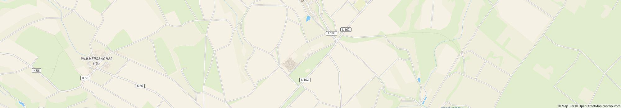
Ohjeet
Map to the Höhenhof: From Autobahn A61 you take the exit Rheinböllen and continue on B50 toward Simmern. Between Argenthal and Simmern take a right toward Gemünden. After about 1 km you get to the sign to Holzbach, you take …
- Järvi: 5 km
- Seuraava kaupunki: 5 km
- Seuraava kaupunki/kylä: 1 km
- Rautatie- tai linja-autoasema: 0,2 km
Yhteydenotto
Höhenhof
Soita tai faksaa
Usein kysytyt kysymykset
Kuinka kaukana Höhenhof on järvestä?
Höhenhof on 5 km:n päässä järvestä. Lue lisää sijainnista
Ovatko koirat sallittuja leirintäalueella Höhenhof?
Koirat ovat sallittuja sesonkiaikana ja sesongin ulkopuolella. Koirat ovat sallittuja myös vuokramajoituksissa. Vieraat arvioivat kohteen Höhenhof kategoriaan ”sopii koiran kanssa matkustaville” arvosanalla 3.7 / 5. Lue yksityiskohtaiset arviot nyt
Milloin Höhenhof on avoinna?
Höhenhof on auki 1. maaliskuu - 31. lokakuu ja 1. marraskuu - 28. helmikuu. Näytä leirintäalueen tiedot
Onko Höhenhof lapsiystävällinen?
Vieraat pitävät kohdetta Höhenhof erityisen sopivana perheille, joissa on alle 6 ja 12-vuotiaita lapsia. Vapaa-ajan viettoon leirintäalue Höhenhof tarjoaa paljon mahdollisuuksia, kuten Leikkipuisto, Ulkouima-allas ja paljon muuta. Huonolla säällä voit käyttää sisäuima-allasta (5 km päässä).
Katso kaikki vapaa-ajanviettomahdollisuudet
Katso kaikki vapaa-ajanviettomahdollisuudet
Miten vieraat ja muut leiriytyjät arvioivat kohteen Höhenhof?
Leiriytyjät arvioivat kohteen Höhenhof arvosanalla 3.5 / 5.
Vieraat arvioivat seuraavat ominaisuudet erityisen hyviksi: Saniteettitilojen siisteys, Rauhallisuus, Vapaa-ajan aktiviteetit
Vieraidensa mukaan Höhenhof sopii erityisen hyvin seuraaviin: Perheet, lapset alle 12 v. ja Perheet, lapset alle 6 v.
Vieraidensa mukaan Höhenhof on ihanteellinen seuraaviin: Ratsastus ja Vaellus
Lue kaikki leiriytyjien arviot
Onko kohteen Höhenhof lähellä ostosmahdollisuuksia?
Ruokakauppa on 5 km päässä. Lähin pikkukaupunki on 1 km:n päässä, lähim kaupunki on 5 km:n päässä. Lue lisää sijainnista
Kuinka kaukana lähin kaupunki on kohteesta Höhenhof?
Lähin pikkukaupunki on 1 km:n päässä, lähim kaupunki on 5 km:n päässä. Saavut bussi- tai junapysäkille 0.2 km:ssä. Lue lisää sijainnista
Mitä ruokailumahdollisuuksia Höhenhof tarjaa?
Ruokapuoli on kunnossa, sillä ravintola löytyy 2 km etäisyydeltä.
Omatoimiseen kokkaukseen löytyy ruokakauppa 5 km etäisyydeltä sekä ruoanlaittomahdollisuudet alueella. Todelliset grillauksen ystävät voivat jopa sytyttää hiiligrillin.
Kaiken kaikkiaan vieraat arvioivat alueen ruoka- ja juomatarjonnan arvosanalla 3.3 / 5.
Katso kaikki vaihtoehdot yksityiskohtaisesti
Onko leirintäalueella Höhenhof wi-fi tai internet?
Leirintäalue Höhenhof tarjoaa wi-fin. Tämä on maksutonta. Lisäksi paikan päällä on internetpääte.
Onko Höhenhof esteetön?
Saniteettitilat eivät ole esteettömät. Katso kaikki leirintäalueen mukavuudet
Kuinka monta paikkaa kohteessa Höhenhof on?
Leirintäalueella Höhenhof on 3 matkailijapaikkaa ja 0 kausipaikkaa.
Katso kaikki leirintäalueen tiedot nyt
Katso kaikki leirintäalueen tiedot nyt
Kuinka suuri Höhenhof on?
Leirintäalue Höhenhof ei valitettavasti ole vielä antanut kokotietoja, pukki voit kysyä tietoja myös suoraan paikan päältä. Lähetä kysely nyt
Etsi muita leirintäalueita alueelta Rheinland-Pfalz
Etsi muita leirintäalueita alueelta Rheinland-Pfalz
Mitä yöpyminen kohteessa Höhenhof maksaa?
Yöpyminen kohteessa Höhenhof maksaa alkaen 21,00 €, mutta hinnat vaihtelevat valitun ajankohdan, vieraiden määrän jne. mukaan. Voit lähettää camping.info-sivustolta sitoumuksettoman kyselyn kohteeseen Höhenhof saadaksesi tietää ajantasaiset hinnat ja saatavuuden. Lähetä kysely nyt