 Deutsch
 English
 Nederlands
 français
 italiano
 Español
 български
 босански
 čeština
 dansk
dansk Ελληνικά
 eesti
eesti suomi
suomi hrvatski
 magyar
 lietuvių
 latviešu
 norsk bokmål
 polski
 português
 română
 русский
 slovenčina
 slovenščina
 српски
 svenska
 Türkçe
%20-%20https://sketchapp.com%20--%3e%3ctitle%3e178342C7-E563-41CE-8EC0-A9A54298CB55%3c/title%3e%3cdesc%3eCreated%20with%20sketchtool.%3c/desc%3e%3cdefs%3e%3ccircle%20id='path-1'%20cx='25'%20cy='25'%20r='25'%3e%3c/circle%3e%3c/defs%3e%3cg%20id='Page-1'%20stroke='none'%20stroke-width='1'%20fill='none'%20fill-rule='evenodd'%3e%3cg%20id='Transparenz'%20transform='translate(-1158.000000,%20-29.000000)'%3e%3cg%20id='Header'%20transform='translate(108.000000,%2031.000000)'%3e%3cg%20id='Profile'%20transform='translate(1052.000000,%200.000000)'%3e%3cg%20id='CI-Placeholder'%3e%3cmask%20id='mask-2'%20fill='white'%3e%3cuse%20xlink:href='%23path-1'%3e%3c/use%3e%3c/mask%3e%3cuse%20id='Background'%20stroke='%23FFFFFF'%20stroke-width='2.5'%20xlink:href='%23path-1'%3e%3c/use%3e%3cpath%20d='M24.9650909,39.2018953%20C22.42,39.2018953%2020.2218182,37.8707667%2019.6992727,36.1567717%20L20.7421818,36.1567717%20C21.1643636,36.1567717%2021.5058182,35.8072948%2021.5058182,35.3765701%20L21.5058182,32.1288835%20C22.5618182,32.6530989%2023.7465455,32.9491525%2025,32.9491525%20C26.2534545,32.9491525%2027.4381818,32.6530989%2028.4941818,32.1299965%20L28.4941818,35.3765701%20C28.4941818,35.8072948%2028.8367273,36.1567717%2029.2589091,36.1567717%20L30.232,36.1567717%20C29.7083636,37.8707667%2027.5101818,39.2018953%2024.9650909,39.2018953%20M18.58,25.4008967%20L18.0956364,20.5093332%20C18.0661818,20.2411041%2018.0465455,19.969536%2018.0465455,19.6924031%20C18.0465455,15.7591185%2021.1665455,12.5592902%2025,12.5592902%20C28.8345455,12.5592902%2031.9534545,15.7591185%2031.9534545,19.6924031%20C31.9534545,19.969536%2031.9349091,20.2411041%2031.9010909,20.5605304%20L31.4189091,25.4053487%20C31.1047273,28.8177569%2028.3458182,31.3898623%2025,31.3898623%20C21.6552727,31.3898623%2018.8963636,28.8177569%2018.58,25.4008967%20M32.6341818,34.5974815%20L30.0225455,34.5974815%20L30.0225455,31.1327631%20C31.6327273,29.7982955%2032.7290909,27.8305403%2032.9396364,25.5567145%20L33.4218182,20.6851846%20C33.4578182,20.3579674%2033.4818182,20.0274112%2033.4818182,19.6924031%20C33.4818182,14.8998951%2029.6767273,11%2025,11%20C20.3232727,11%2016.5192727,14.8998951%2016.5192727,19.6924031%20C16.5192727,20.0274112%2016.5421818,20.3579674%2016.5792727,20.7174611%20L17.0603636,25.5511496%20C17.2709091,27.8283143%2018.3672727,29.7971826%2019.9785455,31.1327631%20L19.9785455,34.5974815%20L17.3658182,34.5974815%20C11.6505455,34.5974815%207,39.3643909%207,45.2209114%20C7,45.6516361%207.34254545,46%207.76363636,46%20C8.18581818,46%208.52836364,45.6516361%208.52836364,45.2209114%20C8.52836364,40.2225014%2012.4916364,36.1567717%2017.3658182,36.1567717%20L18.1316364,36.1567717%20C18.6192727,38.7555888%2021.4938182,40.7600725%2024.9661818,40.7600725%20C28.4374545,40.7600725%2031.312,38.7555888%2031.7996364,36.1567717%20L32.6341818,36.1567717%20C37.5083636,36.1567717%2041.4727273,40.2225014%2041.4727273,45.2209114%20C41.4727273,45.6516361%2041.8141818,46%2042.2363636,46%20C42.6585455,46%2043,45.6516361%2043,45.2209114%20C43,39.3643909%2038.3505455,34.5974815%2032.6341818,34.5974815'%20id='Icon'%20fill='%23FFFFFF'%20mask='url(%23mask-2)'%3e%3c/path%3e%3c/g%3e%3c/g%3e%3c/g%3e%3c/g%3e%3c/g%3e%3c/svg%3e)


Alkaen10,00€
Camp Sutjeska-Tjentiste
- Toiminta-ajat: 01.05 - 30.09 - tällä hetkellä suljettu
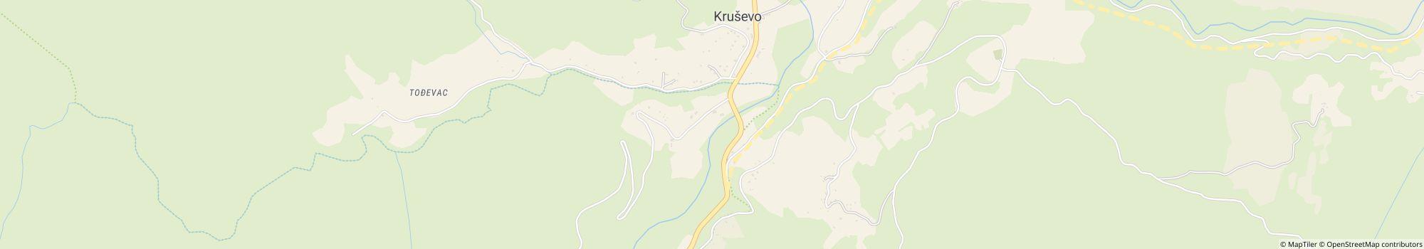
- Osoite: Sutjeska National park, 73311 Tjentiste, Bosnia-Hertsegovina - Näytä kartalla
- Alueella: Mostar
Arviot
Arviot yksityiskohtaisesti
- Rauhallisuus4.4
- Ruoka/kaupat2.3
- Yleinen siisteystaso3.0
- Saniteettitilojen siisteys2.3
- Vuokrattavien majoitustilojen kunto3.5
- Ystävällisyys4.3
- Infrastruktuuri3.2
- Vapaa-ajan aktiviteetit4.0
- Sijainti4.6
- Vastine rahalle3.0
- Saniteettitilat2.5
Mitä vieraat kirjoittavat
%20-%20https://sketchapp.com%20--%3e%3ctitle%3e178342C7-E563-41CE-8EC0-A9A54298CB55%3c/title%3e%3cdesc%3eCreated%20with%20sketchtool.%3c/desc%3e%3cdefs%3e%3ccircle%20id='path-1'%20cx='25'%20cy='25'%20r='25'%3e%3c/circle%3e%3c/defs%3e%3cg%20id='Page-1'%20stroke='none'%20stroke-width='1'%20fill='none'%20fill-rule='evenodd'%3e%3cg%20id='Transparenz'%20transform='translate(-1158.000000,%20-29.000000)'%3e%3cg%20id='Header'%20transform='translate(108.000000,%2031.000000)'%3e%3cg%20id='Profile'%20transform='translate(1052.000000,%200.000000)'%3e%3cg%20id='CI-Placeholder'%3e%3cmask%20id='mask-2'%20fill='white'%3e%3cuse%20xlink:href='%23path-1'%3e%3c/use%3e%3c/mask%3e%3cuse%20id='Background'%20stroke='%239b9b9b'%20stroke-width='2.5'%20xlink:href='%23path-1'%3e%3c/use%3e%3cpath%20d='M24.9650909,39.2018953%20C22.42,39.2018953%2020.2218182,37.8707667%2019.6992727,36.1567717%20L20.7421818,36.1567717%20C21.1643636,36.1567717%2021.5058182,35.8072948%2021.5058182,35.3765701%20L21.5058182,32.1288835%20C22.5618182,32.6530989%2023.7465455,32.9491525%2025,32.9491525%20C26.2534545,32.9491525%2027.4381818,32.6530989%2028.4941818,32.1299965%20L28.4941818,35.3765701%20C28.4941818,35.8072948%2028.8367273,36.1567717%2029.2589091,36.1567717%20L30.232,36.1567717%20C29.7083636,37.8707667%2027.5101818,39.2018953%2024.9650909,39.2018953%20M18.58,25.4008967%20L18.0956364,20.5093332%20C18.0661818,20.2411041%2018.0465455,19.969536%2018.0465455,19.6924031%20C18.0465455,15.7591185%2021.1665455,12.5592902%2025,12.5592902%20C28.8345455,12.5592902%2031.9534545,15.7591185%2031.9534545,19.6924031%20C31.9534545,19.969536%2031.9349091,20.2411041%2031.9010909,20.5605304%20L31.4189091,25.4053487%20C31.1047273,28.8177569%2028.3458182,31.3898623%2025,31.3898623%20C21.6552727,31.3898623%2018.8963636,28.8177569%2018.58,25.4008967%20M32.6341818,34.5974815%20L30.0225455,34.5974815%20L30.0225455,31.1327631%20C31.6327273,29.7982955%2032.7290909,27.8305403%2032.9396364,25.5567145%20L33.4218182,20.6851846%20C33.4578182,20.3579674%2033.4818182,20.0274112%2033.4818182,19.6924031%20C33.4818182,14.8998951%2029.6767273,11%2025,11%20C20.3232727,11%2016.5192727,14.8998951%2016.5192727,19.6924031%20C16.5192727,20.0274112%2016.5421818,20.3579674%2016.5792727,20.7174611%20L17.0603636,25.5511496%20C17.2709091,27.8283143%2018.3672727,29.7971826%2019.9785455,31.1327631%20L19.9785455,34.5974815%20L17.3658182,34.5974815%20C11.6505455,34.5974815%207,39.3643909%207,45.2209114%20C7,45.6516361%207.34254545,46%207.76363636,46%20C8.18581818,46%208.52836364,45.6516361%208.52836364,45.2209114%20C8.52836364,40.2225014%2012.4916364,36.1567717%2017.3658182,36.1567717%20L18.1316364,36.1567717%20C18.6192727,38.7555888%2021.4938182,40.7600725%2024.9661818,40.7600725%20C28.4374545,40.7600725%2031.312,38.7555888%2031.7996364,36.1567717%20L32.6341818,36.1567717%20C37.5083636,36.1567717%2041.4727273,40.2225014%2041.4727273,45.2209114%20C41.4727273,45.6516361%2041.8141818,46%2042.2363636,46%20C42.6585455,46%2043,45.6516361%2043,45.2209114%20C43,39.3643909%2038.3505455,34.5974815%2032.6341818,34.5974815'%20id='Icon'%20fill='%239b9b9b'%20mask='url(%23mask-2)'%3e%3c/path%3e%3c/g%3e%3c/g%3e%3c/g%3e%3c/g%3e%3c/g%3e%3c/svg%3e)
Ilica V.
Majoitusaika: heinä 2022
"Bbb - Ugodan prostor, dobra hrana, ljubazno osoblje, blizina Nacionalnom parku, rafting na Tari, blizina Maglića, planinarske staze

Vieraiden suosittelemia aktiviteetteja
Kävelyt
(2 Vierasta)Uinti
(2 Vierasta)Kiipeily
(1 Vieras)Ruoja/juoma
(1 Vieras)Polkupyöräily
(1 Vieras)Moottoripyörä
(1 Vieras)Kylpylä
(1 Vieras)Vieraiden arvioima "Sopii"
Nuorisoryhmät
Koiranomistajat
Pariskunnat
Telttailijat
Eläkeläiset
Perheet, lapset alle 12 v.
Perheet, lapset alle 18 v.
Perheet, lapset alle 6 v.
Kuvaus
Profiilini
SIZE AND LOCATION OF SUTJESKA NATIONAL PARK Sutjeska National Park (SNP) is located in forested, mountainous country in southeast Republika Srpska on the border between Bosnia-Hercegovina and Montenegro. The park's rugged landscape covers 17,250 ha and is centred approximately on …
- Sivuston koko: 1 ha (Maaolosuhteet: Grass)
- Pelipaikkojen kokonaismäärä: 100
- Turistipaikkojen määrä: 100
- Matkailuautopaikkoja porttien edessä: Ei saatavilla
- Pysähdyspaikat porttien edessä myös matkailuvaunuille: Ei saatavilla
Viitehinta
Huippukausi 10,00 €*
Hiljainen kausi 10,00 €*
*Kaksi aikuista, asuntovaunu, auto, sähköt ja paikalliset verot per yö
Toiminta-ajat
01. toukokuu - 30. syyskuu
Ominaisuudet
Tilat
- Internet-pääte(0,1 km)
- Matkailuautojen huoltopiste
- Pyykinpesukoneet
- Pöytiä ja penkkejä
- Wi-Fi(Partially, Price unknown)
- Yksittäiset pesukaapit(12)
- Kuivausrummut
Parkkipaikalla
- Kemikaali-wc:n tyhjennyspiste
- Sähköliitäntä
- Varjoisia alueita(Mostly shaded)
- Vesiliittymä paikalla
Lemmikit
- Koirat sallittuja hiljaisella kaudella
- Koirat sallittuja huippukaudella
Perhe & Lapset
- Leikkipuisto(0,1 km)
- Ohjelmaa lapsille
Uinti & Hyvinvointi
- Avovesiuinti(River)
- Ulkouima-allas
- Kuumia lähteitä
- Sauna
- Sisäuima-allas
Vapaa-ajan mahdollisuudet
- Lentopallo
- Polkupyörävuokraus
- Tennis
- Golf
- Hiihtohissi
- Minigolf
- Purjehdus
- Purjelautailu
Hinta ja ateriapalvelut
- Kioski(0,1 km)
- Leipää myynnissä alueella
- Ravintola(0,1 km)
- Ruokakauppa(0,25 km)
Esteettömyys
- Esteetön pääsy veteen
Vuokra-asunnot
- Loma-asunnot
- Mökkejä
- Asuntovaunujen vuokraus
- Vuokrateltat
Loman tyyppi
- Nudismi
- Pieni leirintäalue
- Pysyvä leiriytyminen
- Talvileiriytyminen
Sijainti
- Järvi: 20 km
- River: Alueella
- Vuoristossa: Joo
- Seuraava kaupunki: 27 km
- Seuraava kaupunki/kylä: 27 km
Osoite
Sutjeska National park73311 Tjentiste
Bosnia-Hertsegovina
GPS-koordinaatit
Lat 43.36552, Long 18.69788
OhjeetYhteydenotto
Camp Sutjeska-Tjentiste
Soita tai faksaa